Quantcast
Channel: Pinoy Mountaineer
Viewing all 610 articles
Browse latest View live

Opinion: Lessons from Mt. Talinis

$
0
0

FB_IMG_1453970172494

Pinoy Mountaineer is calling for a constructive conversation about what we should do to preserve the beauty of Mt. Pulag and other mountains in light of the problems brought about unregulated ecoutourism. Contributions are welcome at news@pinoymountaineer.com. 

by Eugenio Salonga

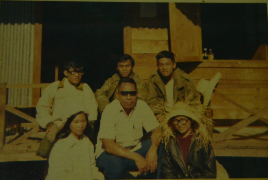
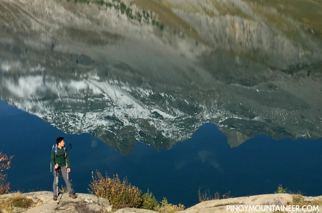
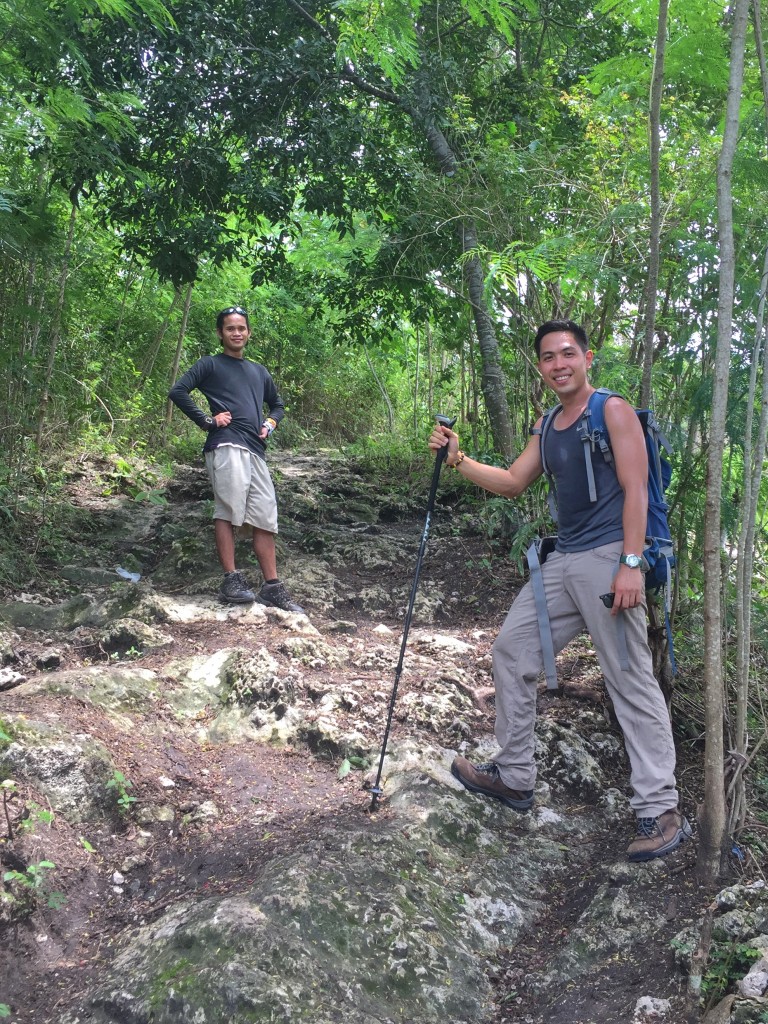
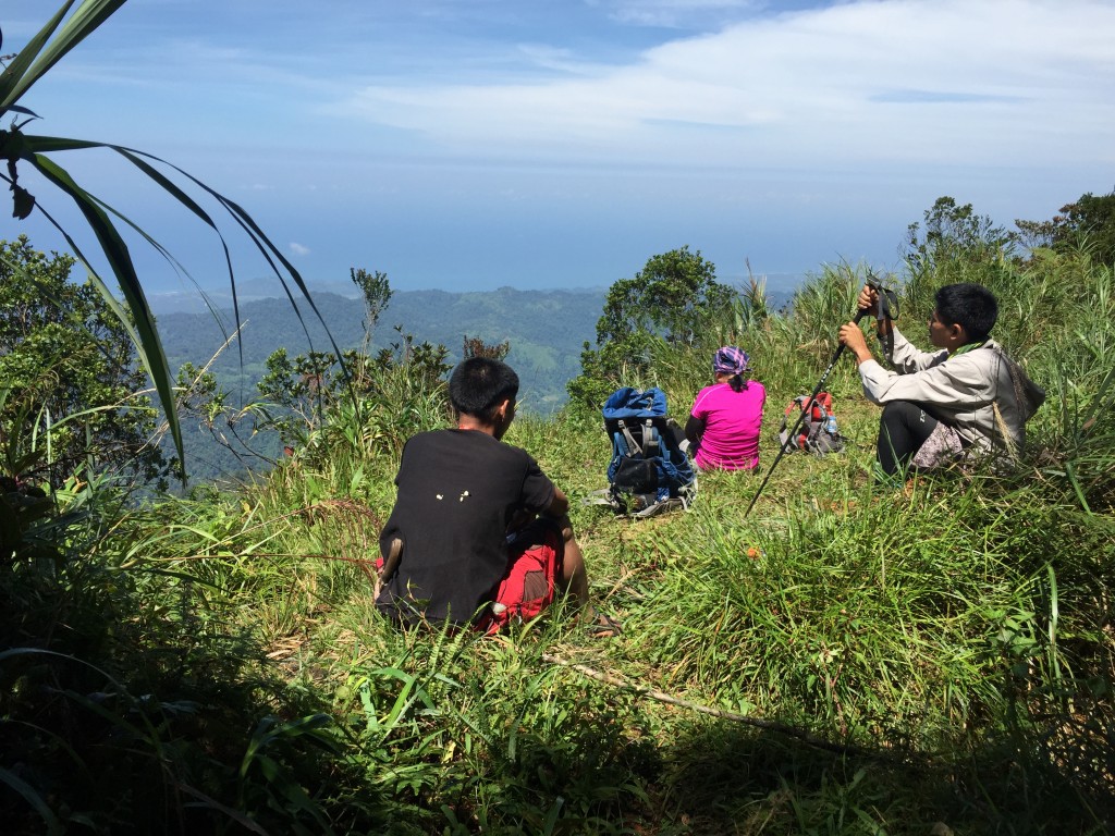
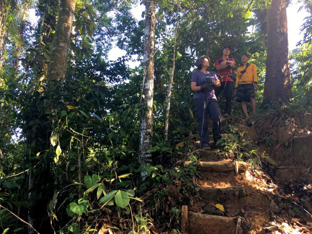
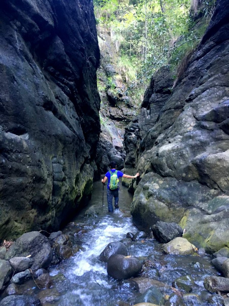
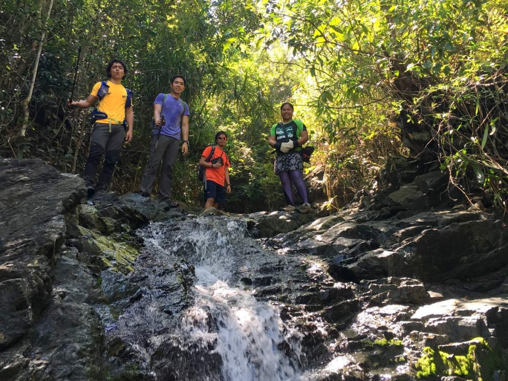
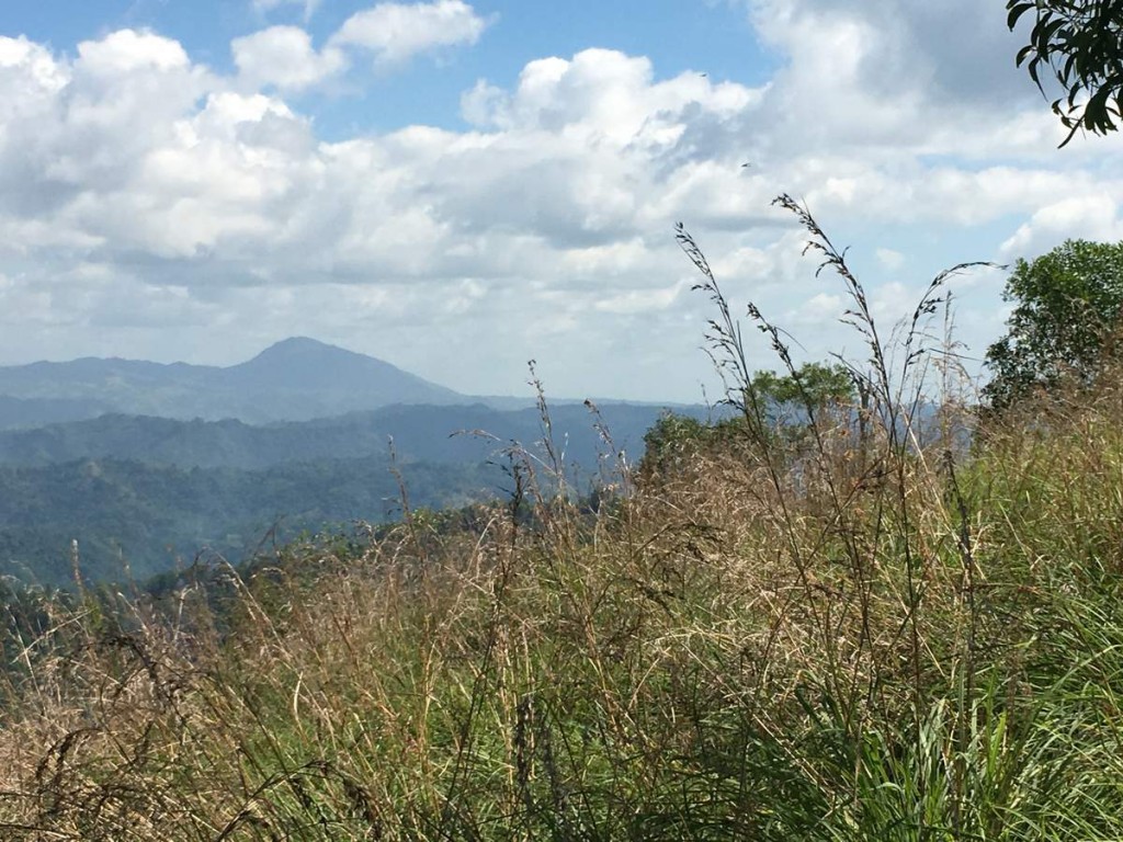
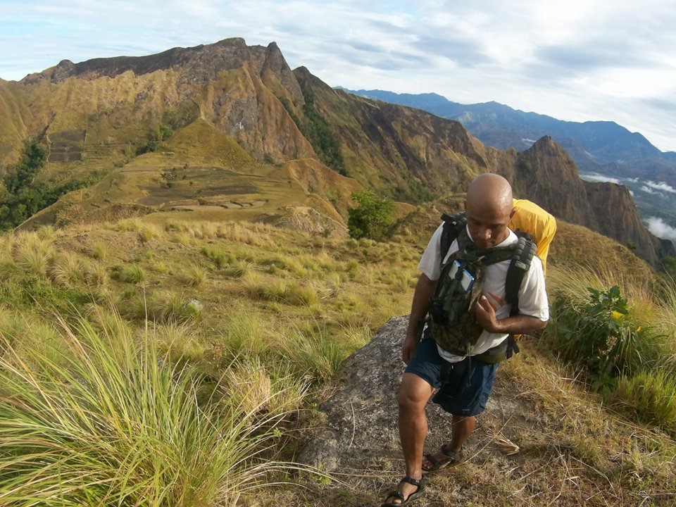
Thought I’d share my two cents regarding the issue of overcrowding in Mt. Pulag. I’m a proud member of the Cuernos de Negros Mountaineers Club, Inc. here in Dumaguete, with Mt. Talinis our beloved bundok here.

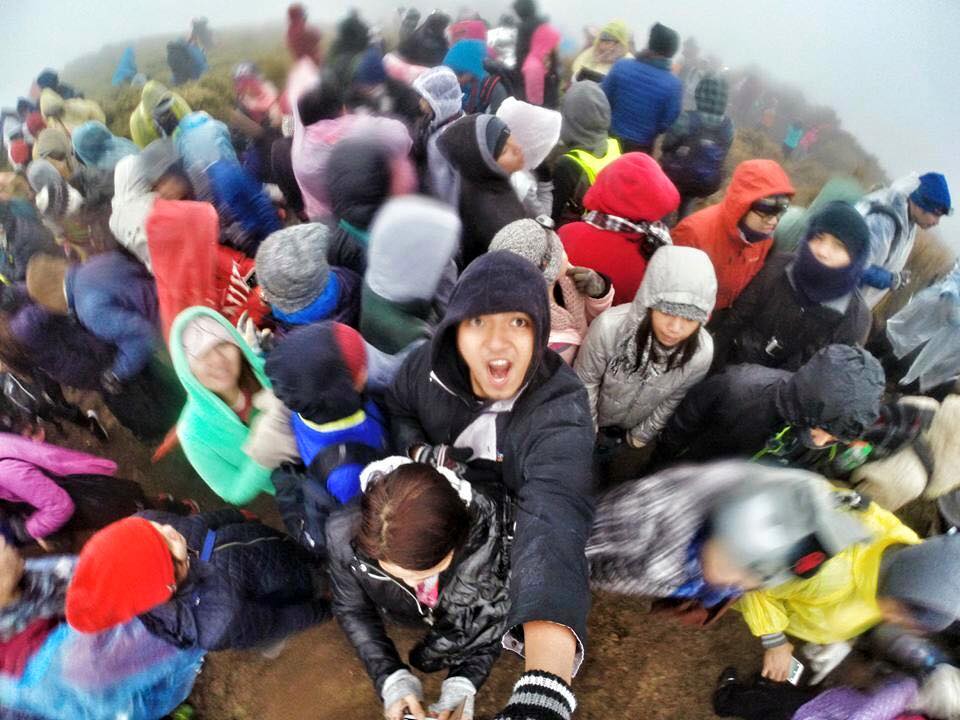
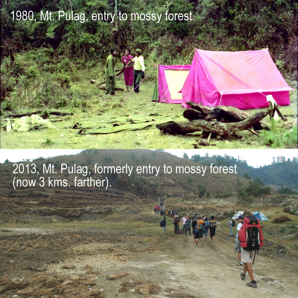
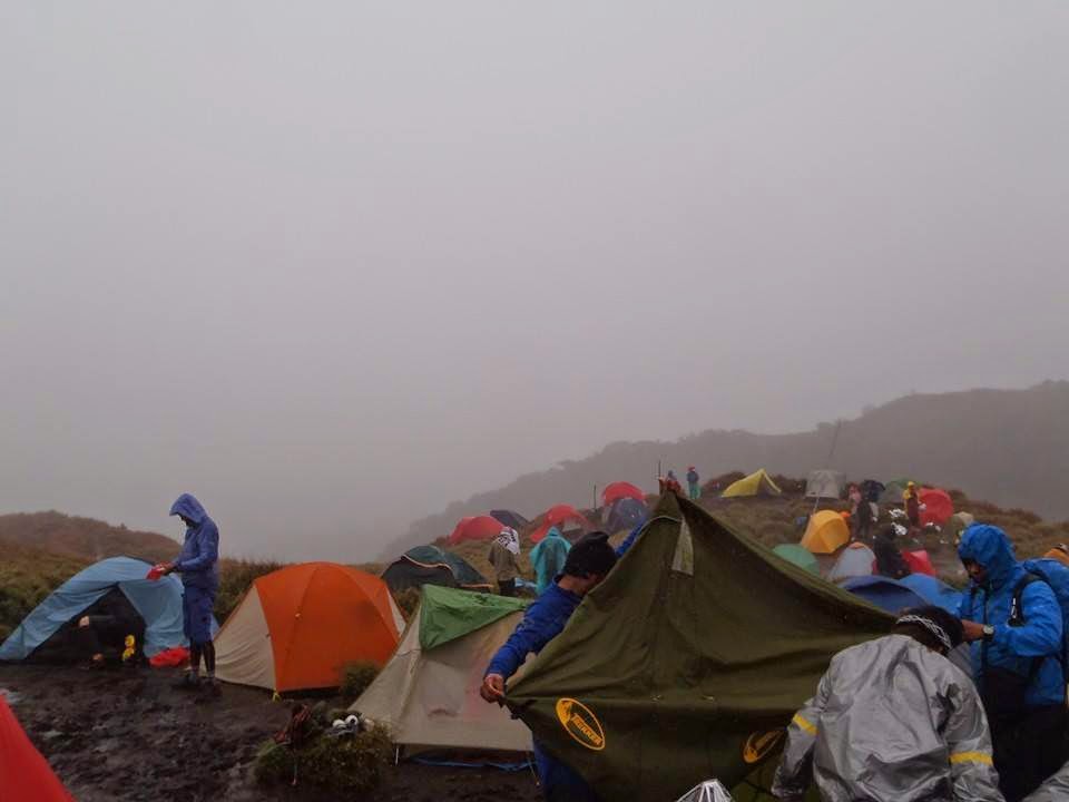
This topic kinda reminds me of the similar scenario in Everest where climbing it has attracted so much people that it has left an unimaginable amount of trash and human waste. I believe it is similar here in Mt. Pulag where it has become more accessible to the common tourist, although of course climbing a sub 3000m mountain is probably easier than climbing a mountain more than twice its height. I fear that the obscurity of the summit has become a mundane experience.

The allure of reaching the summit has been taken advantage as a means of income i.e. guides and related services, especially for the locals. This isn’t bad per se, but at the expense of higher risk of damaging the mountain is already questionable. More often than not it is greed that blinds us and we don’t notice the deterioration of nature that ultimately is a bane to us all.

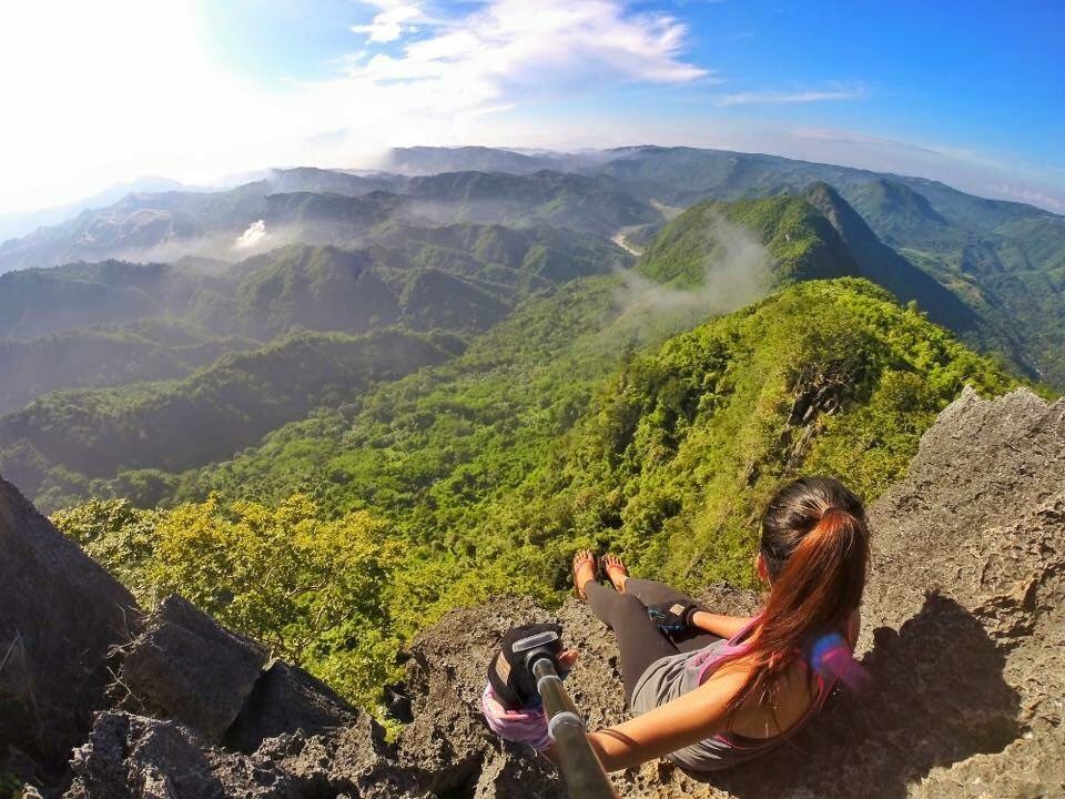
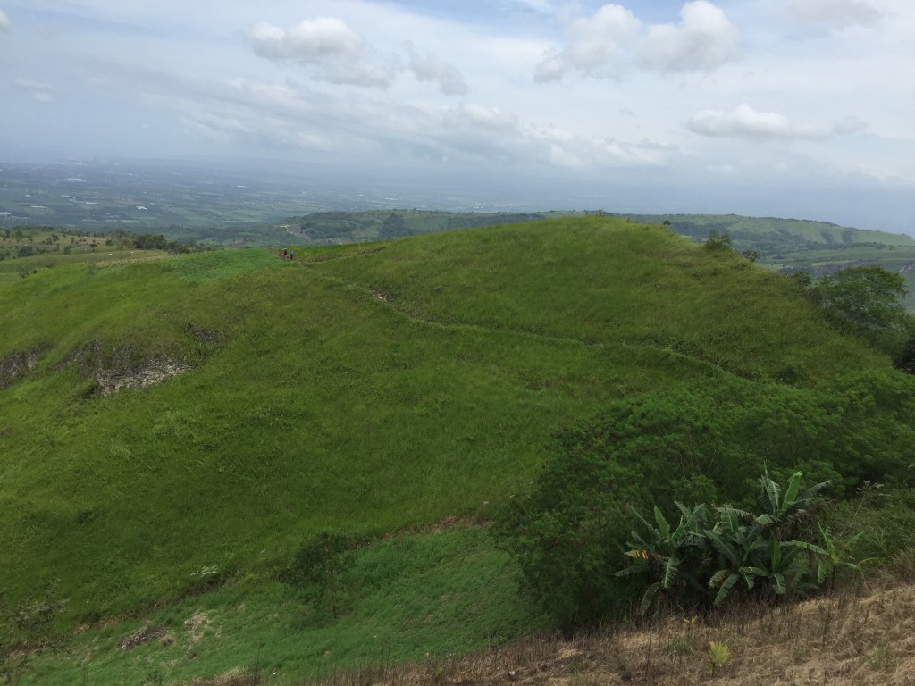
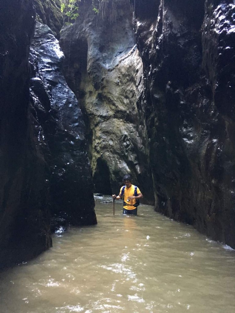
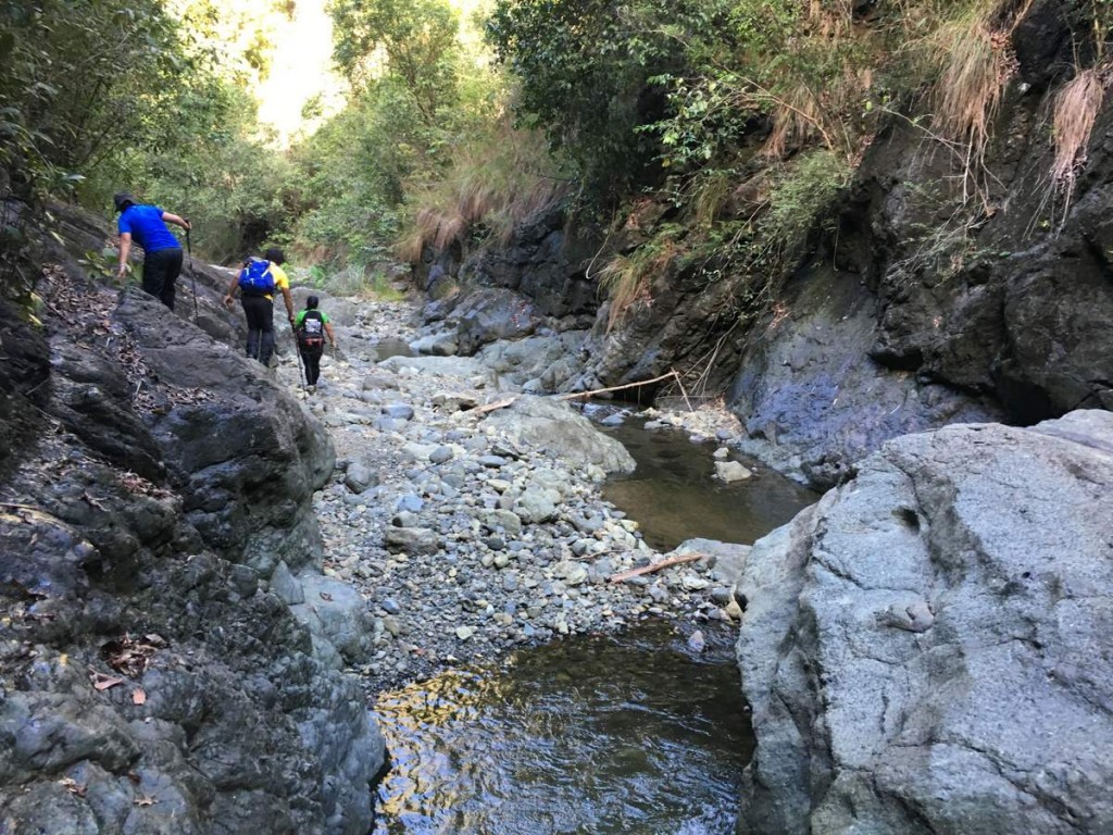
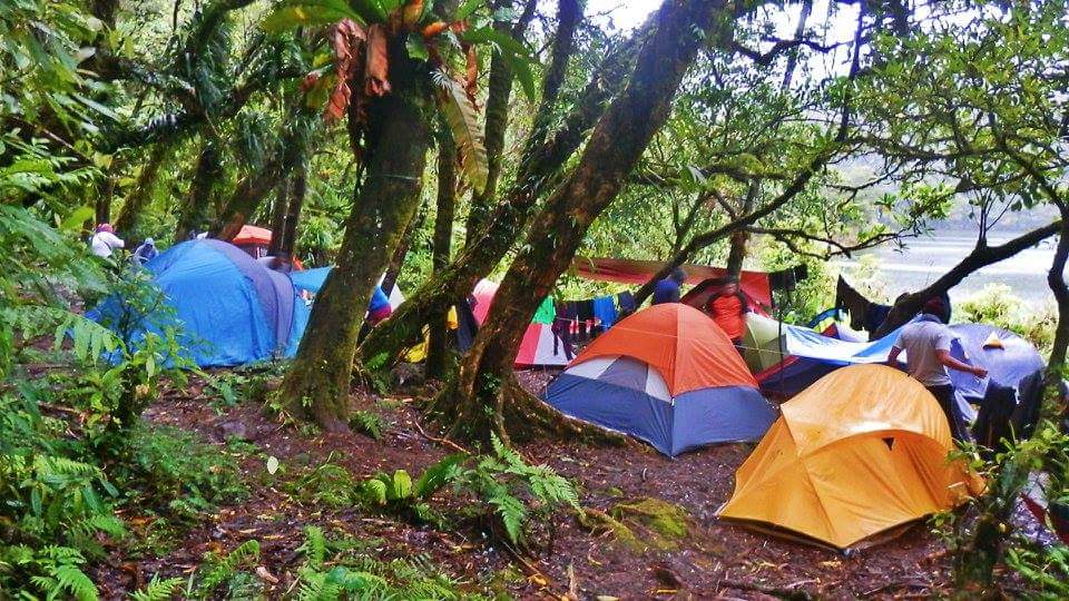
What we do here in Mt. Talinis (via the Dauin jump off) is to limit the number of climbers to (cannot recall the exact number but it is definitely less than 40), also because the campsite before the summit can only accomodate as much. It is quite horrifying that I have seen food wrappers and empty bottles, both plastic and glass at the shores of Lake Nailig.

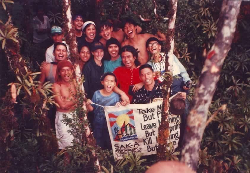
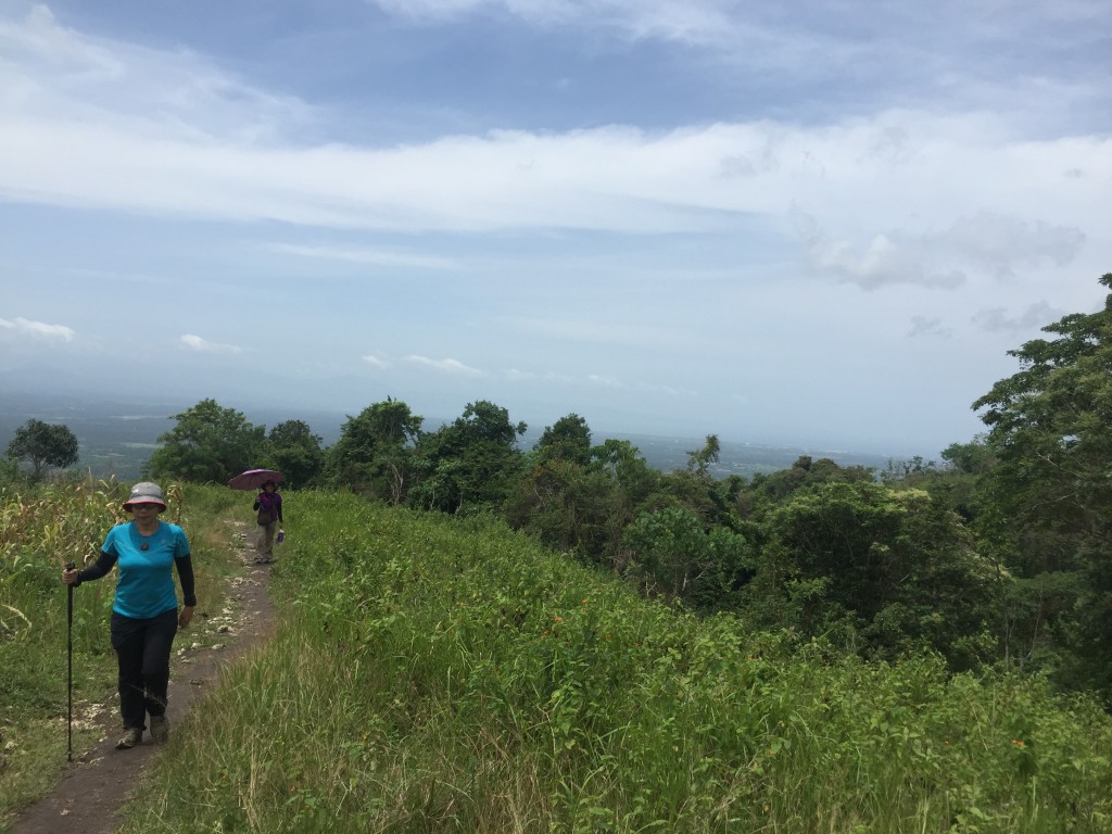
To avoid this, the LGU in Dauin makes sure that the guides are trained properly with the emphasis on Leave No Trace principles. Thankfully within the LGU there are members of our club and they themselves are the ones exerting effort of conserving the mountains. Also, in our club, it is an unspoken agreement that every climb is a clean-up climb. I believe that it is in these small but doable efforts that have major impacts to the health of the mountain.

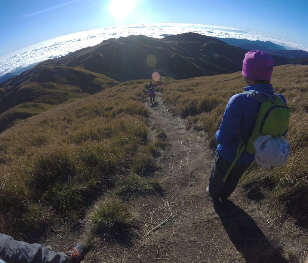
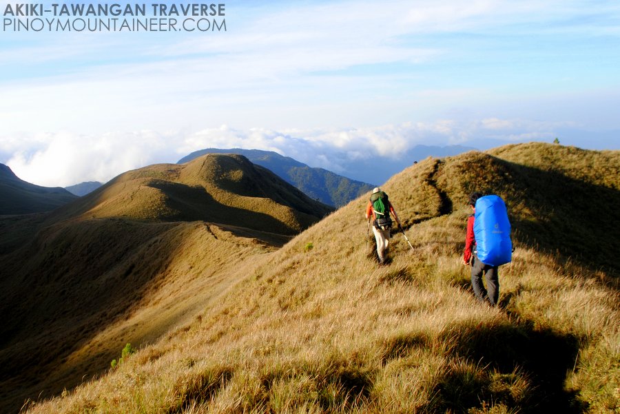
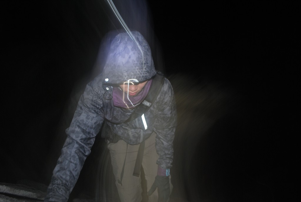
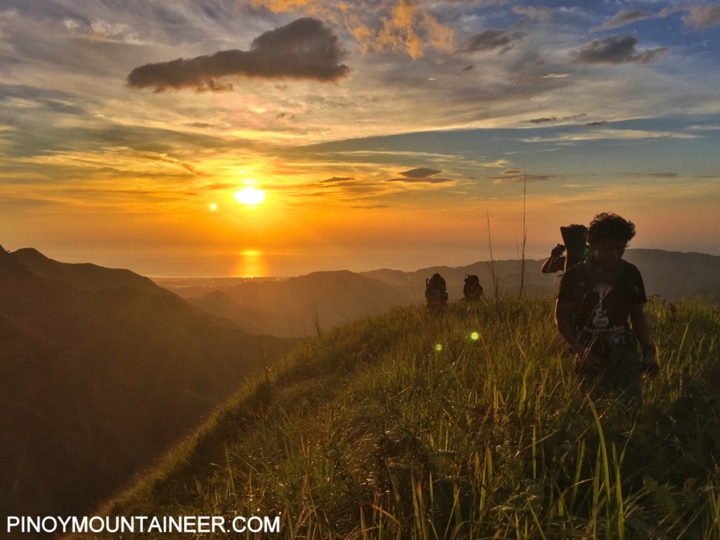
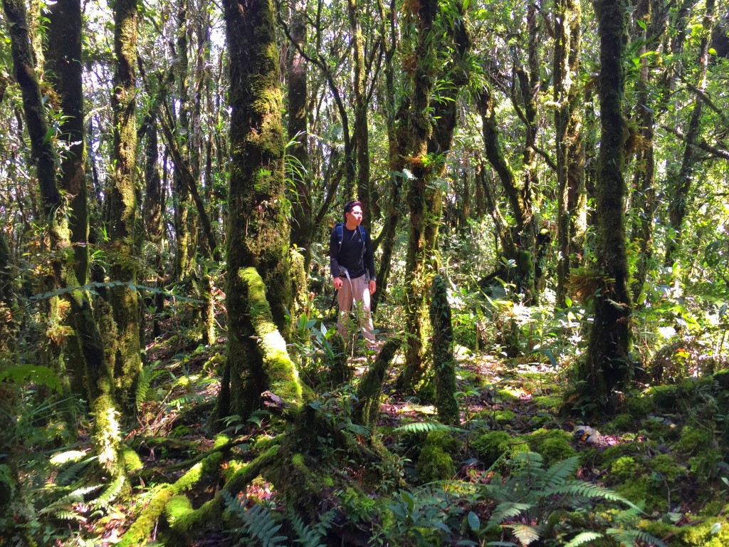
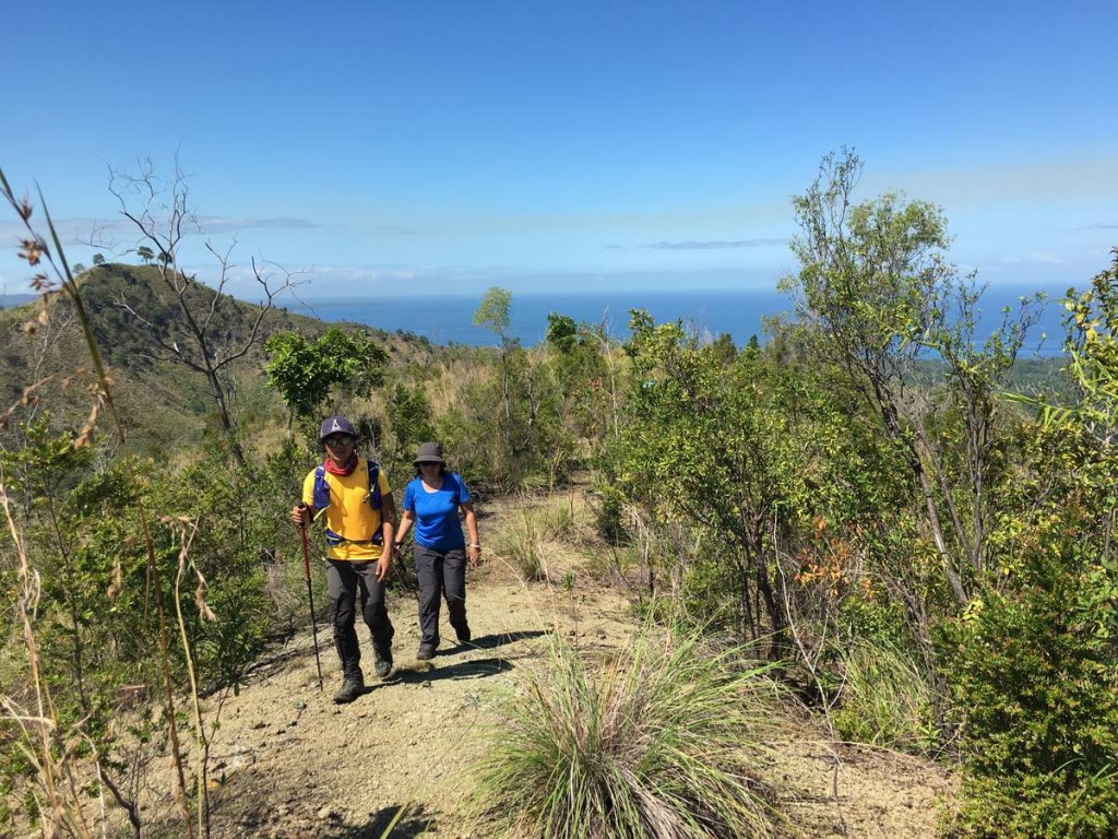
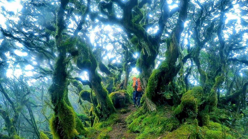
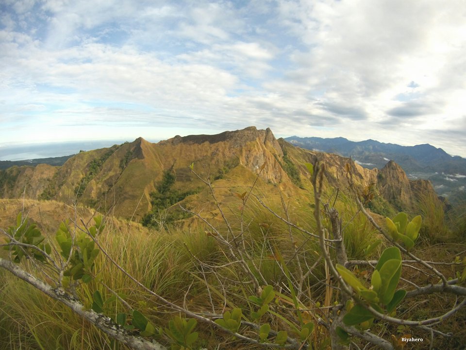
It is also interesting to note that the altitude difference between the jump off and summit of the Ambengeg trail (heard and read that it also known as the tourist trail) is less than a thousand meters. Please correct me if I’m wrong as I only derived this info from an episode of Biyahe Ni Drew. Still, I can only imagine how it would be way less difficult of taking this trail instead of the Aikiki and/or Tawangan trail. Based on what I’ve read and heard, you ought to think twice of undertaking the Aikiki or Tawangan trail if you lack experience. Then again according to what I’ve read and heard, the preparation and journey will reward the climber with awesome views that seems so otherworldly. I think that there should be a limit on the number of climbers on all of these trails to lessen the impact during a trek, thus preserving them.

I also hope that if that many climbers reach the top they all take LNT seriously. Orientation is a must and I think rewarding those who bring down garbage (not just their own) is not exactly a bad idea. Probably a discount in fees of entering the mountain or a free souvenir would be nice. Haha!

One final point I would like to add is that we are quite fortunate that the influence of our club reaches beyond Silliman University, where it is based, partly because it has been here for almost three decades now. The tradition of a local mountaineering club being the guardians of their respective mountain has been beneficial because preservation is prioritized and I applaud this because it is voluntary and out of the love for the environment.

The post Opinion: Lessons from Mt. Talinis appeared first on Pinoy Mountaineer.


Special Issue: Mt. Pulag and ecotourism

$
0
0

6874_10154518675133082_4922699523743559704_n

“The mountain cannot speak, and oftentimes, it suffers in silence. But a mountaineer ought to know how to feel its pain. When the time comes that you have to be its voice, you have to be willing and ready.” – Letter to a Young Mountaineer, V, “Wise words from an old man”

The above photo from the summit of Mt. Pulag, shared to us by Don Kevin Mariano from his recent hike, illustrates the state of affairs in Luzon’s highest peak, once the beloved destination of mountaineers, now a popular tourist site.

Mountaineers feel strongly about this issue, but there is a need a channel our energies and thoughts into a constructive conversation. Yesterday, I asked fellow hikers their opinion about Mt. Pulag and there was an overwhelming sense of sorrow and concern about what’s happening in the mountain.

Some are suggesting that the mountain should be closed. Others say that hikers should be properly oriented and tour groups regulated. There were also those who proposed that the impact should be spread to other trails. These differences notwithstanding, most agree that, at the very least, limits should be imposed.

In the coming weeks I will be posting opinion pieces from hikers about what they think should be done about Mt. Pulag. I have already posted a number of them. Some are reflections about their “then” and “now” experiences: Luigi Bustamante’s “Let Mt. Pulag heal” and Abigail Giron’s “So much has changed in a year” .

Two others offer inputs from other places. In “The Philippines needs a National Park Service”, Kay Veloso-Greenberg draws for her hikes in South America to propose that the Philippines come up with its own National Park Service – one whose mandate is specifically to regulate ecotourism. Eugenio Salonga for his part shares lessons from his experience as a longtime member of the Cuernos de Negros Mountaineering Club, Inc. in taking care of Mt. Talinis in “Lessons from Mt. Talinis”.

Finally, in “Mt. Pulag: A tour operator’s perspective” an anonymous contributor provides her own take about the issue, arguing that closing the mountain will harm the locals. Although her perspective is contrary to the view of many mountaineers, it is nonetheless useful for everyone to know where everyone else is coming from.

Contributions are welcome (email me at gideon@pinoymountaineer.com). We need an open dialogue and a constructive debate about what to do with the mountain, and more broadly, how we can be responsible hikers and travelers – not just for Pulag but for other mountains as well. This is very timely considering that the peak season is at hand. We are in touch with the DENR and will forward key recommendations, even as we also challenge the DENR to act on this forcefully.

On a final, positive note, the fact that this issue is receiving a lot of attention means that there are many people who are concerned about protecting Mt. Pulag. A day after posting the above photo on social media, it has reached almost a million people. The challenge is for us to find common ground.

SPECIAL ISSUE ON MT. PULAG
Introduction: It’s time to talk about Mt. Pulag
“Let Mt. Pulag heal” by Luigi Bustamante
“So much has changed in a year” by Abigail Giron
 “The Philippines needs a National Park Service” by Kay Veloso-Greenberg
“Lessons from Mt. Talinis” by Eugenio Salonga
“Mt. Pulag: A tour operator’s perspective” by Anonymous

The post Special Issue: Mt. Pulag and ecotourism appeared first on Pinoy Mountaineer.

Opinion: Reflections from a “non-mountaineer”

$
0
0

DCIM100GOPRO

Pinoy Mountaineer is calling for a constructive conversation about what we should do to preserve the beauty of Mt. Pulag and other mountains in light of the problems brought about unregulated ecotourism. Contributions are welcome at news@pinoymountaineer.com. 

by Liz Anne Pasana

Before anything else, I would like to disclose to you that I am not a mountaineer but you may classify me as one of the many people with day jobs out there who squeeze in outdoor trips during the weekend, if time permits. Just like you, I go to the mountains for my much needed retreat. I may not be the best person to give you reflections about this matter, but I hope you’d still read on and find these insightful:

To answer the question, “should Mount Pulag be closed?”, YES. I think it should be. Mt. Pulag is a National Park so I ​believe DENR has the right to do what’s best for it. It may help if they close it February-October so the mountain can be well prepared for its peak season. Although I cannot say that this may be a good idea ​for​ the locals since they have been relying heavily on tourists lately. Limiting the number of hikers per tour group and generally controlling the traffic per day may be a good idea, but it is all up on DENR to execute it strictly.

Secondly I would like to reflect on how social media made a big impact on the trails. Not only to Mt. Pulag but to other mountains as well. I believe some people have wrongly marketed it (hiking in general) over the internet, specifically lifestyle websites. I understand that mountaineers consider Mt. Pulag as a 3/9, but IMO, I think this should only be applicable to fellow mountaineers. What’s 3 for a mountaineer may be a 6 for me. Case in point, I follow Gideon’s itineraries for day hikes and everytime I compare it with my actual time, there would always be a 1-3 hours difference. I do understand though that we should always hike at our own pace. I’m just saying there are some seasoned tourists who may not get the point that the 3/9 for a mountaineer may not be on par with their actual capacity. I do not blame the people for recommending Mt. Pulag as a “beginner mountain”, because it may be, at least for some. But for people to promote going to the mountain without any conditioning is wrong, I believe so. I remember reading an article from a lifestyle website that it is okay to go to Mt. Pulag without conditioning, only thick clothes, good shoes and good company. I agree with the latter, but really? No conditioning? I am sorry but it grinds my gears when people take high-altitude hikes so lightly. Actually, hiking in general. Yes, so many people have hiked without prior exercise. Even I didn’t do any form of exercise back before my first hike, not even stretching. But I believe that is exactly the reason behind the sudden influx of tourists in the mountains– people taking it lightly and telling everyone it’s okay to hike mountains without prior conditioning, even when it’s actually very risky. By going outdoors, you surrender yourself to great danger. The best thing you can do for yourself is to prepare for it- condition yourself and know basic first aid at least.

Good move for DENR for recently requiring medical clearance before going to Mt. Pulag. Another problem though, med certs are being taken lightly too. They offer med certs just a few kilometers away from the homestay area if I remember it right. The last time I went there, I was with ​a tour group and although they were very consistent in giving reminders to their participants, some still showed up without med certs so we had to stop by the community hospital nearby. What bothered me the most was the fact that one participant had high blood, but still got his clearance​.​

Finally, there’s the issue of tour agencies. ​​Gone are the days where hike groups are formed by people with the same interest for cost sharing and community building. Now, it is becoming a business. A fashion. I am very frustrated with the sudden influx of tour services. Don’t get me wrong, I am happy that going outdoors are being encouraged now. But this is what I am sad about, they profit from beautiful mountains, islands and caves and what do they leave in return? Trash. Some participants even disrespected the locals. I used to support these tour services by joining them, but I later realized they’re nothing but business, they showed no support for the environment. And some of the participants lacked discipline to be on the trails. Even when you tell them to leave no trace, they will still leave their trash anywhere because it is not of their concern. I thought I was surrounding myself with people with the same passion by joining ​these ​groups, but I thought wrong. Of course, we cannot control the influx of these businesses. It is after all a good source of income. Even locals consider it as their main source of income too. But I just wish that these tour services would promote outdoor ethics and do something in return to Mother Nature for earning from it. I don’t know, maybe make their participants clean up as they hike? Plant/donate a tree? stuff like that! Call me idealistic, but I am hoping that tour services would consider giving back to nature. I also hope tour service companies would also be accredited by the DENR, if that is not being done yet. I’m just not familiar with the process of putting up a tour service company, but I think it will lessen the possibility of irresponsible tour companies emerging here and there if DENR will pose STRICT requirements before being accredited.

I’ve been telling these to outdoor enthusiasts, and I am glad that Pinoy Mountaineer is raising this issue. My appeal to all those who are concerned: Use your credibility, experience, and influence to educate people about the ​environment​.

The post Opinion: Reflections from a “non-mountaineer” appeared first on Pinoy Mountaineer.

Opinion: Mt. Pulag then and now

$
0
0

beforeafter3-001

by Myk Miguel

Thank you Pinoy Mountaineer, for opening up concerns and suggestions on what to do in the destruction of Mt. Pulag in the name of ecotourism and ancestral domain rights of indigenous people.

I witnessed its pristine beauty way back in March 1978 after my group, Zeta Mountaineers, explored Mayon Volcano for four consecutive years. It was a member of Mountaineering Association of the Philippines (MAP, membership: 50) who gave me the direction going up there – either Ambangeg or Ellet Trail. We chose the latter. By the way, for the sake of trivia, the UST Mountaineering Club gave way to MAP after a tragic death of a member while descending Mayon Volcano. I have been in contact with some of their members, the godfathers of Philippine mountaineering, in the likes of Gus Guerrero, Art Cuevas, et al.

This “playground of the gods” became our playground, too. For countless of climbs, we considered it as if our own for being the only human beings wandering on its huge landscape. The atmosphere up there was like a lonely sacred planet. Eerie yet peaceful.

Fast forward. I came back there several times in the late 2000’s ( including the time of havoc of Typhoon Ondoy) and could greatly dismayed by numerous eyesores and missed details. Gone are Chan See store in Ambangeg, nearly 2 kms. of mossy forest, the watering hole near Apo Usok’s hut, water resources along mossy forest, the original triangular steel marker at the summit, the bermuda grass along the narrow path in the grassland and water source halfway to the sum .Eyesores are ala Pasay jeepney terminal at ranger station, bald and idle land of Camp 1, long water pipes to nourish vast vegetable plantations, Woodstock-like ocean of tents in campsites, noisy and drunk “social climbers”, crowded summit and not-so-mossy forest.

I have read some opinions published and here are some of my points of view;

Close the Park: I disagree. It’s not just depriving the local of added income but this idea is not hitting the real problem which is the massive tourist hullabaloo. The DENR must reduce greatly its carrying capacity. It’ll be a controversial matter but surely, it’ll be a problem solver.

Ancestral domain: Yes, the land is indigenous people but it does not mean that they can slash and burn the Park for commercial farming. They must be reoriented and educated that they have more future in Mt. Pulag if environmental concerns are managed well. Most of them know the sad state of Mt. Data in Mt. Province where unabated massive farming and overpopulation dried up the watershed of the area.

Close Ambangeg Trail, open only Akiki and Tawangan Trails: I disagree. It’s discriminatory and macho-like idea. Mt. Pulag is not for “hard cores” only. Trekking is for nature lovers – young ones and “young once” alike.

Tour operators: It’s simple. Individual hikers are there for pleasure while tour operators are for business, money. Regulate them. Charge them higher. The “taxes” go to community improvement, school children, medicines, etc.

Locals: Educate them not to expand their existing plantations. Show them the repercussion of the destruction of their environment. Concerned mountaineering groups could bring audio visual presentations of environmental issues like deforestation. Visuals have impact. Encourage them about rewards of homestay, arts and crafts.

Reforestation of Camp 1: There must be mandatory tree planting for all hikers. The local community grows and sells pine tree saplings – an added income for them. They must nurture the plants, too. An added value in this project is environmental responsibility to everyone – newbies and oldies alike. Let the individuals and clubs to be proud of their planted trees by putting markers with their names on it. On their next visit, they will look forward seeing not only the “sea of clouds” but also the growth of their planted trees.

Apo Batacagan aka Apo Usok: Restore the original hikers’ watering hole and the old man’s landscape. It’ll bring back the history and nostalgia of Mt. Pulag. There are several descendants of Apo Usok who are farmers and porters. They will take charge of maintaining the park in the Park. By the way, the place is can be reached past the Mt. Pulag sign near the ranger station. After, say, fifty steps away from the sign, climb the slope on your left. In a few minutes after a short hike, you’ll be there. Ranger Larry knows it.

To begin with, what we need is a serious dialogue among all the stakeholders. We must strive for a win-all solution and ACTION that will save Mt.Pulag from its deathbed.

The post Opinion: Mt. Pulag then and now appeared first on Pinoy Mountaineer.

Opinion: The view from South Africa

$
0
0

DSC09489 - Me near Cape Point, Cape Peninsula

Pinoy Mountaineer is calling for a constructive conversation about what we should do to preserve the beauty of Mt. Pulag and other mountains in light of the problems brought about unregulated ecotourism. Contributions are welcome at news@pinoymountaineer.com. 

by Justin Hawthorne
Professional Mountain Guide & member of the Mountain Club of South Africa

CAPE TOWN – I will contribute to this conversation as I have hiked Mt Pulag and feel any discussion related to conserving and protecting the National Park is of great importance. It is a mountain of incredible beauty, offering a wonderful multi-day hiking trail – one I would love to do again. When we hiked the trail, we were the only hikers ascending via the Akiki Trail, and the only ones sleeping at the summit camp (3 pax, incl. guide). We descended via the relatively straight forward Ambangeg Trail.

I do not have a thorough knowledge of all the politics and agreements in place in terms of who manages the Park, the relationship between neighboring farms/landowners and the Park, any issues and concerns over the flora and fauna within the boundaries, and I have not read all the latest rules and regulations regarding hiking Mt Pulag. However, from my experience, I picked up similarities in terms of issues faced with Mt Pulag, and the Table Mountain National Park in Cape Town, South Africa and also noted certain issues which Pulag should address.

The Table Mountain National Park (formerly Table Mountain Nature Reserve pre-1998) has a policy in place which bans anybody from camping on the mountain. There are a few mountain huts/overnight facilities, but under no circumstances may you pitch tent/ camp under the stars or sleep in a cave. With camping comes many negative aspects: litter, human waste, degradation of the immediate environment (flattening vegetation, burning vegetation), graffiti, and worst of all, unwanted vegetation fires. Camping and sleeping on the mountain was permitted until 4 decades ago.

A problem we face here in Cape Town is the open access nature of the Park (no fenced boundary). Pulag faces the same challenge. Having to deal with neighboring farmers and villages poses an interesting challenge for authorities. Issues we have include illegal bark stripping of indigenous forest trees (a major ongoing battle), poaching and crime (muggings). What is a simple and primitive, but essential, approach is visible patrolling within the Park. Field rangers need to be actively patrolling (in uniform) in order to create a presence, the first step to controlling any aspect of law enforcement.

Mt Pulag in my opinion should be managed at a provincial level, and remain open – all year round. Managing at National level requires a thorough and efficient administration and one fears that officials sitting in the head office managing National Parks around the nation will not give every Park the required funding in order to function optimally. What should be implemented is a simple permit system: limited permits issued per day, at a set fee, open to all. Depending on the route to be hiked the authorities could implement a guide requirement (e.g. Akiki Trail – guide required, Ambangeg Trail – no guide required). Of course, should a guide be wanted for the trail, that should be the hikers’ choice. A limit to numbers (incl. guides) – for example 24 persons per day. Group size limitations could be limited to 12 persons. Having a group of 30 persons camping at the same campsite creates a massive burden on the fringes of camp – damaging the vegetation, etc. The permit/payment system needs to be simple and efficient.

There is a delicate balance needed between creating a safe trail for hikers, and not destroying the uniqueness of a particular route.

Lion’s Head in Cape Town has ladders, chains and staples affixed to rock face, to create a safer climb as the mountain has high numbers of ill-prepared people venturing up its slopes which often results in mountain accidents. Having fixed assistance, more people venture up the mountain because these climbing aids have made it easier to succeed. As a result, the mountain sees an incredible volume of walkers and still sees a large number of incidents (mountain rescues). Mountain purists would prefer the routes to not have fixed climbing aids, and rather rely on skill and scrambling ability to get up – an issue that creates an interesting debate.

Sure, the trail could have had a little extra maintenance, but in no way was the footpath in a bad state. One observation I made was that on the Ambangeg Trail there were Tree Fern stems that were being used in muddy sections as ‘boardwalks’ – surely another material could be used? Or are these large ferns of no environmental value?

The authority needs to listen to everyone’s opinions and draw up a solution which primarily aims to conserve Mt Pulag, while not closing the door on the international mountain community and considering the local community who may rely on the mountain as a form of income. Interesting times ahead…

The post Opinion: The view from South Africa appeared first on Pinoy Mountaineer.

Opinion: Popularity is Pulag’s Salvation

$
0
0

Pulag via Akiki Tawangan 11

Pinoy Mountaineer is calling for a constructive conversation about what we should do to preserve the beauty of Mt. Pulag and other mountains in light of the problems brought about unregulated ecotourism. Contributions are welcome at news@pinoymountaineer.com.

by Chris Tejirian

Two of my most exciting and exotic hiking experiences have involved Pulag: the Akiki-Tawangan Traverse (http://goo.gl/ttSEM2) and the Ugo-Pulag Traverse (http://goo.gl/yqF52U and Hiking Matters 320-323).  During our Akiki-Tawangan Traverse, we camped below the edge of the grasslands on the Akiki trail.  In the morning we continued up, over the summit, and then descended through the high-altitude rain forest of the Tawangan trail– an extraordinary place that I will never forget.  During the Ugo-Pulag Traverse, we explored a rarely-visited valley with no road access.  By providing a school and a health clinic with solar panels on the roof, the Philippine government has brought many of the best aspects of modernity to this beautiful place without ruining it’s traditions.  The thatched huts and suspension bridges we passed as we made our way down the valley were  captivating, and I suspect that many Filipinos do not realize that such places still exist in their own country.  Sadly, I suspect that many Filipinos also do not realize the extent of the illegal logging and rogue roadbuilding that we found the next day, ascending the slopes of Pulag between the Ambangeg and Ambaguio trails.

I am writing this as part of a series of opinions discussing the fact that Pulag is in trouble.  Much of the Philippine outdoors, in fact, is in trouble.  It is tempting to say that sensitive areas should be closed; that people should be kept out… but that would be a mistake.  We need people to love Pulag, to love Ugo, to love Makiling, to love Guiting-Guiting.  Only with the love and support of many people will these outdoor areas recover and thrive.  And in order to learn to love them, people must be able to visit them.  With timely protection and regulation, natural areas like Pulag can rebound and recover in just a few years. 

Filipinos must find their own way for their own land, but other countries are coping with these same problems and their strategies should be studied.  One of the biggest and best-run systems of hiking trails in the world is the French “GR”s, where the increasingly popular GR20 trail across Corsica has had camping banned in between the established “refuges” on the route.  The 180 km GR20 is famous for being the toughest trail in Europe, and perhaps also the most beautiful.  In California, permits must be secured as long as six months in advance if one wishes to hike the entirety of the 338 km John Muir Trail among the High Sierra, most of which is above 3000 meters.  Human solid waste is a major issue, and there is extensive discussion of how to properly deal with it.  Fires are banned, and even the type of stove you carry is dictated.  Rangers stop you and check that your permit is in order and your food is encased in a special vault, on account of the bears.  Because of these regulations, these trails and many others stay open and preserve wilderness access for many thousands of hikers every year.  But protecting and regulating an area requires money.

The popularity of Pulag is the key to it’s salvation.  There should be ranger stations at the head of every trail, but restrictions should be kept to a minimum.  Perhaps only the Ambangeg trail needs to have a system of permits, and no one should need a doctor’s certificate just to walk in the park.  Modest fees should be charged for all hikers, the money should be designated for Pulag only, and it should be publicly accounted for in a transparent manner.  The top priority is the protection of the mountain, but the experience enjoyed by visitors is almost as important.  Both the adventurers, who come for a beautiful and challenging experience in the wilderness, and the tourists, who normally just hike in on the Ambangeg with a guide, must feel welcomed.  Properly-marked and -routed trails must be built, and Enforcement Rangers with police powers to issue tickets and even arrest people who violate rules on the mountain must patrol.  Perhaps the fees could also be used to improve the Ambangeg road, build a health clinic at that trailhead, and finance loans to build guesthouses and shower facilities in the villages, outside of the most sensitive areas of the park.  Think how many people would love to have another place like Sagada, where they could enjoy the outdoors all day and then relax at a nice restaurant in the evening.  By channeling visitors on to properly-constructed trails, using permits to regulate visitors on the busiest trails, limiting group size to ten or twelve people, banning camping in the grasslands, and perhaps setting up composting toilets and proper fire-rings at carefully-located campsites, Pulag could continue introducing people to the natural beauty of the Philippines on the Ambangeg trail, and continue to provide the freedom of an ultimate wilderness experience to that smaller number of passionate people who take the other trails.

___________________________________________________________

Chris Tejirian is an international professional who has hiked in many of the world’s great locations over the past thirty years, including the Philippines, Japan, Taiwan, Himalayas, French and Swiss Alps, Caucasus, East and West Coasts of the U.S., and others.  His family has been involved with the Philippines, particularly the Cordillera region, since 1926.  He lived and worked in Manila from 2011-2013, traveling to and hiking in many locations around the country during that time.

The post Opinion: Popularity is Pulag’s Salvation appeared first on Pinoy Mountaineer.

Photoessay: Memories of my 1973 Mt. Pulag hike

$
0
0
DSC_8576

by Vicky LeaÑo

Blogger’s note: In March 22-24,1973, five law students from the Baguio Colleges Foundation (Agapito “Pete” Laoagan, Jr., Prudencio “Jun” Mejia, Jr., Rolando “Lando” Arriola, Evelyn “Lyn” Babsaay, and Victoria “Vikki” LeaÑo) climbed Mt. Pulag via the now-defunct Ellet-Abukot-Babadak Route. 43 years later, Vicky Leano, through the efforts of her daughter Onaya Longid, has furnished a rare account of this hike in this very special feature.

Just looking at the Mt. Pulag summit from the town gave us no worries, but deep inside we craved to meet the mount’s challenge.  Whatever lay ahead and beyond we never dared speculate. It seemed that the summit was just within our grasp, and we said to ourselves we could make it.  We did make it and our experiences atop were proofs!
DSC_8588
Pulagmania was starting to have its effects on us during our descent from Kabayan to El-let.  From El-let to Abukot, Pulag’s challenge was answered by our efforts to climb it. But during the hike itself, we were preoccupied not by the summit, but by thirst! Talking of water, the vital speech of the day was a three-word statement, “Tubig, pare ko!”  The vital reply to it was, “Tatlong lagok lang pare ko, mauubusan na tayo!”
DSC_8582
Lando, the best marcher of us all, tickled my ears with lots of comments about the weather, the trail, his legs, etc., with added grimaces of effortless dismay, a la Steve McQueen (as Jun put it).  He did make a good job though, of carrying on ’til the summit.  I thought all the while he’d flop down and say, “Let’s go back,” which nobody dared do anyway.
DSC_8580
All along the way, the tallest, biggest and strongest of us, Pete, never succumbed to dismay at the sight of the almost impossible distance of the summit, which was our main goal.
DSC_8581
Here and there, Jun would put on a smile and say. “I’ll reserve my triumphant smile when we get there.”
DSC_8579
We reached the summit 3:10 p.m., March 24, 1973, with the biting cold around us.  What a relief and what an achievement.  Then and there we questioned ourselves why we were there.  It was simply “kalokohan”.  Come to think of it, the venture was purposeless, but we did give our objective views about it.  Jun was ready for his triumphant smile when I took the first snapshots in black-and-white.
DSC_8577
I could hardly forget our different reactions to the cold morning atmosphere.  It all started when we planned to start the day with a series of picture-takings at the summit.  Pete, of all people, was the most enthusiastic subject of the cameras.  all he cared for were pictures taken of him atop Mt. Pulag, with the metal flag swaying in all directions as foreground.
DSC_8578
Of much attention was the flat wine bottle suspended at the tip of the metal flag, which contained pieces of paper of which were written the names of those who came ahead.  Prominently seen was the piece of cheese carton on which we had our names written down.
***
JUST AS MEMORABLE as the summit was the camping and all the mini-adventures that went with it. Pete helped Lando and Lyn with the fire.  It was Lyn’s turn to be the cook.  Using our empty fruit juice can for a pot, she cooked an indescribable supper for us, which was dubbed as a rare one.  Jun exclaimed, “It is the kind of cooking that tickles my palate!” Never mind, we consoled her, it was palatable enough to eat, what with the hunger we felt.  We could not choose, could we?  Hunger knows no law.
DSC_8583
Pete, Jun, and I ran down the east side of the hill where there was heavy jungle growth, in quest of firewood and precious, all too precious, W-A-T-E-R.  In the process, Jun got stuck into believing that the spreading branches of a dead tree beyond were little streams of water.  Pete tried to convince him that that was a mirage of water in the forest.  Jun couldn’t be convinced–almost.
DSC_8584
While I waited for them I was fascinated by the natural beauty of the forest and I pondered at the mystery behind such beauty and of existing wildlife.  All of a sudden, I found myself captive to the enchanting beauty of the forest and its wonderful foliage.  I thought all the while that if I were a painter, I would have captured its beauty on canvas and brush.  The panoramic view of the mountain gave me afeeling of peace and serenity, accompanied by wonder of a lurking mystery in its bosom.

We paused for a while and satisfied our aesthetic thirst with the natural beauty, grandeur and mystery of the surrounding terrain at the summit of Mt. Pulag.  The valley down could be seen, colored in dark green, almost covered by mist.  Then and there we were at the disposal of the chilly winds.

The downhill hike was easier and we descended almost nonstop ’til we reached the only water source along the way.  This time, Lando and Pete were the alternating cooks.

DSC_8566
Jun adeptly handled the situation of tension by starting to lecture on cleanliness.  He preached to us from his “bible” of military jungle operations, and made us aware we had added precautions to undertake on our next venture.  One suggestion from Jun I’ll never forget was about perfume and getting lost.  “If you think you are lost in the forest, apply perfume.”  Nobody knows what creatures will follow your trail.
A big surprise awaited us when we reached the town.  Mayor Octaviano Aroco met us and invited us for a morning merienda which was more than a merienda.  It was a good, hearty breakfast.  We were most honored!
DSC_8589

The post Photoessay: Memories of my 1973 Mt. Pulag hike appeared first on Pinoy Mountaineer.

A guide to night-trekking

$
0
0
DSC_0777
by Gideon Lasco
There’s nothing mystical or particularly difficult about night-trekking – it’s simply hiking at night – but still, it takes some preparation and experience to get the hang of it and be able to do it safely. Here are some of my tips about night-trekking.
Why go night-trekking in the first place? For some, it is a way to expedite their itinerary: by hiking non-stop for 12 hours or more instead of the more usual 8 hours,  one can shorten a three-day itinerary into two days or even make it a dayhike. For others, it is a way to make up for lost time: if you get delayed but still want to be on time for the next day, the “make up” happens at night. And then there are those who find themselves desirous of getting back as soon as possible after a hike. Some, for instance, after reaching Mayo’s Peak from G2’s summit, decide to push all the way down “para isang pagod na lang” (so that the fatigue will come in one blow). Finally, there are also those who choose night-trekking to catch the sunrise (as in Mt. Pulag), and those who simply want to avoid the sun as much as they can.
Night-trekking, however, can be a force majeur for any hiker – for all kinds of reasons, including getting lost or injured, or simply spending too much time in the mountain. This is reason why every hiker must be prepared for for the possibility of night-trekking – even if you’re doing a dayhike. Which brings me to my first important point: Never ever forget your headlamp! Make sure that it is enough battery power, and bring extra batteries if you’re not sure. Also, save power! Turn off your headlamp when it’s not needed.
Let me segue a bit and discuss this question: What is a good headlamp? For me, it must be bright enough to see the surroundings in detail. 40 is good enough, 60-80 is ideal. Having a waterproof headlamp is also important because in hiking you must always be prepared to be wet and I’ve night-trekked many times while soaked in the rain. You must also think of comfort: does the strap fit well in your head? If it’s too tight it can cause a headache, but if it’s too loose, the headlamp itself will sag in your forehead and you will have to keep adjusting it.
Some headlamps also feature a red light option and the purpose of the red light is to preserve night vision: the eyes can easily adjust to the darkness if you’re using it – and you will not blind people in front of you. The red light is also useful in NOT attracting insects. Oftentimes if you have a white light while hiking in a really pristine forest, you will be swarmed by a lot of insects, so the red light is an option here. Or, take off your headlamp and hold it like a flashlight.
Bringing a headlamp works best is everyone else has it – so make sure your companions have it too. If you’re an organiser, make sure to remind your groupmates to bring headlamps or flashlights. If you’re hiking with guides, they may not have a headlamp or a flashlight with them, so it will help if as a group you bring extra headlamps.
If someone has no headlamp, put her in between two people with headlamps. But again, let me reiterate that you must always have a light source with you when you hike. The cellphone flashlight is a good backup but is not enough: to climb safely you need to be able to see the details of what’s in front of you.
One small tip: If it’s about to get dark, make sure you can easily bring out your headlamp from your bag. You don’t want to open your whole bag in search for where you put your headlamp while it’s getting dark and raining!
However, don’t rely on the headlamp alone. Engage your other senses to walk safely. Use your hands to feel the branches, and use your feet to test what you’re stepping into. Listen to the sounds of nature – you may detect the hissing of a snake or the approach of other people.
Safety must come first and you should consider your team before even considering to night trek. It’s better for novices to have hiked a few mountains in daytime before going on a night trek. Consider also the trail: Well-established trail with a lot of handholds (i.e. branches) and minimal hazards are ideal. On the other hand, trails that are overgrown with lots of thorns, or with ravines, slippery/very steep parts, or river crossings should be night-trekked only when it is absolutely necessary.
You should also tailor your itinerary to reflect these concerns. It’s better to get the difficult parts done when there’s daylight – this includes ridges (i.e. “Knife Edge”), river crossings, steep / slippery parts, and others.
Consider also that people move more slowly at night and you should adjust the itinerary accordingly. In my case I multiply the times by 1.5 to account for this delay, but it depends on your group. (Walking slowly is actually not a bad idea: it can make night-trekking safer.)
Another important consideration is the group formation: it is best to stick together when night trekking, as it is much more difficult to look for your friends at night. Make sure you are within sight of each other’s headlamps. If you’ve been hiking all day, people are already tired by the time they night trek, so you can also allow for rests. Don’t forget to hydrate and to eat something along the way – you’re gonna need the calories.
My penultimate point is to consider the appropriateness of night-trekking in the particular mountain you’re in. While it’s usually safe for any mountain, in some areas with security concerns, trekking at night may be risky – ask your guide or ask the locals. There are may also be some mountains where culturally, trekking at night is not acceptable – for instance, because they think it’s when the forest spirits roam. These are very rare cases, however, and most of the time night-trekking is okay – as long as your prepared for it.
Finally, don’t forget to enjoy the trail! Hiking at night has its own rewards, and some of my magical moments in mountaineering include trekking while surrounded with fireflies in Kibungan – or seeing an owl in the Kitanglad Range. One can always appreciate the mountain at night – in a slightly different light.

The post A guide to night-trekking appeared first on Pinoy Mountaineer.


Ten tips on how to be a good climb participant

$
0
0

12666486_1091985480834319_2133607930_n

by Gideon Lasco

As hiking becomes more popular, many hiking parties are formed by people who don’t know each other that well, and while beginners are often (understandably) more worried about themselves (i.e. worrying if your jacket is enough for the cold of Pulag or thinking about having enough power banks to last the whole hike), this article emphasizes the need to be a good member of the team. Towards this end, here are some tips that I can offer:

1. If you’ve committed to join a climb, don’t back out. Organizers consider group size in planning transportation, food, campsite, number of guides, and in the computation of the budget – among many other considerations. Backing out, especially just a few days before the hike, is not good and you should try to avoid it at all costs – especially if you want to get invited again. Of course there are unavoidable problems but as I

2. Join the preclimb, and make an effort to know as much as you can about the hike. Don’t just show up without any idea about the mountain. Do your own research. Joining the preclimb is a sign of support to your team leader, and is a way not just for you to get to know the other participants, but for them to get to know you. Another related tip is: Don’t be ashamed to ask questions, even if they betray your ignorance. It’s better to look stupid on a preclimb than to be stupid on the climb itself.

 3. Don’t be late. One of the main concerns of a team leader is the itinerary, and to be late is to compromise the plan of the entire group. If the bus leaves at 10 PM, be there at 9:30 PM. Being late is a poor reflection not just of yourself as mountaineer, but as a person.

4. Be prepared. Don’t join a climb if you’re not physically prepared for it, otherwise you will be a burden to the team. If the team leader tells you to do aerobic exercises in preparation for a hike, take it seriously. Also, make sure that you’ve brought all the necessary gear. Forgetting to bring a headlamp, for instance, can compromise your group’s ability to trek at night. If you have assignments – like buying butane cans – don’t forget them.

5. Do your own research. Don’t just rely on your team leader for information. There’s so much information  in the Internet that there is no excuse for ignorance. Your TLs are also not perfect and you may be able to contribute information that’s needed. Also, there may be situations when you will be alone and you must have an idea about the mountain: where the campsites are, where the water sources are.

6. Try not to be a liability to the team. Follow the itinerary, don’t be late for the summit assault, don’t take too long in packing your bags. Also remember that when you climb with a group or an individual, people will associate your behaviour with them. Make sure that follow the LNT principles. It would be unfortunate, for instance, if you would leave some trash behind, and such bad behavior would be ascribed to the group you’re climbing with.

7. Share your skills, knowledge – and trail food – to others. The surest sign of maturity in a hiker is when he begins to think of the welfare of others. Even if you don’t have a major task (i.e. cooking), be helpful in the campsite; volunteer to do tasks like washing cooksets or getting water from the water sources. Offer assistance to fellow hikers who are in need, and throughout the hike, be someone who shares. By sharing your stories, your jokes, your experiences, your skills, and your personality, you can make people remember you in a nice way. Bear in mind that after all, hiking is not just about gaining new peaks, but also winning new friends.

8. Be open and honest. If you’re too tired to continue the climb, or if you are feeling bad, you must tell your host. In some instances, this is a more important principle than “Try not to be a burden”. For example, if you have a very severe stomachache, don’t be shy or “nahihiya”, say it! If it becomes worse, you would end up being a greater burden for yourself and for the group. Also, if you do not drink alcohol, or use marijuana, don’t be embarrassed to say “no”, politely and firmly, even if the rest of the group would be happy if you can join them in their activities.

9. Respect the privacy and intimacy of your group. Hiking can be a very intimate experience, because there are so many things that can happen in a climb. Hikers can sometimes get into embarrassing situations, like a very upset stomach, a psychological breakdown, or hiking with torn clothing. Gossiping about someone or some group you’ve climbed with is considered bad taste, especially if you were a guest of that person or that group. If there are problems, resolve them during the climb, or during a postclimb. Ranting about your climb mates in the Internet, where everyone can watch, will not make you a very desirable person to invite on future hikes.

10. Appreciate the effort of your team leaders and organizers. It takes effort to organise the climb and appreciating your team leaders and organizers will mean a lot to them. Even just a little shoutout alongside the summit photo you will be posting on Facebook will be appreciated. And of course, the best way to appreciate them is to be a good participant – that is, following the above tips as best as you can. Remember, it’s easy to be part of a group. The challenge is to be part of a team.

The post Ten tips on how to be a good climb participant appeared first on Pinoy Mountaineer.

Letter to a young mountaineer, VIII: Treat her well, the girl who climbs mountains

$
0
0
IMG_4973

You mentioned a girl who joined you in your hikes and although you spoke of her in passing, I feel that there was something in her that attracted your attention. If you are to encounter her again in the trails I have some words to share about how you should treat women who climb mountains.

First you must realize that women and men are more similar than you think – if you let go of your stereotypes about them. They can be even more down to earth, skillful, and strong than men are – but they can also be just as clumsy or reckless. Guides in the Philippines often blame women for slowing down the pace – “May kasama kasi kaming babae” – but surely you know better. Some of the people I look up to in the outdoors have been women: There’s Carina Dayonon – one of the first Filipinas to climb Everest – and my great mentor Jo Steven, the “Iron Lady” from New Zealand who caused both of my legs to cramp after a continuous ascent in Korea’s highest peak. Surely after seeing her hike nobody can say that “women are slow”!

But you must also realise that women and men have fundamental differences. When I speak of differences, I don’t mean in any way that they are not equal – we should no longer be debating about these things in this century. What I mean is that there are undeniable specificities of being a women that you should try to understand. There are times for instance when a girl has her menstrual period. How do you hike with a “bad day”? I don’t even know the answer (I should invite a female hiker to write about this) – but what I know is that it can alter their experience of the hike. Surely, you can try to be more understanding.

In our culture, most girls are more “sheltered” by their parents than most boys so if the girl is still living with her parents – or even after – she may have a hard time getting permission from her parents to climb mountains, in a way you never experienced. Be prepared for situations when she will back out because of this. Be prepared to talk to her parents and orient them about hiking, and they may yet change their minds. Once I had to do this and it turned out that all the parents needed was reassurance that their daughter isn’t with dubious characters. Her father only had one concern: “Wala bang NPA dun?” and when I assured him that the mountain we were going to hike was very safe, I sensed victory. When I added, that there was cellphone signal at the campsite and she can text them every day, I knew it was a success.

Be a good companion during the hike – not a show-off. A woman may admire a guy who climbs fast, but she will have more respect and admiration for the guy who climbs with her, hiding his impatience, letting go of his desire to be the first or to show his speed or strength.

Many of our women have been socialized to be “girly and “feminine” and sometimes they would act this way, but in my experience they’re much tougher than they would admit. In fact, they would rarely articulate something in their minds – the challenge is for you to interpret her actions and nonverbal cues. Once, I a girl I had brought on a mountain got angry at me and I was completely clueless, only to find out that it was because I wasn’t offering to take her pictures. She had brought this really nice camera and really looked forward to having nice shots – but I was too in a hurry. Bear in mind, however, that even guys have communication problems: many will never admit weakness or fatigue.

When you hike with a girl don’t treat her like a baby. Don’t scare her with limatiks or snakes as if you were an 8-year old boy scaring your girl classmates with a spider. One could say that boys and girls are equally afraid – but the boys just won’t admit it. I do think that many girls are genuinely afraid of limatiks but again, much of this is simply because when we were young we were socialized differently: boys tend to be more outdoorsy in childhood. I have a confession to make: There was this girl who told me that she’ll never hike a mountain with limatiks and I told her there are no limatiks in Makiling! Of course it was to test if she’ll do her own research – but also partly to get her to experience something I know is perfectly safe. When the first limatik came along she screamed, but by the time we were at the summit she couldn’t care less about them!

Don’t patronizingly ask her all the time if she wants to rest, and in doing so make her feel weak.
If she’s getting tired, cheer her up. Talk to her about her favorite things and she will find the hike more bearable. Your task is not to cover for her weaknesses, but to help bring out her strengths. Never underestimate the determination of a woman’s heart to achieve her goals, and climb the mountains of her dreams.

Perhaps the only time you need to step in is when you see that she is becoming uncomfortable in dealing with other men. Never allow others to disrespect a girl you’re hiking with. Steer the conversation away from sex, or from dirty jokes. Don’t talk about women’s bodies in front of a women.

But you yourself are in the position to fall into temptation. She may come to admire you or desire you, and this is easier in the mountains, not just because of the altitude. Don’t take advantage of situations that make her vulnerable to your gaze or touch…

***

The woman who climbs mountains is worthy of respect, admiration, and friendship. Treat her well: if you win her trust, consider it a great honor, for the woman who climbs mountains encounter all kinds of men, and the mountains must have taught her additional lesson of discerning authenticity.

If you wish to pursue her, there are two routes that you can take. The first route is that of friendship. The stereotype for girls is that they bring better trail food – but she can offer more than that. She can be the sounding board for adventures you’ve had, and adventures you’re always wanted. I’ve said it before: “Four feet are better than two. In any climb, a great companion is better than sunshine.” And I do think girls make great companions on a hike.

The second is the route of love. The heart is a lonely hiker, and companionship in life is just as fulfilling as companionship on a long distance trail. Indeed, love is an adventure in many ways similar to going outdoors: it involves opening your heart to the unknown, exposing yourself to both the epiphany of a sunrise and the misery of a cold night.

Whatever route you take, I wish you success. To the joys and hardships, ups and downs, sunshine and rain, may the mountains be witness.

***

I have a theory: Women become more beautiful when they reach higher altitudes. Perhaps this is just illusory thinking on my part, and perhaps I conflate physical beauty with the virtues within; the strength of character, the cheerfulness, the spirit of adventure. Whatever it is that makes me say that, there is something powerful, something beautiful, in seeing the woman on top, reaching for summits and the passions of her life.

Perhaps you have already met her, or perhaps someday you will meet her on the trail: Treat her well, the girl who climbs mountains.

Amsterdam
9 Feb 2016

Photo credit: Toni Sy Gambala (Mt. Hapunang Banoi)

LETTERS TO A YOUNG MOUNTAINEER
Personal essays by Gideon Lasco
I: A letter to a young mountaineer
II: Why do accidents happen?
III: Of doing and loving
IV: A difficult situation
V: Wise words from an old man
VI: The Philippines that I love
VII: The calling
VIII: The girl who climbs mountains

The post Letter to a young mountaineer, VIII: Treat her well, the girl who climbs mountains appeared first on Pinoy Mountaineer.

My Top 10 Hikes of 2015

$
0
0
1-IMG_0237

In 2015 I wasn’t able to do any big expeditions, and I was still busy working on my PhD, and I spent a term as an exchange student in the US, and then went to my home university in Amsterdam later in the year. Still, I managed to do some hikes including an unforgettable journey to the Ecuadorian Andes. Here, as per tradition, are my Top 10 Hikes of 2015:

 IMG_9794
1. Mt. St. Paul – It was more of a climb than a hike as we ascended the limestone cliffs above the Puerto Princesa Underground River to reach the summit of Mt. St. Paul – a unique challenge that’s matched only by Mt. Guiting-Guiting in terms of intensity. Read more in Hiking matters #445.
DCIM100GOPROGOPR0042.
2. Mt. Ugo Traverse – This is really one of my favorite Cordillera treks of all time, and it was great to do it again. This time, we did it as a dayhike, munched on strawberries as trail food, and were back in Baguio in time for a dinner at my favorite, Hill Station! Read more in Hiking matters #443.
1-IMG_4012-001
3. Hiking in the Ecuadorian Andes – My five-volcano adventure in Ecuador was my first trip in South America and the volcanoes were simply incredible. The highlight was Illinizas Norte, at 5124 MASL the 4th highest mountain I’ve climbed. A very memorable and special adventure. Read more in Hiking matters #457.
11330034_10153885949178082_9089896213540335799_n
4.  Appalachian Trail (Massachusetts section) – Together with my American hiking buddy Chris, we did a good section of the Appalachian, reaching Mt. Greenock – the highest mountain in my sister’s home state of Massachusetts. Highlights include encountering a black bear while camping on a tarp tent!
IMG_7730
5. Mt. Busa, Saranggani – It’s another mini-tradition for me to do at least one major climb in Mindanao every year – and fortunately in 2015 I managed to do Mt. Busa in Kiamba, Saranggani. The
1-DSC_0355-001
6. Big Bend National Park, Texas – Though it was really a family outing than anything else, I managed to do three hikes in this park, which sits at the border with Mexico. Read more in Hiking matters #477.
10295234_10154410075503082_6900134619673670226_o
7. West Highland Way, Scottish Highlands – Basing myself in Glasgow, I took the train to Balmaha and did a couple of hikes in the West Highland Way in the Scottish Highlands. Truly magnificent – parang Batanes! Can’t wait for more hikes in Scotland! Read more in Hiking matters #481.
1-IMG_0078
8. Le Luisin and Col d’Emaney, Swiss Alps – Once again I visited Leo Oracion and we did an intense hike which I described at the time as: “a worthy 23-kilometer, 2000-meter altitude gain challenge.” The views, however, were breathtaking: Imagine having lunch with some ibex a few meters away from you and Mont Blanc at the background. Read more in Hiking matters #484.
via Ferrata tavolara sardinia
9. Via Ferrata in Tavolara Island, Italy – Set in the Mediterranean sea off Sardinia, the small isle of Tavolara had spectacular scenery and rock formations, but what made it really exciting is the via Ferrata experience – right in Italy, the birthplace of this climbing technique. Read more in Hiking matters #486
IMG_1591
10. Mt. Nangtud and Napulak – After coming back from Europe, I went for a mountain that I’ve always wanted to climb: Mt. Nangtud in Antique – the second highest mountain in Panay island, next to the mighty Mt. Madjaas. Mt. Napulak was a great bonus!
Thank you Coby Sarreal for joining me in three of these hikes (St. Paul, Ugo, Nangtud)! Koi Grey joined me in two (St. Paul, Ugo) and 18-time Halcon climber Cynthia Sy (Ugo, Busa). Thank you to Leo Oracion and Chris Tejirian for guiding me in your backyards! And thank you to all the mountaineers in Palawan, Panay, and Gen. San. for welcoming us. Cheers to more adventures in 2016!
PINOYMOUNTAINEER TOP 10 HIKES OF THE YEAR

The post My Top 10 Hikes of 2015 appeared first on Pinoy Mountaineer.

Mountain News: New Mt. Pulag rules limit groups to 20 participants

$
0
0
10991254_10203849952829874_1774512733245969079_n
Camping will continue to be disallowed from Fridays to Sundays
In response to the continued influx of visitors and amid growing concerns among mountaineers over the ecotourism in Mt. Pulag, the Mt. Pulag National Park has issued an advisory limiting the number of participants to 20 per group “to give chance to others climbers to trek the park”. This will not affect groups with previous reservations, but from now on, Park will not grant permits anymore to groups exceeding 20.

Moreover, the Park also announced suspensions for reservations on Saturdays beginning in 2017, giving priority to group of 10 and below. (Note: We will have to clarify what this means). Camping  in the Ambangeg Trail will continue to be disallowed from Friday to Sunday every week.

It further disclosed an increase on the entrance fee from P100 to P175/person, on top of the green fee and camping fee. In total, this would translate to P300 for hikers doing the standard Ambangeg route.

The announcement was made via the Park’s Facebook page.
The Park, led by Park Superintendent Emerita Albas, also warned organizers not to violate rules in a separate post:
Warning for the organizers who insisted in going to the Babadak Ranger Station last week despite the advise and refusal of the park management to let them enter the park. The park management will reveal your names if you will repeat such violation. Some have even gone to the extent of intimidating the park ranger on site and the guides. This warning also goes to the other team leaders who also went to the Babadak Ranger Station without passing through the Park Management Office. 

We welcome these efforts to regulate ecotourism in Mt. Pulag, while at the same time recognising the value of ecotourism among locals who would otherwise resort to destructive farming practices. We call on organizers to respect these rules and not attempt to circumvent them, and we call on the national government to allocate more funds for Mt. Pulag considering that it is generating hundreds of thousands each month in gross revenue but is short of human resources and facilities.

For more of the environmental issues Mt. Pulag face today, see our Special Issue on Mt. Pulag and Ecoutourism.

Feedback welcome at news@pinoymountaineer.com

The post Mountain News: New Mt. Pulag rules limit groups to 20 participants appeared first on Pinoy Mountaineer.

Hiking matters #475: Sanchez Peak, a refreshing dayhike in General Santos City

$
0
0

IMG_7463

AMSTERDAM – Last year I went to General Santos City to do the famed Mt. Busa – the highest mountain in Saranggai – but as a sidetrip, I also did Sanchez Peak, the favored hang0ut of hikers in the area. Following a very warm social media welcome, we were accompanied by GenSan-based hikers EL “Kulot” Quintayo and Sherlyn Diaz Reyes.


IMG_7483

Taking a tricycle from the city proper, we started the trek at Purok Balsinang in Brgy. Olympog. The trail starts from the typical rural village scene, but surprisingly involves some pleasant ascent surrounded by some trees. Afterwards, the trail emerges into grassland slopes that overlook the city as well as the Saranggani Bay.

IMG_7446

It does not take long to reach the summit – which is actually more a picnic ground with huts, benches, viewpoints – and a cooking service by the Sanchez family, after whom the peak is named. We were welcomed by Manang Mising and they prepared the house specialty – native chicken tinola – for us. At the top, Mt. Matutum would have been visible, if not for the clouds, but the view was still a very refreshing sight.

IMG_7417

Afterwards we took another trail – via Purok Balakayo – for our descent and it was fairly straightforward; by mid-afternoon we were back in GenSan in time for a van to Kiamba, where we would start the main adventure: an overnight hike up the formidable Mt. Busa (2064m). Thank you to Che and Kulot for guiding us! Looking forward to visiting GenSan again.

The post Hiking matters #475: Sanchez Peak, a refreshing dayhike in General Santos City appeared first on Pinoy Mountaineer.

Hiking matters #476: Mt. Busa, the highest mountain in Saranggani

$
0
0
Mt. Busa in Saranggani province
At the forested summit of Mt. Busa, Saranggani

After hiking up Sanchez Peak in General Santos City (see Hiking matters #475) we proceeded to climb Mt. Busa in Kiamba, Saranggani. The plan was actually to stage it as a dayhike from Kiamba but the tourism officer,  Bong Velasco, advised us to go to Tulad village that very night so we can get a headstart.

IMG_7493

And so we took the habal-habal to Tulad village – an arduous trek in itself given the slippery and treacherous roads – then hiked a good two hours to reach the village. This involved a descent from Barangay Banate down to a valley, and then crossing some rice fields to reach the village. We came across a military outpost and we explained to the soldiers that we have permission from the municipality to do the hike.

IMG_7496

The next day, we woke up very early to do the dayhike. From the village it is more or less a straightforward ascent, except for a tricky river crossing less than an hour up, in which you have to literally balance yourself on a log to cross over! To be honest, I don’t have the sense of balance of Koi Grey, who relishes these sections, but I guess I have grown accustomed to it – having gone through Candalaga, Talomo, and the olden days of Apo’s Kidapawan Trail.

IMG_7713

Fortunately, the forest trail itself was relatively easy – although quite long, and requiring over 1000 meters of altitude gain. It was very much reminiscent of Mt. Isarog’s Patag-Patag trail, and to some extent Mt. Talomo in terms of steepness – but it did not have the mossy forest gravitas of Kalatungan or the other big mountains of Mindanao.

IMG_7567

The summit itself was forested, but about 50 meters down there is a very nice viewpoint, which offers a southern view of Moro Gulf. This is the only part of the mountain with a view, but it was a nice one all the same!

IMG_7668

After having some snacks at the viewpoint, and taking a peek at the summit (see the cover photo for this post), we scrambled our way down, knowing that we still had to go back to the barangay from the village. Most fortunately, we managed to get to Kiamba by 1700H and catch a van back to General Santos, where we spent the night. Thank you to the friendly people of Kiamba, especially Tourism Officer Bong Velasco and the T’Boli tribesfolk of Tulad village for accommodating us!

IMG_7722

The post Hiking matters #476: Mt. Busa, the highest mountain in Saranggani appeared first on Pinoy Mountaineer.

Hiking matters #494: Exploring Mt. Magdiwata in San Francisco, Agusan del Sur

$
0
0

IMG_3489

As one of the sidetrips of our Mt. Hilong-Hilong hike, we went to San Francisco, Agusan del Sur to climb Mt. Magdiwata, a low but very wide mountain that is held in high esteem by the indigenous Manobos as home to supernatural spirits (diwata). We took a van from Butuan City and asked a tricycle to take us to the “swimming pool used by Boy Scouts”, where we had imagined an access point to the mountain would be.

IMG_3433

It turned out, however, that there was virtually no trace of the trail, given that very few actually climb the mountain! From what I billed to be a relaxing dayhike, the adventure has turned into a mini-exploration! Fortunately we spotted the trail further up the forest, and followed a forested ridgeline to reach the summit plateau, which I logged at 567m, 8.478200 N, 125.994920 E.

IMG_3483

IMG_3477

We then explored the plateau – which by the way doesn’t have much of a view – and found a house northwest of the summit, and met the man who lived there. He pointed us to a trail that much more trodden – there were even some stations of a cross and a chapel that belonged to a religious sect. Here, there was a bit of a view of the Agusan Marsh – really a great bonus!

IMG_3469

It was actually a very short hike and if not for our exploratory beginnings we could have done it in 2-3 hours in toto. Thus I can liken it to Gulugod-Baboy or Mt. Pinagbanderahan in Atimonan, Quezon in terms of difficulty. But the mountain is wide and people speak of waterfalls in the mountain. In any case, we were very glad to have visited San Francisco and Mt. Magdiwata!

IMG_3459

HIKING IN CARAGA (JANUARY 2016)
Hiking matters #495: Mt. Hilong-Hilong, Cabadbaran Day 1
Hiking matters #496: Mt. Hilong-Hilong, Cabadbaran Day 2
Hiking matters #494: Mt. Magdiwata, San Francisco
Hiking matters #485: Kasunugan Peak, Nasipit

The post Hiking matters #494: Exploring Mt. Magdiwata in San Francisco, Agusan del Sur appeared first on Pinoy Mountaineer.


Hiking matters #485: The canyons of Kasunugan Peak in Nasipit, Agusan del Norte

$
0
0

IMG_3705

After Mt. Hilong-Hilong and Mt. Magdiwata, we proceeded to our final hike in Caraga, Kasunugan Peak in the historic town of Nasipit, west of Butuan along the way to Gingoog and Cagayan de Oro. We were welcomed and accompanied by Nasipit-based mountaineers Aileth Capilitan and Homer Galope – one of the few people who were familiar with the trail.

IMG_3555

Although Kasunugan was just a little over 340 MASL – hence “peak” not “mountain” – we were pleasantly surprised to see that it is actually an exciting adventure with a variety of attractions. The first part of the trail was trekking on a creek with some mini-waterfalls in tow – and occasional rattan in some of the more overgrown parts.

IMG_3590

After doing this river trek for an hour or so, the trail then reaches a wall of rock that is the usual rest area and the start of the brief ascent. From this rest area, the summit is at hand in about 30 minutes past a steep ascent that emerges in open slopes.

IMG_3611

At the summit there are views of the northern coast of Mindanao, the town of Nasipit, and on the other side, Butuan’s Mt. Mayapay!


IMG_3613

From the summit, we descended into some vaguely-defined and overgrown trails and somehow found our way (thanks to the navigational skills of our hosts) to what turned out to be the most exciting part of the hike: the canyons! Surrounded by limestone cliffs on both sides of a creek, we had no choice but to trek on the canyon itself, and at one point we had to use a ladder to get down from a narrow ledge of the cliffside!

IMG_3732

After this part, there were some more river trekking parts but it was basically just a cool-down until we reached the trailhead – where our jeepney back to Butuan was waiting for us. Thank you Homer and Aileth for guiding us in this beautiful and exciting destination in your town!

IMG_3758

HIKING IN CARAGA (JANUARY 2016)
Hiking matters #495: Mt. Hilong-Hilong, Cabadbaran Day 1
Hiking matters #496: Mt. Hilong-Hilong, Cabadbaran Day 2
Hiking matters #494: Mt. Magdiwata, San Francisco
Hiking matters #485: Kasunugan Peak, Nasipit

The post Hiking matters #485: The canyons of Kasunugan Peak in Nasipit, Agusan del Norte appeared first on Pinoy Mountaineer.

How to take a dump outdoors

$
0
0

IMG_7493

by Gideon Lasco

I still remember the first time I took a dump outdoors -it was in 2007, in Mt. Hibok-Hibok. During my very first major hikes I resisted the idea of taking a dump outdoors at all, and decided to just hold it off for as long as I can. Anyway, my hikes then were mostly overnighters and dayhikes – I thought that could always do it in the morning of Day 1, and then the evening of Day 2. Or, the morning of Day 1 then the evening of Day 3, technically skipping just a day without doing this diurnal habit. Of course, for me this is no longer something to think of, and is just a routine part of any hiking trip.

Why am I even mentioning this? My point is that sooner or later, any hiker will inevitably have to take a dump outdoors. Unfortunately, it seems that many are woefully uneducated about how to do it properly, as Sky Biscocho pointed out in a recent Facebook post:

To all mountaineers….isang advice lang bago ako matulog KAPAG NASA BUNDOK TAYO UGALIIN NATIN NA MAG HUKAY SA ATING PAG DUMI AT TABUNAN -ito ay isang nakakaligtaang gawi na di dapat malimutan, sa ganitong paraan makakatulong ito na mawalan ng amoy ang campsite na kinatatayuan kadiri man sabihin pero ito ang aking na obserbahan sa nowadays mountaineers’ sorry pero marami sa inyo ang ganito……… so tandaan isa ito sa mabuting gawi na dapat ginagawa ng isang responsible mountaineer.

So how should it be done properly?

First, choose a “dump site” that is about 60 meters away from any water source, body of water, campsite, or trail. Make sure that it is highly unlikely for anyone to go there. Go for loamy soil vs. sand, gravel, clay, or other unsuitable soils. Make sure that there are no noxious plants in the site – you don’t want your butt to get intimate with lipa leaves!

Second, using a trowel or an improvised tool, dig a hole that is at least 6-8 inches deep. Be mindful that you will use the soil that was dug out to cover the poop afterwards.

Third, squat properly and precisely – make sure that your pants and clothes are far enough from “ground zero”. Actually, the squatting position is physiologically conducive to this kind of endeavor and you should not be in that position for a long time.

Minimize the use of toilet paper or wet wipes. Some actually use certain kinds of leaves, rocks, or even snowballs to wipe their butts – but this really depends on where you are. If you will use tissue paper or wet wipes, it is recommended that you pack them out together with the rest of your trash, separately sealed using a ziplock or a plastic container.

Finally, bury your poop using the soil you dug up. Don’t bury any plastics or trash together with your poop. You can mark your site with a stick or some stones to prevent someone else digging in the same area.

(Note: In some situations, one must poop in a plastic bag or a container, and bring it down the mountain yourself. This is because there is simply no suitable “dump site” – there is no soil – as in the high camps of Mt. Aconcagua. In other situations there are latrines for this purpose – I’ve used these in Kilimanjaro and in the Himalayas. Don’t hesitate to ask your local guides or contacts about what the best/customary practices are in that area.)

If you’re just starting to hike, don’t hesitate to ask the advice of your more experienced companions in choosing your site. If you don’t have a trowel, borrow one from your groupmates or from other hikers, or improvise using your trekking pole, fallen sticks or stones. Don’t take shortcuts, and absolutely don’t make the error of taking a dump along the trail or very near the campsite.

In short: Leave no trace.

The post How to take a dump outdoors appeared first on Pinoy Mountaineer.

#SpreadTheImpact: Striking a balance between protecting and promoting the mountains

$
0
0

12734025_10154582282738082_6933556076295901173_n

by Gideon Lasco

Whenever I post photos of a mountain on Facebook – or blog about it in my website – there would be a number of comments like “Dudumugin na naman yan ng mga tao!” (People will come in droves!). Even when I was posting about distant mountains like Mt. Busa in Saranggani, my posts have elicited such reactions.

They have a valid point. When I posted about Mt. Hapunang Banoi last year, the guides said that the number of visitors increased dramatically in the following weeks. The popularity of certain mountains like Mt. Tibig and Mt. Lubog can also be traced to their posting in my page.

However, to say that just by posting a picture, a mountain automatically gets popular, is to give social media too much credit. Actually, of the over 160 mountains I have climbed in the Philippines, only a few have become popular. The Palawan mountains, for which I devoted an entire year of blogging, remains terra incognita for most hikers. Ditto with my recent hikes in Nangtud and Hilong-Hilong.

Also, take note that even mountains and destinations that I didn’t post about became popular anyway. A classic example is Maranat Falls: some hikers requested me not to post about it – and I even avoided going there. By the time I visited it in 2014, its popularity has already gone past its crescendo.

Based on these observations, there are two things that make a mountain popular: accessibility and ease. This is why Pulag’s Ambangeg Trail is overcrowded, but hardly anyone goes through the beautiful – but logistically and physically more demanding Ambaguio Trail.

Moreover, it must be emphasized that popularity does not always translate to overcrowding. In popular but well-regulated mountains like Mt. Kanlaon, hikers are limited by a strict permit system, and therefore, the mountain is preserved, even if they’re very popular.

What can we do then, in response to these insights?

First, we must realise that the problem is not that there are too many hikers, but that there are too many hikers at the same place at the same time. Blaming newbies for uncontrolled ecotourism is not useful because we are not addressing the real problems.

Second, this realisation should encourage us to spread the impact of hiking. This entails encouraging – and inspiring – hikers to pursue more difficult and less accessible destinations. The problem now is that many hikers seem content with Pulag, Pico de Loro, Batulao, and the mountains of Montalban, among a few others. We need to inspire other hikers, especially newbies, to go beyond these, and discover more of our outdoors. Spreading the impact not only mitigates the harmful effects of ecotourism, they also distribute benefits of ecotourism to different sites.

Spreading the impact can also mean choosing to climb during times when only a few are likely to be in the same destination. Hiking on weekdays is a good choice for those who have the means to do so. Avoiding the Holy Week in popular (or even modestly-popular) mountains is another.

Third, we should discourage people from going to very popular destinations – without discouraging them to pursue the outdoors. The challenge is to identify which places are going over their ideal carrying capacities, but even without these numbers, we have an idea what these mountains are.

Social media has a role in shaping people’s destination preferences. In recognition of this, PinoyMountaineer has avoided featuring photos of Pulag, Pico de Loro, Batulao, opting to highlight other mountains instead. I have also personally chosen to climb lesser-known destinations. With over 165,000 Facebook followers, I acknowledge that I have a great responsibility in this regard and would keep developing guidelines as to what to post – and what not to post – with a mindfulness of potential impact on these places.

However, this responsibility is borne by all of us. We all have social media accounts, and in our own ways we too are promoting destinations with the photos we share. Hike organizers – whether clubs, freelancers, or tour operators, in a way drive people based on where they organize their hikes, and they too can help #SpreadTheImpact by organizing their hikes elsewhere.

There is nothing wrong with the popularity of the outdoors. And there is also nothing wrong with posting pictures in Instagram on Facebook. As Chris Tejirian argued in his essay on Mt. Pulag, popularity can even be the salvation of mountains: The fact that issues involving Pulag are now covered by mass media speaks of the influence mountaineers now wield – and this is an influence we can use to make the country more environment-friendly, to defend the mountains from threats, and to encourage the government to create more parks.

However, we need to mitigate the possible harmful effects of the popularity of the outdoors with a more distributed way that it is experienced by hikers. This can be accomplished primarily by government regulation. Limiting the number of hikers at a given place at a given time, based on carrying capacities, should be enforced particularly for vulnerable ecosystems like that of Mt. Pulag.

Finally, we need not wait for the authorities to regualate us. By spreading the impact, we can strike a balance between promoting and protecting the outdoors.

#SpreadTheImpact

Photo of Mt. Dulang-Dulang courtesy of Andro Molina.

The post #SpreadTheImpact: Striking a balance between protecting and promoting the mountains appeared first on Pinoy Mountaineer.

Trip Report: Mt. Igduao – Mt. Tarabgan Traverse in Valderrama, Antique

$
0
0

12735580_1698917353696548_669079678_n

Blogger’s note: In the spirit of encouraging hikers to explore more of the Philippines, we welcome “trip reports” like this one! Just share the following (1) General Itinerary (short description lang of each day, jump off points, and/or sequence of the mountains); (2) Team leader/s (3) Participants (4) Guides (5) What inspired you to do the particular? (6) What are the highlights of the trip? (7) How do you feel about the experience? And email them to news@pinoymountaineer.com.

Mt. Igduao – Mt. Tarabgan Traverse (870m)
Brgy. Binanogan, Valderrama Antique

ParticipantsLimuel Lajo (author of this account)
Date of Hike: Feb 14 to 15 2016

Name of Hike: Mt Igduao -Mt.Tarangban Traverse via Binanogan Trail Location: Valderrama Antique

General Itinerary: It was already very late when we arrived in the town of Valderrama Antique, and we walked a further 20mins to reach the barangay, from where it took us another hour to reach the nipa hut at the trailhead. The nextday we start to climb the 1st summit of Mt.Igduao with elevation 870masl.

What inspired you to do the particular hike?
As a travel advocate I was inspired to explore this area and help its ecotourism.

What are the highlights of the trip?
The sea of clouds and views of Mt. Igcuron, Cangaranan river, and Sulu sea facing Palawan

How do you feel about the experience?
The hike was special because it felt like its where the mountains meet the sea. Panay is so close to the sea, yet it has great mountains like Madjaas and Baloy Dako.

How can others do the same or similar trip?
Contact Paulino Francisco Fano of AMSI – you can look him up on Facebook!

MT. IGDUAO PICTURES

11950780_1698920580362892_317800903_n  12735767_1698518623736421_513602820_n

The post Trip Report: Mt. Igduao – Mt. Tarabgan Traverse in Valderrama, Antique appeared first on Pinoy Mountaineer.

Taking hiking gear on a plane: What’s not allowed

$
0
0

IMG_3779

Going to Mt. Apo for your first out-of-Luzon hike? Packing your bags for a hike that involves air travel? What’s allowed – and not allowed – on planes – as checked or carry-on luggage – is a common concern for hikers, and for the benefit of everyone, here are some guidelines on what (not) to bring on a plane when carrying hiking gear.

Note: Most of the rules apply internationally, but take note that these rules keep changing all the time so it’s best to confirm with your airline’s website or customer service to confirm if there’s something you’re not sure about. Also, maraming makakasulot dito – a lot of people can get away with not complying with these – but that’s your risk.

NOT ALLOWED IN THE CABIN AS CARRY-ON “HAND CARRY”

  • Trekking poles
  • Ice axes
  • Canned goods, raw meat and fish, cooked food with sauces
  • Long umbrellas
  • Knives and bolos, including Swiss knives
  • Fluids such as insect repellant, sun block exceeding 100 mL*
  • Fuel including butane canisters and lighters ^
  • Matches ^
  • Firearms ^
  • Pepper sprays ^

NOT ALLOWED AS CHECKED LUGGAGE “CHECK-IN”

  • Spare lithium batteries (this is a relatively new rule, but better just bring them as carry-on luggage to be safe)
  • Fuel including butane canisters and lighters ^
  • Matches ^
  • Firearms ^
  • Pepper sprays ^

^ items that are not allowed at all in planes

NOTES ON CERTAIN ITEMS

  • Tents – Mixed feedback. It depends on the inspector. Better check-in to be safe.
  • Crampons – Allowed in the US but not in some European countries. In other jurisdictions the metal spikes might unsettle some inspectors especially those who aren’t used to seeing them. Again, better check-in especially in the Philippines they’re not very familiar.
  • Rock climbing gear (i.e. carabiners) – Should be allowed either as carry-on or checked luggage.
  • Stoves and cooksets – Should be allowed either as carry-on or checked luggage.

The United States TSA Blog has some useful information for backpackers in this post, but take note that these rules do not necessarily apply in the Philippines.

For specific questions for airlines in the Philippines try tweeting them: @CebuPacificAir, @PhilippineAirlines, @AirAsiaPH or contacting them through their customer service hotlines – you can easily google these.


The post Taking hiking gear on a plane: What’s not allowed appeared first on Pinoy Mountaineer.

Viewing all 610 articles
Browse latest View live