Quantcast
Channel: Pinoy Mountaineer
Viewing all 610 articles
Browse latest View live

Medical certificates now required for Pulag; here’s how to get one

$
0
0

This way to the clouds1
BAGUIO CITY – Amid confusion brought about by the reports of requiring a medical certificate in Mt. Pulag, Park Superintendent Emerita Albas published an article in the Baguio Midland Courier on November 29. She was unequivocal: “Time and again, [we are] asked if a medical clearance is mandatory before going to Mt. Pulag National Park. the answer is YES. Medical clearance is necessary before ascent to Mt. Pulag for the safety and best interest of the trekker.”

She makes the following elaborations:

The medical clearance is an instrument to assist every trekker, climb organizer, and the park workers if one is physically fit to climb or engage in any strenuous physical activities like basketball, swimming and other challenging physical activities. Major body organs needing assessment is the HEART, which may need an Electrocardiogram or ECG. The KIDNEYS for elimination, LUNGS for oxygen exchange, LIVER and other vital parts of the body. Self declaration or gut feel doctrine of being healthy is not healpful. This practice further puts oneself to double jeopardy. Nothing beats a prepared body and mind.

If you have personal physician, informs him/her before the climb. Get a printed copy of heis/her concurring clearance with his contact number and license number including some medical advises or notifications. This will be needed during the outdoor journey. When emergency happens, other physicians, rescuers or paramedics attending to you will have a reference for faster intervention especially if you cannot talk or a fellow trekker in unconscious in which interview is futile.

Your personal physician is the best source of your medical clearance. In the absence of one, any government facility or hospital can assist you on this. The government has provided physicians to assist the public so there is no excuse for anybody not to have one. The ultimate intention of the medical clearance is to save lives and provide information for the trekkers on how to assist any climber during emergencies.

This requirement is likely brought about by recent deaths in the park involving medical conditions. In November 6, a 51-year old female hiker, Edna Ocampo Villanueva, died of an apparent heart attack in the mountain.

The requirement has drawn mixed reactions from mountaineers, with some protesting the additional “hassle”. Others have argued however that given the fact that Mt. Pulag is drawing not just regular mountaineers, but casual hikers, a medical certificate would be beneficial in avoiding future deaths. Weighing in this issue, we gave the following remarks:

I’ve hiked in six continents and I don’t remember being required to make a medical certificate – not even for Mt. Kilimanjaro or Mt. Elbrus. Actually, I don’t think they require med cert for Mt. Everest: it’s already understood that you’re only gonna attempt it if you’re fit enough. As a medical doctor and a mountaineer, I believe that hikers should be responsible enough to ensure they are prepared for whatever activity they want to engage in, and thus I don’t believe in medical certificates in general. However, I’m not gonna oppose the DENR in this move because they’re dealing with not just regular hikers but also casual tourists, which makes this policy, if not acceptable, then at least understandable. If this can make people take hiking more seriously, then so be it – even if I also understand and feel sorry for the added inconvenience.

HOW TO GET A MT. PULAG MEDICAL CERTIFICATE

Any licensed physician is eligible to issue a medical certificate. However, if you have pre-existing medical conditions, it might be better for a specialist to give you a medical clearance. For instance, if you have a previous heart surgery, it would be ideal that a cardiologist would be the one to give you a medical clearance. However, for a majority of hikers, any licensed physician will suffice.

There are some reports that there’s a doctor near the park who can issue certificates. However, if you’re hiking on a weekend, this might delay your hike so it’s better to just a certificate beforehand.

Pinoy Mountaineer (Gideon Lasco, MD, MSc) together with Pito Magno, MD has designed a medical certificate specifically for hiking that hikers can ask their personal physicians to fill out. With or without the need for medical certificate, we advise hikers to coordinate with their physicians about hiking activities especially if they have risk factors (i.e. old age, pre-existing medical conditions). You can also check out this Climb Health article on Hiking Preparation on how to physically prepare for a hike.

The post Medical certificates now required for Pulag; here’s how to get one appeared first on Pinoy Mountaineer.


Mt. Kinabalu reopens with “more challenging” Ranau Trail

$
0
0
12346457_10206700704170678_8163075652882583598_n
Malaysian Everest climber Ravichandran Tharumalingam at the summit of Mt. Kinabalu. Note the new summit marker. Photo taken from Ravichandran’s Facebook page.

Our Malaysian colleagues have informed us that Mt. Kinabalu has reopened,  with a group of foreign tourists, local mountaineers, and journalists, numbering 135, inaugurating the new Ranau Trail from Laba Rata to the summit on December 1, 2015. The Ranau Trail replaces the old trail to the summit; Timpohon and Mesilau Trails will remain accessible going to the guesthouses.

The mountain had been closed following the Sabah earthquake on June 5 that claimed 18 lives, including 4 hiking guides.

Malaysia’s The Star, quoted one hiker as saying that the Ranau Trail was more challenging: ““It is more challenging with the steep sections but climbers are then rewarded with awesome views of the mountain terrain” Malaysian Everest climber Ravichandran Tharumalingam posted on his Facebook page:

Its so nice to see people climbing to the summit of Mount Kinabalu and with the new summit message. 2nd Dec is a historical date for the people of Sabah, Sabah State Government, Sabah Park, Sabah Malim Gunung and to be part of the team on the re-opening was a proud moment for me. Together with the media, the group started slowly and reach the summit from 6am onwards. Last media team was at 7..20am. Nice to see the smiling face of everyone involve in the making especially upon reaching the summit. Congratulations to all summiteers especially the media group. The new Ranau route is challenging but very rewarding with good view.

According to one tour operator based in Kota Kinabalu, the park is prioritising those whose reservations were suspended due to the earthquakes. Pinoy Mountaineer organised two successful expeditions in 2011 and 2012 and might schedule one again in 2016.

The post Mt. Kinabalu reopens with “more challenging” Ranau Trail appeared first on Pinoy Mountaineer.

Mt. Hugom (570m) in San Juan, Batangas

$
0
0

IMG_2752-001
MT. HUGOM

San Juan, Batangas
Trailhead: Brgy. Hugom, San Juan
LLA: 13.6731 N, 121.3593 E, 570 MASL
Days required / Hours to summit: 1 day / 2.5-4 hours
Specs: Minor climb,  Difficulty 3/9, Trail class 1-3
Features: Tropical rainforest, scenic views of Laiya beach
Article history: Created 4 Dec 2015 by Gideon Lasco

BACKGROUND
If Mt. Daguldol (670m) is a nice overnight hike in San Juan, Mt. Hugom, from the same jumpoff, is a nice dayhike, with a summit that is arguably a more scenic viewpoint than its more famous counterpart – even if it is a full 100 meters low. Though it has no water sources (hence, not a favourable destination for an overnighter), its trail that’s easy enough to be negotiated in a few hours, making it ideal as a dayhike – or possibly a sidetrip of Mt. Daguldol.

Mt. Hugom’s trail is forested throughout, save for a brief interlude of talahib slopes. The forest is pleasant, its flora and fauna reminiscent of other mountains (i.e. some parts of Tarak Ridge; Malinta Hill in Correigdor) – and there are even occasional sightings of hermit crabs. Although its 570 meters in height is lower than the likes of Maculot (930m) and Batulao (811m), the fact that it starts from sea level makes it a worthy challenge.

At the summit, there are scenic views of Laiya beach opening up to Tayabas Bay, and on the other side, the foothills of the Lobo-San Juan Mountain Range. The summit is surrounded by trees making it an ideal site for a lunch stop. In all, Mt. Hugom is a pleasant and very rewarding dayhike in San Juan, Batangas.

ITINERARY

0400 Take San Juan-bound bus from Cubao
0630 ETA San Juan; take jeep to Brgy. Hugom
0715 ETA Brgy. Hugom; Register / secure guides
0730 Start trek
0830 Arrival at ‘talahib’ interlude
1100 ETA summit / Lunch
1200 Start descent
1500 Back at jumpoff; Tidy up
1530 Head back to San Juan by jeep
1630 Take last trip to Cubao*

*See alternative routes to Manila below, if doing a Laiya sidetrip.

PRACTICALITIES: MT. HUGOM

Transportation Public (1) Bus, Cubao or Buendia to Lipa [P130, 2 hours] then jeep, Lipa to San Juan [P50, 1 hour] OR direct bus (ALPS) Cubao to San Juan [P200, 2.5 hours]
(2) Jeep, San Juan to Hugom (first trip 0400H; last trip 2000H) [P40, 45 min; charter P800/way]
Alternatively: Take Lucena-bound bus to Candelaria, Quezon, Supreme bus to San Juan, then take (3).
Private: SLEX>Star>Ibaan exit>turn left to San Juan>Laiya>Hugom
Registration Logbook at trailhead; P35 fee
Guides Available, required: P400/day
Contact numbers Jeep rental (Rene) – 09127570867
Brgy. Hugom (Kap. Boyet) – 09167664936
Campsites and waypoints ⛺ Campsites:
(1) Potentially at the summit 📶
Water sources 🚰 None at the trail
Cellphone signal 📶 Present in most parts of the trails.
River crossings None
Roped segments / Technical parts None.
Limatik None
Lipa None
Rattan None
Hiking notes Beginners may find some parts of the trail to be steep, and they can also be slippery when wet.
Sidetrips Mt. Daguldol from the same trailhead (separate trail throughout) – can be Day 2 of a two-day, two-mountain hike or even a “twin dayhike”

Laiya beach is a very convenient side trip – resorts cater to different budgets.

Alternate trails None as of Dec 2015
Dayhikable Yes (2.5-4 hours up)
Facilities at jumpoff (+) Sari-sari stores
(+) Restrooms / paid wash-up places
(+) Parking
Estimated budget P850-1150 from Manila

MT. HUGOM PICTURES

Lobo Map
Map shows Mt. Hugom’s location as the easternmost peak of the Lobo-San Juan Mountain Range
IMG_2841
View from the summit of Mt. Hugom
IMG_2846
The blogger at the summit of Mt. Hugom
IMG_2843
The tropical rainforest is reminiscent of other coastal mountains in Luzon
IMG_2845
Though mostly forested, there is an interlude of ‘talahib’ grass in the trail

TRIVIA
An account of the blogger’s hike in Mt. Hugom is narrated in Hiking matters #492.

The post Mt. Hugom (570m) in San Juan, Batangas appeared first on Pinoy Mountaineer.

“I am a blogger”: Reflections on 8 years of blogging

$
0
0

IMG_2603
by Gideon Lasco

Blogger’s note: In lieu of my attendance at the Philippine Blogging Awards, to express my appreciation
to the organizers, I have written an “acceptance blog post” on the occasion of winning the “Best Sports and Recreation Blog” for 2015 that reflects on my experiences in blogging in the Philippines

Pinoy Mountaineer (1)When I started blogging in 2007, there was the perception that bloggers are weird. We still are – at least I am (it takes some weirdness to climb 40-50 mountains a year). But what has changed is the fact that today, more people celebrate, and take pride in, this weirdness – that is, the individuality that makes each blog unique. When my teacher-friends tell me that some of their students say they want to be bloggers when they grow up, alongside those who say they want to be doctors or engineers – this tells us that lot has changed.

Blogging has been no less than a revolution. In the past, for your voice to be heard, you have to be published in magazines, newspapers; you have to appear on television, or on the radio. Today, you can make a blog and express your thoughts, share your experiences, in an instant. Ivan Henares, w
ho introduced me to blogging and helped set up my blog, was an early inspiration. One of the first to blog about traveling around the Philippines and appreciating our cultural heritage, he reached a generation of students and young professionals, ushering in a more democratic platform to share travel experiences.

Blogs have also fostered the growth of communities. My blog, Pinoy Mountaineer, started as a sharing of itineraries and hiking experiences, but I have soon acquired some informal functions, such as reporting news and updates from various mountains, serving as a message board for events, providing a venue for people to articulate their views about issues that affect the outdoors. Hiking was too small to have its own TV channel or even a magazine – maybe it is not too small today – but it was big enough to support a blog. This community-building aspect is, I believe, the greatest potential of vlogs.

The Philippine Blogging Awards 2015 is a celebration of this diversitiy, and of the communities that various blogs have helped build. Raissa Robles’s award-winning blog reminds us that even journalists can become bloggers – there is no longer any difference between the virtual and printed forms of expression. Conversely, as a regular contributor to Inquirer’s Opinion page, I must credit my blogging experience for maintaining my writing throughout my medical school years.

But there are also challenges that we bloggers must meet, if we are to maintain our relevance, and the respect that we have somehow gained through the years.

First, we bloggers must strive to preserve the independence that makes our platform revolutionary in the first place. Even when blogging has for some become a profession – or at least a source of income – we must not trade our uniqueness and character of our blogs for material or social gain. For example, I have been asked to post about supplements, but as a medical doctor, doing so would be tantamount to using my medical license for a product I cannot attest to. Just as journalism has a set of ethical principles, bloggers too, must act ethically. But this does not mean turning sponsors away: We can instead critically engage with them, urging them to help us in our advocacies. And we can also choose to partner with causes and products we support. Today I am a proud “endorser” of the Worldwide Fund for Nature (WWF) – Philippines and the Climate Reality Project, both of which tackle issues that are close to my heart.

Second, bloggers must be willing to step up and take leadership in issues affecting the communities they cater to. As Pinoy Mountaineer, I have for the first years of my blog been content with just posting itinearies and sharing my experiences. But as I gained more blog readers, I began to feel the sense of responsbility – to inspire people not just to climb mountains, but to protect them. Fashion bloggers can take the lead in promoting local brands, and of course political bloggers can highlight issues that mainstream media outlets do not pay attention to. This is not always easy: I’m sure I will be “safer” with my readers if I avoid the inconvenient truths. But we must accept the responsbility that comes with the influence we achieve.

Third, we must welcome other blogs in our field. There is no competition, because no two bloggers are the same – my experience of climbing a mountain will be different from another person’s, and we should celebrate this diversity. The last thing we want is bloggers competing with each other in a negative way, dragging the name of blogging itself in the proces.

Finally, we must also go back to the reasons why we blogged in the first place. It must not be tedious. Blogging has been fun, and it should always be fun! A lot of blogs have died a natural death when its authors got burned out. The greatest challenge a blogger faces is continually finding joy and satisfaction in blogging and sharing.

Blogs are the face of a more connected world, and as I blogger I am proud to be part of this frontier. Let us keep expressing ourselves, building communities, inspiring others – one blog post at a time.

The post “I am a blogger”: Reflections on 8 years of blogging appeared first on Pinoy Mountaineer.

Gideon Lasco is World Wide Fund for Nature – Philippines environmental advocate

$
0
0

12356823_10153749747184618_4155390000979309923_o

World Wide Fund for Nature Philippines (WWF-Philippines) announced last night the selection of Pinoy Mountaineer Gideon Lasco as one of its partner advocates. In a statement on Facebook it said:

We are happy to introduce Mr. Gideon Lasco (Pinoy Mountaineer) as WWF-Philippines’ newest online advocate!

Mountains form a natural wall of defense against floods and storm surges. Gideon is a protector of these mighty mountains. He is well known in the hiking community, online and offline, as an avid climber with a heart for the environment. He regularly writes about the the state of our mountains and forests and shares tips on how to leave no trace on the trails.

Gideon also contributes to the Philippine Daily Inquirer. Read what he has to say about our forests: http://opinion.inquirer.net/89369/the-presidency-of-the-forests

For his part, Gideon has responded with this statement:

Very happy to partner with the World Wide Fund for Nature Philippines as an environmental advocate! I still have so much to learn about the issues affecting our environment and your thoughts are always welcome. I will do my best to lend my voice and helping hand to cause of defending the mountains that defend us.

In 2015, Pinoy Mountaineer has been vocal about environmental issues, releasing statements opposing the mining in Lobo, Batangas, and quarrying in Norzagaray, Bulacan, as well as initiating the first DENR Forum with Mountaineers and continuing the National Mountain Clean-up Day. This year Gideon Lasco also accepted the role of ‘Environmental Champion’ by the Climate Reality Project – Philippines.

The post Gideon Lasco is World Wide Fund for Nature – Philippines environmental advocate appeared first on Pinoy Mountaineer.

Hiking matters #493: The return to Mt. Tabayoc

$
0
0

IMG_2403

In May 2008 I went to the then-little known 2842-meter Mt. Tabayoc, at the “far side” of Mt. Pulag National Park, hoping to climb the second highest mountain in Luzon (see Hiking matters #10). According to our guide Santiago at the time, we were the first to reach the actual summit, which was then just an area with moss-covered (the wooden viewdeck didn’t exist until a few years ago).

IMG_2489

I have gone back the area a couple of times – en route to Brgy. Tawangan, trailhead to Tawangan trail, but it was only last week that I finally got the opportunity to climb Mt. Tabayoc itself again. We arrived on an auspiciously sunny day and it was great to be reminded how beautiful the area is, vaguely reminding me of Hokkaido.

IMG_2493

It was already afternoon when we arrived, having spent the first part of the day exploring another nearby trail. From the Lake, Mt. Tabayoc is almost immediately forested: relatively straightforward at first, but somewhat becoming “monkey trail-like” as one gets higher – reminiscent of the trails of Talomo and Napulauan. However, since we were already starting at a relatively high altitude (Lake Tabeyo is at 2301 MASL), it did not take long and after less than two hours we were at the summit, where the wooden viewdeck offers a view without destroying the trees.

IMG_2531

Although we did not have views at the top, on the way back we were very fortunate to experience some glorious moments with the setting sun, which cast a majestic glow while we were inside the mossy forest.

IMG_2582

And we did manage to catch a glimpse of Lake Tabeyo, even just for a few seconds. The sun descending behind Halsema Highway – what the guide referred to as “Mountain Trail” – was the perfect reward for the day in the highlands. Thankful for the opportunity to go back to this beautiful mountain!

IMG_2566

The post Hiking matters #493: The return to Mt. Tabayoc appeared first on Pinoy Mountaineer.

Pinoy Mountaineer Mt. Fuji Expedition 2016

$
0
0

dsc05296

I have very fond memories of Japan, having lived in Tokyo as part of my medical training in 2008, during which I climbed Mt. Fuji, and in subsequent trips to the Kansai area, Hokkaido, and other areas in Japan (see my essay on Japan here). For my fourth hiking trip to Japan, I am pleased to announce the PinoyMountaineer Mt. Fuji Expedition 2016 from July 8-13, 2016. Aside from Mt. Fuji, the expedition will include two training dayhikes in the Kanto area and enough time to go around the highlights of Tokyo, for a fuller experience of Japan.

The budget for the hikes, including hotel accommodation in Tokyo and excluding airfare, is $800. Limited slots only! To reserve slots and get more information please email expeditions@pinoymountaineer.com.

The post Pinoy Mountaineer Mt. Fuji Expedition 2016 appeared first on Pinoy Mountaineer.

Mountains as medicine: Hiking for health and wellness

$
0
0

IMG_2493

By Gideon Lasco, MD

Note: This article was originally published in Health and Lifestyle Magazine Philippines, October 2013.

As a medical doctor and a mountaineer, I am convinced that climbing mountains is a perfect prescription for the sedentary, urban lifestyle that we have come to embrace in this era of modernity and convenience. It takes care of so many, oft-neglected aspects of our bodies and our lives: from physical exercise to socio-cultural awareness, all of which contribute not only to healthy individuals, but also to a healthy nation.

In our age of cars, elevators, and LRT, walking has lost its place as the fundamental means of transport. When was the last time you climbed more than two flights of stairs? But walking actually plays an important role in health. G.M. Trevelyan said it best: “I have two doctors, my left leg and my right.” Hiking makes us realize that we can actually cover so much distance just by walking. This fosters an attitude within us that makes us ‘walk the extra mile’.

The more footsteps we take, the less carbon footprints we make. Walking not only makes us healthy persons, it also contributes to a healthy environment. I think it will also help decongest the traffic in our roads when people begin to consider their feet as a means of transport, especially in urban centers where everything is close by.

Of course, hiking is not just walking: it activates other muscle groups, too, not just the lower limbs: the upper and lower back carries your pack; the shoulders assist in balance and helps lift you when the trail becomes steeper. Some studies have demonstrated that hiking helps in the prevention of osteoporosis by strengthening the bones in your back. The more muscle groups are mobilized, the better the exercise, and by this measure, lhiking is a great fitness activity.

Finally, as an aerobic activity, hiking improves our lungs, our heart, our blood circulation. It burns calories, especially if you complement it with other activities like jogging or swimming.

Now, let us go to the mental health benefits. When was the last time you had a full breath of fresh mountain air? When was the last time you heard the sounds of the forests, far from the noise of the city? Hiking may be physically exhausting, but it is mentally relaxing, because it brings us back to nature, where our species used to belong. When I was a medical student, I found out that I actually felt better after a hike, even if I just came from a 24-hour duty! . In the mountains, ‘physical exhaustion’ can be a very fulfilling feeling. Doesn’t it feel great to sweat out your body? Bear in mind too that the mountain is not a treadmill where the best view you can see is a LCD screen. The mountains are beautiful!

At this point, you may ask: “This is all nice and good, but I am no athlete.” Is hiking really for everyone? The answer is a big YES! In fact, hiking itself brings us to the realization of how much we can do as human beings. it gives us confidence to do our goals in life. In 2009, our fraternity of medical students – the Mu Sigma Phi – accompanied amputees on top of Mt. Batulao in Batangas. Though they had to push their selves to the limit, they became emotional when they reached the summit. “I made it! I can actually do things like this!” one of the exclaimed.

In this way, hiking is also great for our spiritual health because it molds not just our bodies, but also our character. Perseverance, patience, confidence, camaraderie, courage, faith: these are courses you take at the university of the mountains. Presence of mind, too: and this is a valuable asset in an increasingly uncertain world. When the storms and floods come, a hiker is always prepared. Finally, when we dream of high mountains but realize that we have to start with the low ones first, we appreciate the value of discipline and humility, and we allow ourselves to learn from others ahead of us.

Earlier, I said that discovering the outdoors can help us build a healthier nation. I say this because of the social, cultural, and environmental awareness that climbing mountains bring. Mountains are not just habitats for wildlife; they are also homes for our many of our fellow Filipinos. By encountering them in their ways of life and the struggles they face, we become more concerned and connected to them. We cannot love that which we do not know, and by going there – in the hinterlands of our country, beyond the watchful eye of mass media – we see, we learn, and we begin to empathize.

If you have heard the sound of falling trees, you feel illegal logging and become more empowered to speak about it. If you have heard stories of indigenous peoples and their poverty, you become inspired to be their voice. When social issues become more real, calls to action – and change – are not far away.

There is so much more that mountains have to offer. It is up to you to discover what the mountains can mean in your life. For some, it is an escape, for others, it is a pursuit. Some people climb to challenge themselves, others climb to relax themselves. Others look ahead to the summit and the triumph it represents; others look around the trails and the beauty it reveals. For families, couples, and friends, it is a great bonding activity where we are away from the distractions and stresses of life, allowing us to focus on building relationships. With all its benefits, I can sincerely say that hiking will take you up but it will never let you down.

What are you waiting for? See you on the trails!

Amsterdam, The Netherlands
October 2013

The post Mountains as medicine: Hiking for health and wellness appeared first on Pinoy Mountaineer.


Hiking matters #495: Mt. Hilong-Hilong Day 1 – to Baranas Falls and Diwata campsite

$
0
0

IMG_2924

Mt. Hilong-Hilong is the highest mountain in the Caraga region of Northeastern Mindanao and one of the mountains I have long dreamed of visiting. (It rises to around 1936 MASL, which, though lower than the official measurements of 2102m or 2012m, is still majestic considering that the coast is just 20 kilometres away from the summit.) Towering above the Agusan river, which has cradled civilisation in the region for millennia, this mountain is steeped in history and tradition, and is reputed by hikers and locals alike to be enchanted by the diwata (spirits) after which the mountain range is named.

Due to accessibility and security issues, Hilong-Hilong has remained elusive to hikers, and while it was opened briefly in the early 2000s, the actual summit (Mt. Aung-Aung) – a sacred prayer ground to the Mamanwa people – has remained off-limits to outsiders, and it was only in 2014 when the local hikers won the trust of the tribe and gained permission to visit Caraga’s highest point. Even so hikers are enjoined to respect the local customs by not making loud noises while on the mountain.

IMG_3355

Upon the invitation and assistance of Cabadbaran-based mountaineer Fredgie Dacera of the Cabadbaran Baranas Adventure Team, my hiking buddy Jacob Sarreal, 18-time Halcon climber Cynthia Sy, and I went to area  to finally climb this mystical mountain.

From Purok 3 of Brgy. Mahaba, we met our three Mamanwa guides Danny Buboy Antong, Amay Harinayan, and Wowie Antong, and started trekking at around 0830H. We had only been trekking for thirty minutes when we encountered a gigantic stick insect that was well over a foot long! Definitely the largest insect I’ve ever seen in my life!

IMG_3200
The hike required some nine (or so) river crossings – but they were quite benign, and nothing like the raging rivers of Sultan Peak in Palawan or Mt. Nangtud in Antique. The highlight of the day was having lunch at Baranas Falls, where the crystal clear waters made for a nice dip. Past Baranas (800 MASL), the trail got steeper and narrower, and we entered a forest similar to that of Mt. Talinis in Negros: verdant, mossy, very pristine.

IMG_3386

We arrived at Camp 1 (~1250m) at 1356H. Spacious and can easily accommodate several tents, this is the usual campground for the traditional three-day itinerary. Wanting to make the most of the day we decided to push for the higher campsite halfway between Camp 1 and the summit. After two more hours of hiking, we reached this campsite (Camp 2; Diwata campsite; 1706m) at 1604H, and decided to set up camp there. It was a tiny campsite (with the really flat spaces only good for only one or two tents) but it sufficed for our small group.

IMG_3207

Although we had dry weather the entire day, the night was completely different, as rains and winds pounded on our shelters until the next morning. Fortunately, my tarp tent withstood the conditions and I managed to stay dry (mostly).

The following day would turn out to be a much more challenging one. Continued in Hiking matters #496.

IMG_3199


The post Hiking matters #495: Mt. Hilong-Hilong Day 1 – to Baranas Falls and Diwata campsite appeared first on Pinoy Mountaineer.

Hiking matters #496: Mt. Hilong-Hilong Day 2 – Mt. Aung-Aung (Peak 1) traverse to Peak 3 and back

$
0
0

IMG_3340

The next day we resumed our trek at 0745H, after the aforementioned ceaseless winds and rains that pounded our campsite throughout the night (see Hiking matters #495). With only over 200 meters of altitude to gain, we arrived at Peak 1, and mountain’s very summit, at 0849H.

IMG_3309

It was a true privilege to be there, given the fact that it was off-limits to hikers until recently. Out of respect for the local customs, we kept our silence while we were there, and I uttered a prayer for the protection of the mountain and the lumads of the region. Because the summit was covered with clouds we didn’t linger and proceeded to the traverse to Peak 3.

IMG_3287

IMG_3304

This traverse route turned out to be much more difficult, and very much reminiscent of the tortuous routes of Talomo on the way to Mt. Apo. The trail was not just vertical, but three-dimensional, necessitating all kinds of “acrobatics” to negotiate. To the seasoned hiker, every step was a delight, but even so it was still a pleasant surprise when the guides told us that we were actually already in Peak 3 by 1045 H, and that “Peak 2” isn’t really a notable part of the trail!


IMG_3331

Fortunately, the skies had cleared up a bit by the time we reached Peak 3 so we stayed there for a while to appreciate the views – and the rainbow that appeared. The traditional endpoint of the old hikes, this peak is also the place to spot Philippine eagles in flight – if you’re willing to camp out for several days! If only I had more time, I would have stayed there for even just an extra day.

IMG_3300

We were supposed to spend the night in Agila campsite – so called because of its proximity to the eagles’ nests – but we realised that we could actually finish the hike on the 2nd day. When we told the guides of our plan, they suggested a “shortcut” back to Baranas Falls, but as in the movies, “shortcuts” aren’t always shorter and easier. What we found ourselves doing was a several-hour long sojourn through even denser and forest!

IMG_3353

By 1700H, however, we were back into the river crossings and by 1830H back in the trailhead – in what turned out to be a very memorable trek. Thank you to our guides for accompanying us and cheers to my companions Coby and Cynthia for another wonderful hike! The adventures don’t end there however: we would still go on with hikes up Mt. Magdiwata (San Francisco, Agusan del Sur) and Mt. Kasunungan (Nasipit, Agusan del Norte).

IMG_3266

HIKING IN CARAGA (JAN 2016)
Hiking matters #495: Mt. Hilong-Hilong Day 1
Hiking matters #496: Mt. Hilong-Hilong Day 2
Hiking matters #497: Mt. Magdiwata
Hiking matters #498: Mt. Kasunugan

The post Hiking matters #496: Mt. Hilong-Hilong Day 2 – Mt. Aung-Aung (Peak 1) traverse to Peak 3 and back appeared first on Pinoy Mountaineer.

Hiking fitness: The muscles you need to carry a heavy backpack

$
0
0

Pulag via Akiki Tawangan 11

The “fullpack” as we call it in the Philippines, refers to the big backpacks mountaineers carry on multi-day packs. In the past when gears like stoves have not yet undergone miniaturisation, the packs were even heavier, but even today hikers must have the ability to carry a heavy backpack – for multi-day hikes and also for emergency situations. Improper use of, and inadequate training for carrying a heavy backpack can lead to injuries and back pain.

First, let me state the basic principle that most of the weight of the backpack should be borne by the hips, at the level of the waist. This is what the hip belt or waist strap is for, and this is why we pack our bags in such a way that the weight is closer to the body and located higher in the pack.

1. When you lift your backpack to place onto your back, you use your shoulder muscles (i.e. deltoids). Throughout the hike you will do this a number of times so make sure that you also have enough strength.

How to exercise them: Dumbbell and barbell raises, shoulder presses

Trapezius
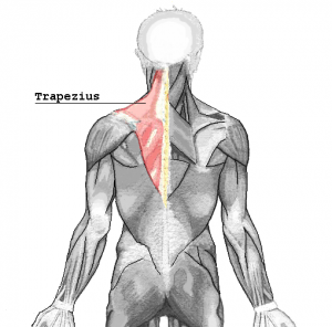
2. The trapezius muscles (“traps”) are your upper back muscles that radiate all the way to the neck: they are crucial for carrying your pack, not just for their muscle power, but because the muscles themselves are where the shoulder harness sits and they’re not strong or robust enough it could lead to soreness and pain. One Israeli study in 2013 found that carrying a backpack can damage the nerves at the upper back and this may be mitigated by stronger muscles.

How to exercise them: Pull ups, dumbbell or barbell shrugs, rows, etc. Shoulder shrugs are useful particularly for the upper trapezoids on which the backpack strap sits. 

Interestingly, the abdominal muscles (“abs”) are also very important in supporting your backpack, especially in mountains that require a lot of bending, twisting, and turning (i.e. Talomo-Apo Traverse), and at the same time maintaining your posture.

How to exercise them: Planks, hanging leg raises, crunches 

The middle and lower back muscles are also involved in carrying a backpack. Like the abdominal muscles, they stabilise the body and prevent fatigue especially on longer hikes.

How to exercise them: Planks, squats, core exercises 

Of course, the quadriceps (“quads”) and all the leg muscles are also essential not just for hiking itself but for carrying a backpack, which adds to the weight that the body needs to lift itself especially when doing steep hikes. If they are weak, the weight will borne by the knees and can cause knee injuries including the patellofemoral syndrome (PFS).

How to exercise them: Squats, deadlifts, leg presses 

SOME NOTES:

1. Because of all the repetitions that you’re doing through the hike, you can actually think of hiking is a one long leg workout, and to some extent it also works out your abs – though this can not be said of the back muscles.

Weight-Distribution2. But careful not to overdo it too much: if the backpack is too heavy it can also affect your body and cause back pain. Gradually increasing weights of backpack can help and you can also do it before the hike: by doing walks with a backpack with you, progressively adding weight until you reach the expected weight of your hiking pack.

3. Make sure that you are wearing your backpack properly, with the hip belt adjusted to make sure the weight distribution is more towards the pelvis and the upper back (see diagram on the side.

The post Hiking fitness: The muscles you need to carry a heavy backpack appeared first on Pinoy Mountaineer.

Hiking matters #497: Exploring Cagua volcano in the Northern Sierra Madre, Cagayan

$
0
0

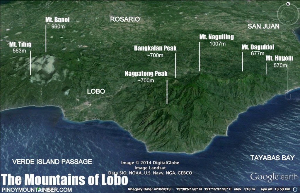
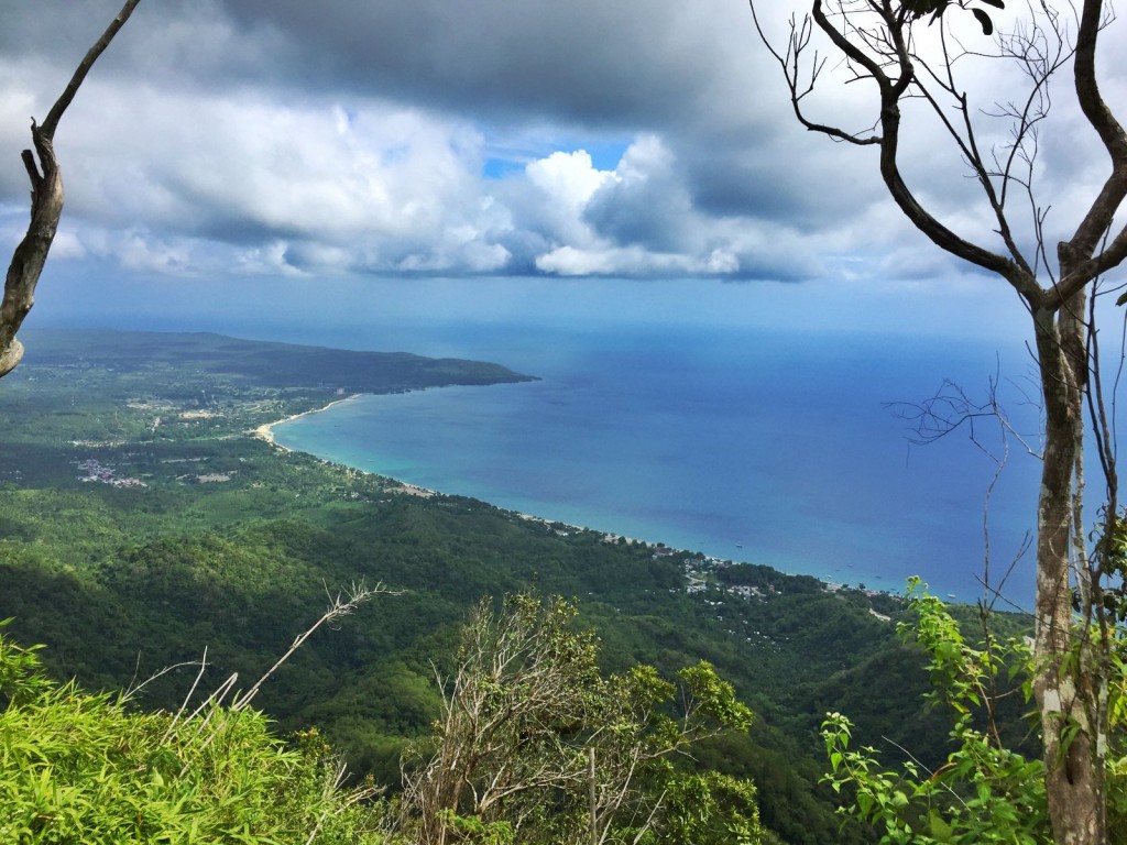
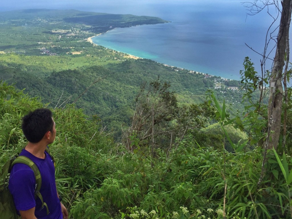
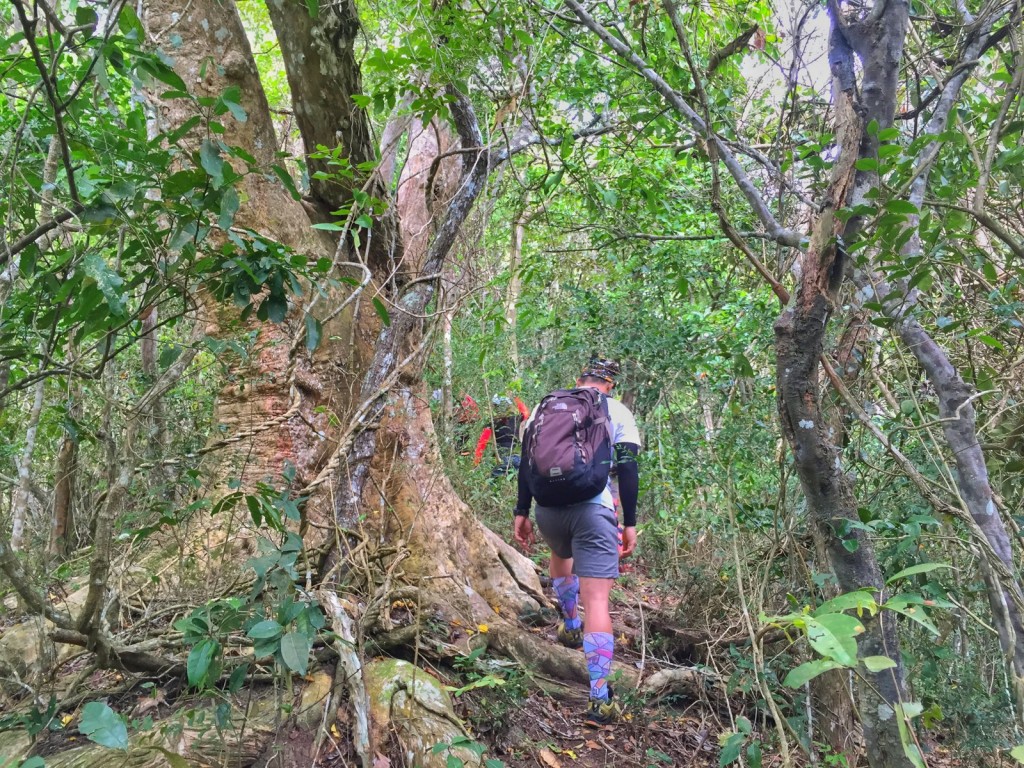
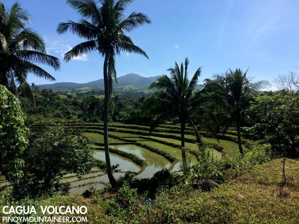
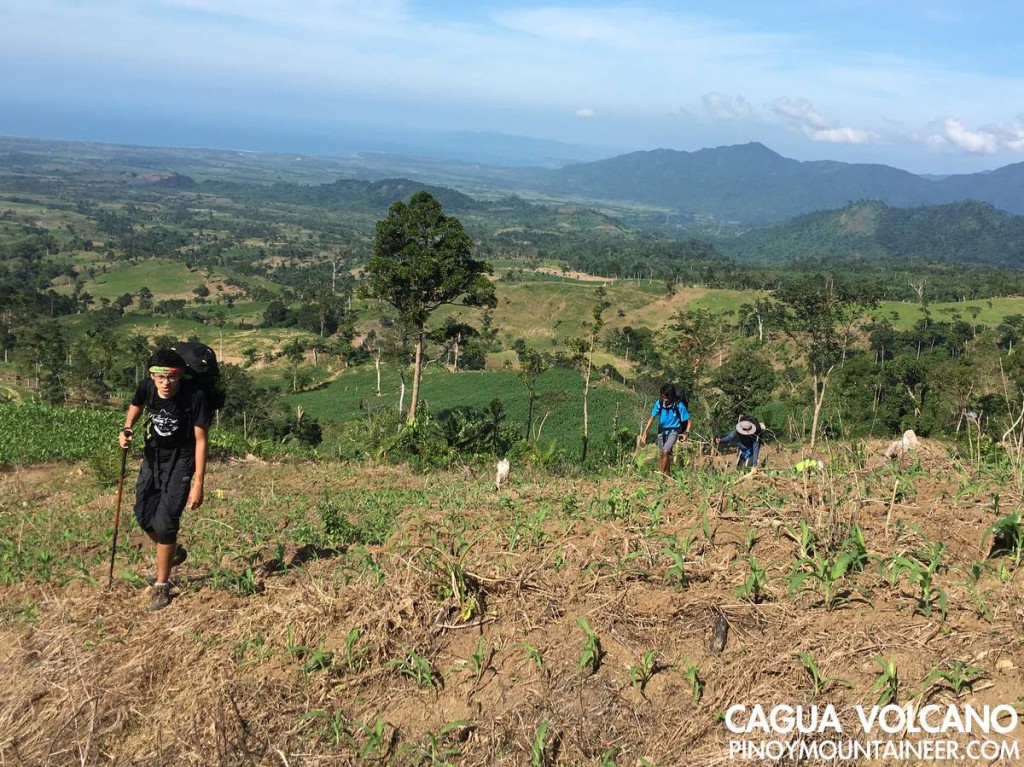
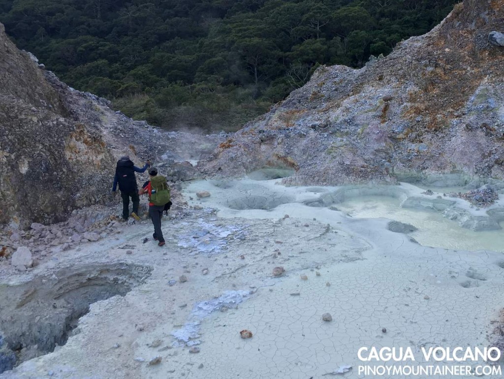
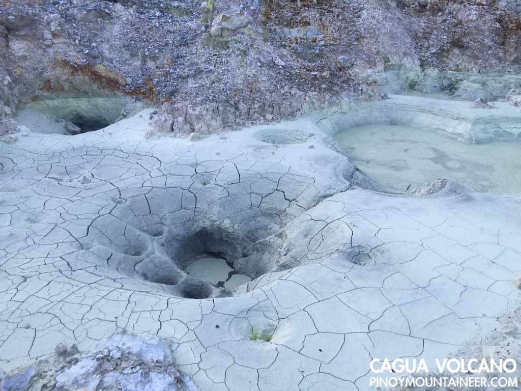
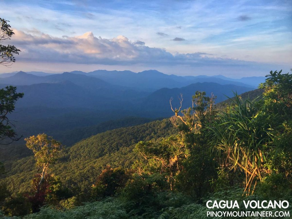
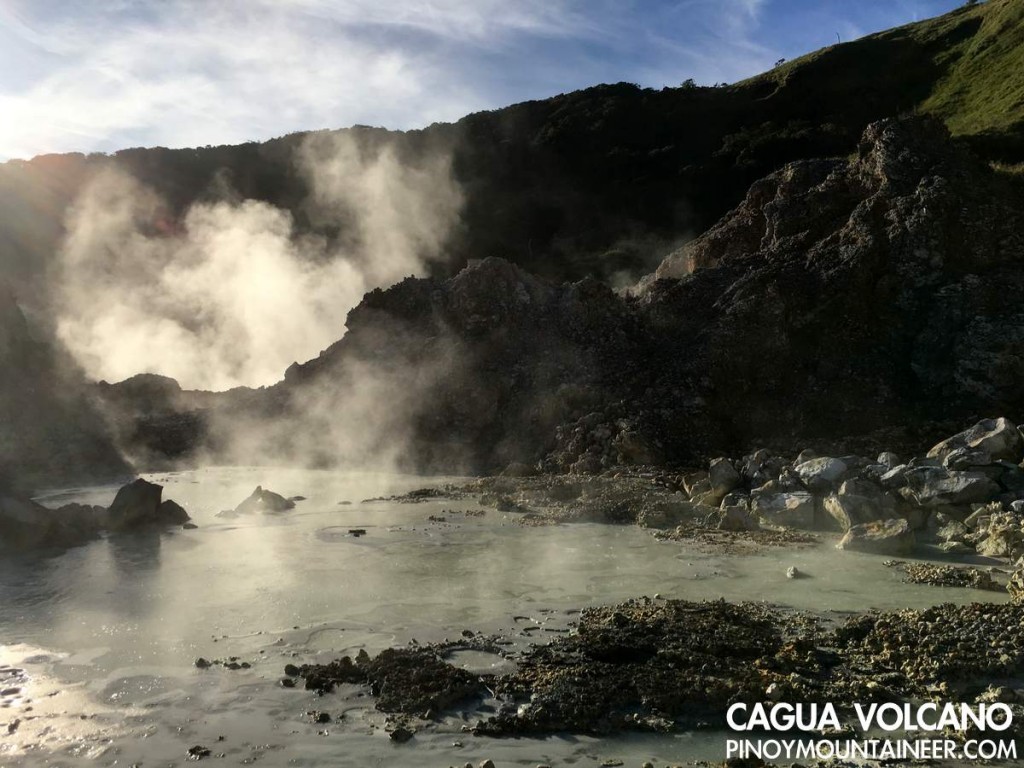
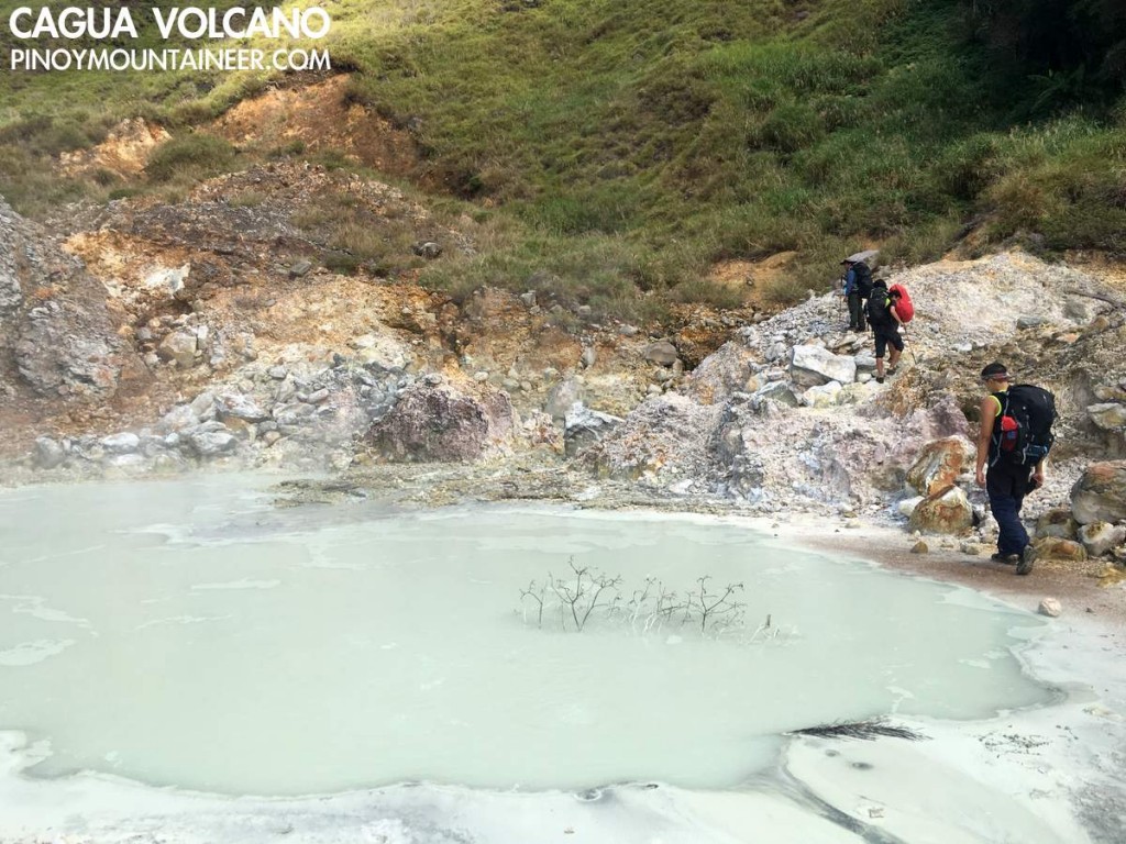
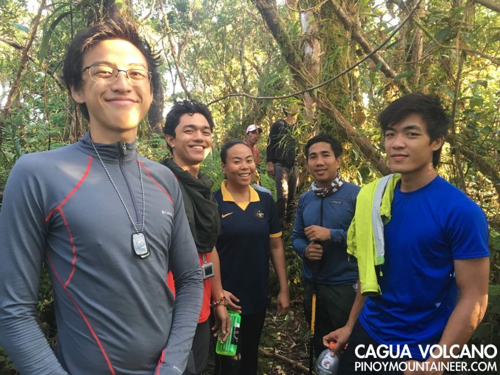
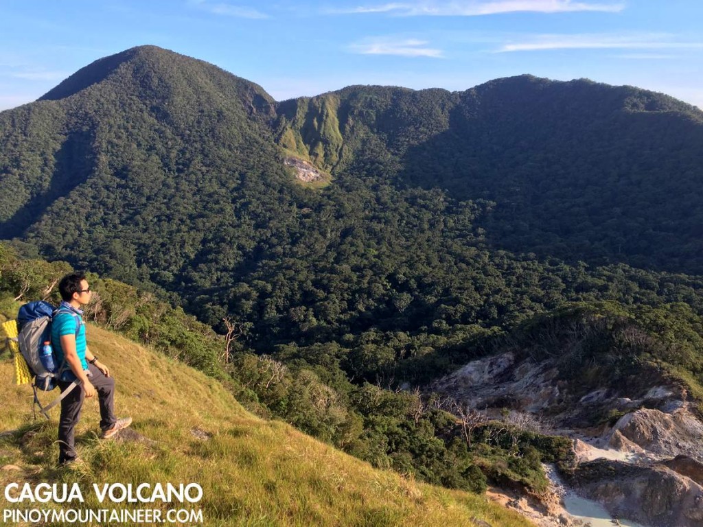
TUGUEGARAO CITY – It all began with a Google Earth search of the highest mountains in Sierra Madre. Mt. Bintuod in Nueva Vizcaya, Mts. Mingan and Anacuao in Aurora, Mt. Dos Cuernos in Cagayan, and several others emerged as candidates for the distinction of “highest” in each of their provinces and perhaps the entire range, but the real surprise to me was the presence of a caldera-looking topography in Gonzaga, Cagayan, which turned out to none other than Cagua Volcano. Largely unknown to mountaineers, this 1168-meter active volcano is part of the Babuyan island chain of volcanoes, and I lost no time in pursuing it as a possible exploration.

IMG_4145
Last year, our trainee Julius de Vera and I went on an ocular to Cagayan to talk to the LGU and get contacts; last week we went back to do a two-day exploration of Cagua volcano, starting from Brgy. Magrafil. Getting to the trailhead is an achievement in itself: 10 hours by bus from Manila to Tuguegarao, 2 hours by van from Tuguegarao to Gonzaga, and 30 minutes by multicab from Gongaza to Magrafil.

IMG_4125

We started trekking at 1100H, immersing in the midday sun as we walked up a rough road surrounded by corn and rice fields up to 400 MASL. Even at this point, we could already see Palaui island (NE) and the faint outline of Camiguin island (yes, there is a northern version of the Camiguin in Northern Mindanao which is just as volcanic).

IMG_4142

The rough road, evidently an old logging conduit transitions into tropical rainforest. The trail, similar to the trails of Cristobal and Isarog, is well-established, and as it ascends to 900 MASL the sufuric smell foreshadows the volcanic features we would later encounter.

IMG_4163

Finally, the forest gives way to grassy slopes that mark the North Rim of the caldera. Here – the highest point we reached at Day 1, the views are spectacular, with full view of the calera and its two fumaroles: one right beneath us, and the other on the opposite side of the rim, obliquely to the west of the summit. At the opposide side, on the other hand, one could see the coastal towns of Cagayan, from Aparri to Sta. Ana, with Palaui island at the northeastern tip.

From the North Rim we descended to the campsite in the middle of the caldera, passing by the fumaroles. The trail edges perilously close to the boiling ponds of sulfuric water, and I nearly got into serious trouble by stepping onto the pond itself as some of the seemingly-solid rocks turned out to be but a layer of solid ground above the pond (This should serve as a warning to future hikers: Be careful when trekking in this area!).

From the northern fumarole, the forested campsite was just 20 minutes away, which was located near a water source. It was there, right in the middle of the caldera where we spent the night. Fortunately I found a nice spot to set-up my one-man tarp tent, and we were blessed with great weather.

***

The next day, we woke up early to explore the other parts of the caldera, starting with the Southern Fumarole, which unlike the Northern one, is without ponds of boiling sulfuric water. Instead, it had lots of vents. We passed through these vents to reach the South Rim of the volcano, entering a nice forest to reach the summit of Cagua volcano, which registered an elevation of 1168m. As an additional highlight, from this forest one can have a glimpse of the countless peaks of the Northern Sierra Madre.

IMG_4430

According to our guides, there are other trails in Cagua which are commonly used by the indigenous people who forage for rattan and other products: we did see some of the them during the previous day. Based on our guides’ accounts, then, there are traverse possibilities although for our purposes we were very satisfied with the extent of our exploration and we happily went back to the campsite. In all, the fumarole-and-summit excursion took less than 3 hours.

IMG_4207

IMG_4395

After breakfast at the campsite, we broke camp and headed back to the Northern Fumarole, then the rim, then marched back to Magrafil. As in Makiling and Tapulao, the rough road felt longer during the descent. Fortunately by 1300H we were back in the barangay and very soon we were making our way to Sta. Ana to reach the second leg of our adventure: Palaui island! Thank you Chuck ,Coby, Tin, Tony, Gab, Gonzalo, and Julius for joining!

IMG_4287

The post Hiking matters #497: Exploring Cagua volcano in the Northern Sierra Madre, Cagayan appeared first on Pinoy Mountaineer.

Hiking matters #498: Trekking in Palaui island: Cape Engaño via the Lagunzad and Leonardo trails

$
0
0

IMG_4524    TUGUEGARAO CITY – From Cagua Volcano (see Hiking matters #497), we took a multicab to the San Vicente port, where a boat ferried us to Punta Verde, the inhabited community in Palaui island, at the northeastern tip of Luzon. A National Marine Reserve since 1994, it has a diversity of flora and fauna including dozens of birds and numerous species of trees. It is also home to the historic Cape Engaño lighthouse – one of the few surviving Spanish-era lighthouses in the country.

IMG_4476

It was already late afternoon when we arrived in Palaui, so we just decided to rest, and partook of a sumptuous dinner of lobster and tinolang manok, which I garnished with the leftover quinoa I had cooked in Cagua.

IMG_4470

Early the next day, we started for Cape Engaño ligthouse, taking the Lagunzad Trail, which allowed us to see the sun rising from the notherneastern extremity of Luzon. We were amazed by the diverse environments the trail offered: from beach and mangrove to forest and grassland. After all of 7.5 kilometers, we hiked up the hill where the lighthouse sits, and up there the view of the Dos Hermanos islets and much further the islands of Babuyan – including the surging Didicas volcano – was mesmerizing.


IMG_4510

The Leonardo Trail – named after the late scientist Leonard Co just as Lagunzad was named after a botanist – was far more challenging that the Lagunzad and could constitute a Difficulty 3/9 hike in itself, with its ups and downs inside a forest. It is amazing that we were just several hundred meters away from the coast!

IMG_4505

By lunchtime we were back in Punta Verde and after another lunch with lobster we headed back to Sta. Ana, en route to Tuguegarao, then to Manila. What a great island adventure! I enjoyed Palaui a lot and the next destination in this part of our country has got to be the Babuyan islands!

The post Hiking matters #498: Trekking in Palaui island: Cape Engaño via the Lagunzad and Leonardo trails appeared first on Pinoy Mountaineer.

Trip Report: First Documented Hike of Mt. Kemalugong, Nueva Ecija

$
0
0

12576138_1133396953339988_2138270258_n

Blogger’s note: In the spirit of encouraging hikers to explore more of the Philippines, we welcome “trip reports” like this one! Just share the following (1) General Itinerary (short description lang of each day, jump off points, and/or sequence of the mountains); (2) Team leader/s (3) Participants (4) Guides (5) What inspired you to do the particular? (6) What are the highlights of the trip? (7) How do you feel about the experience? And email them to news@pinoymountaineer.com.

12557699_1133384136674603_1561083049_o
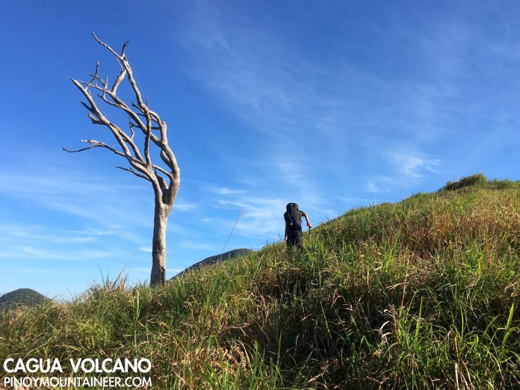
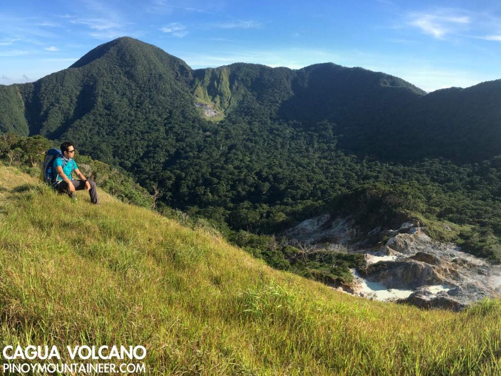
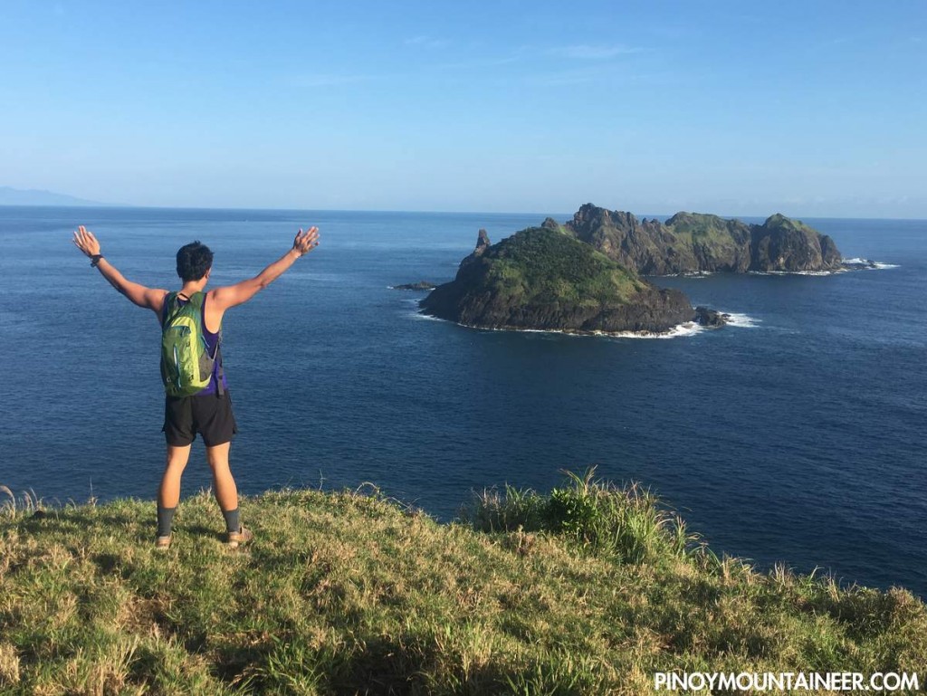
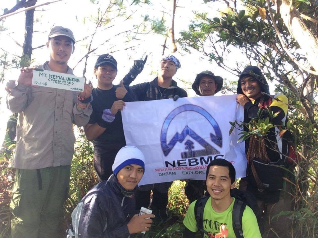
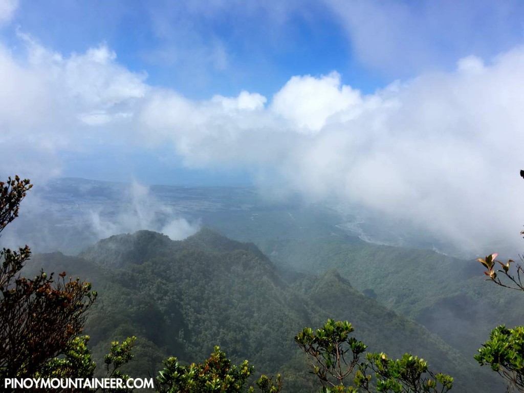
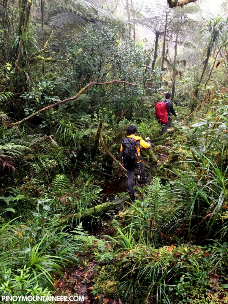
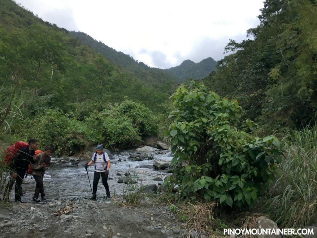
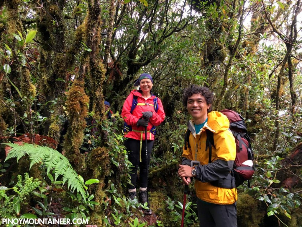
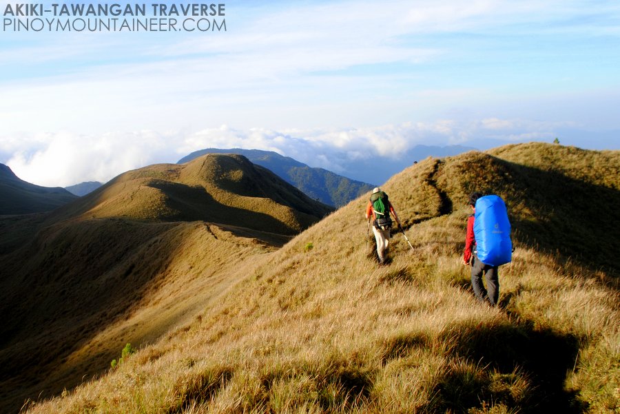
Mt. Kemalugong (Paasa Peak), 1750 MASL
Brgy. Siclong, Laur, Nueva Ecija

ParticipantsNEBMC Exploration Team Marty Cellona (author of this account), Jon-jon Bacquel Garcia, Joy Ann Marie Arieta, Alvin Yuzon, Christian Jayson Narciso, Jerome Austria

Guide: Cristobal Linda

Day 01
2230 At Cubao, Take a bus ride bound to Cabanatuan City
0130 ETA Cabanatuan City Terminal,
0200 ETD going to Brgy. Siclong (Private Vehicle)
0330 ETA Jumpoff Point Brgy. Siclong, Registration @Brgy. Hall
Entry Point side of Brgy. Cemetery
0400 Start trek (Farmland)
0415 River Crossing
0510 ETA Gordon River(water source)
0530 ETA Kubo sa Kawayanan
0600 Start Trek up to Gordon Hill/Cogon Area
0645 Arrival at Forested Area
0715 ETA Giant Baliti Tree
0720 Start trek up (series of uphill and downhill)
0930 ETA @Creepy Kubo
1130 Possible Lunch stop at the trail
1230 Start Trek Up
1330 ETA Tobal’s Trail/ Hunter’s Trail
1600 Arrival @Campsite Set up tent (optional)

Day 02
0500 Wake up Call/Breakfast
0600 Start trek to Paasa Peak via Paasa Ridge
0725 ETA @ Paasa Peak Campsite
0735 ETA @ Mt. Kemalugong Summit (Paasa Peak)
0830 Start Descent
0945 Campsite (Break Camp)
1100 Start Descent via Tobal’s Trail
1445 ETA at Giant Baliti Tree
1500 Arrival Gordon Hill/Cogon Area
1630 ETA Gordon River
1745 River Crossing
1800 Farmlands
1830 Arrival at Brgy. Hall (Tidy Up)
1850 Head Back to Cabanatuan City
(via rented service)

What inspired you to do the particular hike?
We were inspired by the fact that there we were surrounded by majestic yet unexplored mountains here in Nueva Ecija, and our hike is in line with the exploration team’s dream to reach peaks and summits that no one has ever reached yet, with the intention of promoting ecotourism while protecting these mountains from any form of acts that threatens their natural wonders.

What are the highlights of the trip?
The “sea of clouds” is among the highlights of the trip. We were overwhelmed to realise that such spectacular view of mountain scenery, popularly seen in the mountains of Benguet, can also be found in Nueva Ecija. However, prior to this invaluable prize of seeing the spectacular view, there were instances where the exploration team lost excitement in finding trails, but we are thankful to our vigorous guide (“Kuya Christobal”) in making ways to proceed with the exploration. The feeling of disappointment for not reaching the summit sometimes lowered the morale of the exploration team. But at the end of more than 12-hour long and exhaustive trek, the summit (eventually named as “Paasa Peak”) was reached.
The camaraderie within the group is likewise highlighted considering the diversity of the profession and experience of the team members.

How do you feel about the experience?
It was like finding a diamond in the middle of unknown. It was a mixed emotion. The feeling of uncertainty, having considered that this will going to be the first time to explore the mountain. We don’t have any idea of the difficulty range of the mountain, are there going to be snakes along the trail, or some other wild predators, or a Cannibal community amidst the jungle. Perhaps it makes us uncomfortable because it is uncomfortably close to our own limited experiences of our usual hikes. The same time breath-catching feeling of exhilaration that this is going to be exciting.

How can others do the same or similar trip?

Commute:
Take a bus ride bound to Gabaldon/ Dingalan,then alight to Brgy. Siclong crossing and ride a Tricycle going to Brgy. Hall. (There is no bus going directly to Brgy. Siclong.) First trip usually starts around 6am in the morning at Cabanatuan Bus Terminal. Last trip going back to Cabanatuan City is around 3pm.

Private Vehicle/Rented
via NLEX
Take Sta. Rita Exit you will be passing by the Towns of Bulacan, Gapan, Sta. Rosa, Cabanatuan City, Palayan City and take right going to Laur. It’s just a straight drive towards Brgy. Siclong.

Any Contacts?

Brgy. Capt. Zosimo Tabing Jr – 09196908901
Councilor Jerry Sapon – 09075115765
Brgy. Sec. Edward del Rosario – 0949452491

MT. KEMALUGONG PICTURES
12557707_1133399013339782_482356570_o

12557098_1133403556672661_134403920_o12562777_1133401920006158_927129271_o

The post Trip Report: First Documented Hike of Mt. Kemalugong, Nueva Ecija appeared first on Pinoy Mountaineer.

Mountain News: Ongoing forest fire in Mt. Piapayungan

$
0
0

DSC_0131

Mr. Benjamin Alangca of DENR-Koronadal has notified us of the ongoing forest fire in Mt. Piapayungan in ARMM and is requesting mountaineers who have done hikes/explorations in the Piapayungan range to share their GPS tracks/coordinates to help in their efforts to suppress the fire.

I did two exploratory hikes in the range, reaching the summit of Mt. Ragang via Wao, Lanao del Sur in 2013 (see link). The group that reported a hike Mt. Piapayungan the year after might be more helpful since the fire seems in that direction. In any case here are the coordinates of our hike:

7.72028 N, 124.61301 E, 1445m (campsite)
7.72623 N, 124.56816 E, 1751m
7.71414 N, 124.53354 E, 2561m
7.71200 N, 124.53407 E, 2643m
7.70985 N, 124.53468 E, 2714m (summit)

We are very saddened about the news of this ongoing fire and will continue to coordinate with the DENR about how mountaineers can be of assistance.

The post Mountain News: Ongoing forest fire in Mt. Piapayungan appeared first on Pinoy Mountaineer.


The 10 highest mountains in the Philippines (2016 update)

$
0
0
IMG_2533
Mt. Tabayoc in the Cordilleras, formerly the 6th and now regarded the 7th highest mountain in the Philippines.

Several years ago, a lot of people thought that Mt. Pulag is the 2nd highest mountain in the Philippines, but with better documentation of the Mindanao mountains we were able to include the Bukidnon mountains, making for a better picture of the country’s highest peaks: Pulag, it turned out, was third; the second is actually Mt. Dulang-Dulang, whose sister peak, Mt. Kitanglad, is 4th.

The big update now is the documentation of the Piapayungan Range, which like the Kitanglad Range reveals a number of distinct mountains. In 2013, I successfully reached the summit of Mt. Ragang (2714m), and later there was also a reported ascent of Mt. Piapayungan, with altitudes even higher than that of Kalatungan. These reported coordinates are corroborated by satellite imaging, including Google Earth data which reveal that indeed the range is indeed higher than previously reported.

Thus I am posting this tentative update as a corrective to the previous; here is our updated list of the 10 highest mountains in the Philippines, plus five mountains with recordings above 2700 MASL and are within the margin of error of Mt. Ragang. Your feedback are very welcome – and references / sources will be highly appreciated. The final revision will be released soon:

1. Mt. Apo (2956m) ⬌1
2. Mt. Dulang-Dulang, Kitanglad Range (2938m) ⬌2
2. Mt. Pulag, Cordilleras (2922m) ⬌3
4. Mt. Kitanglad, Kitanglad Range (2899m) ⬌4
5 . Mt. Piapayungan, Piapayungan Range (~2890m) – as reported by hikers who reported an ascent in 2014 and based on satellite imaging. Based on visual evidence also from my 2013 Mt. Ragang ascent. ⬆︎6
6. Mt. Kalatungan (2860m). ⬇︎5
7. Mt. Tabayoc, Cordilleras (2842m) ⬇︎6
8. Mt. Maagnaw, Kitanglad Range (2742m) ⬇︎7
9. Mt. Timbak, Cordilleras (2717m) ⬌9
10. Mt. Ragang, Piapayungan Range (2714m) – based on my own measurements at the summit and on satellite imaging (Google earth). Ragang is 2.7km away from Piapayungan.🆕

Other candidates for the 10th place (and certainly part of the Top 15):
– Amuyao (2702m)
– White Peak (2700?m)
– Talomo (2707m)
– Al-Al (2704m)
– Kalawitan – some sources 2714m but more likely 2689m

The post The 10 highest mountains in the Philippines (2016 update) appeared first on Pinoy Mountaineer.

Opinion: The Philippines needs a National Parks Service

$
0
0


(null)

Pinoy Mountaineer is calling for a constructive conversation about what we should do to preserve the beauty of Mt. Pulag and other mountains in light of the problems brought about unregulated ecoutourism. Contributions are welcome at mews@pinoymountaineer.com. 

by Kat Velayo Greenberg

I just came back from a trip to the Patagonias in South America and learned so much about how other countries regulate their tourism.

Many people know that the US has a National Parks Service, but it really opened my eyes that a country like Chile, a country that is not that much wealthier than the Philippines has such an established and well-run organization as their CONAF (National Forest Corporation). It’s understandable, thousands of people have been visiting the national parks in the US and Chile for many years, so they had to find a way to maintain them much earlier on. In the Philippines, our national parks have only boomed as popular tourist destinations in the last decade or so, but we are very ill-equipped to handle this new interest in ecotourism in our country. And if we don’t do anything about it, we risk doing irreversible damage to these areas over time.

While hiking in the Torres del Paine National Park in Patagonia, I saw traces of CONAF everywhere. Before we entered, they made us watch videos so that we would know about how dangerous it is to light any open fires in the park and to show us that we shouldn’t disturb the wildlife. While trekking, it was clear on the trails where they had closed off overly eroded trails and were directing hikers to new trails to let the old tracks rest. It was also clear where they were trying to close off the rogue trails that were being beaten by undisciplined hikers by blocking them with branches and rocks. And there were always rangers at the campsites to keep a loose watch on people.

The Philippines really needs a National Parks Service. The DENR cannot handle the workload of maintaining our national parks on top of enforcing rules about environmental degradation and policing corporations. Many other countries have a government body that is just about maintaining the parks. It should be separate from the Department of Tourism and the DENR because it needs to focus on its own agenda: regulating the amount of traffic to our natural wonders and maintaining the health and beauty of those natural wonders.

That is why many of the natural tourist destinations in other countries charge fees. The fees pay for park rangers to clean up the area, to maintain trails when they become too worn out, to limit the amount of tourists that can enter everyday, to maintain “seasons” so that they can close the trails and parks for certain parts of the year so that the destinations will have some time to rest from the amount of people that go there, and also to educate tourists before they enter the park about rules like Leave No Trace and staying on official trails to prevent damage as well as enforcing these rules when people are in the park.

I’ve always wondered why we don’t have this. Imagine, we have all these natural wonders but no one is caring for them. If we had a body to properly regulate how people visit them, they would last for many generations to come. And a National Parks Service would create jobs too, for local people to become rangers who can manage their areas.

You should propose this in your meeting with DENR. Before, only mountaineers would visit these places, mountaineers who know the rules and respect nature. Now, too many people who have no idea what they are doing out there are going to our mountains, and we need a body to regulate them and teach them the rules.

The post Opinion: The Philippines needs a National Parks Service appeared first on Pinoy Mountaineer.

Opinion: So much has changed in a year

$
0
0

10991254_10203849952829874_1774512733245969079_n

Pinoy Mountaineer is calling for a constructive conversation about what we should do to preserve the beauty of Mt. Pulag and other mountains in light of the problems brought about unregulated ecoutourism. Contributions are welcome at mews@pinoymountaineer.com. 

by Abigail Giron

Firs of all I would like to say that I am happy that this topic was finally brought up. I have chosen mountain climbing as hobby because I’ve always loved being in touch with nature, working hard for the reward I’m about to get at the summit, and taking part in the lives of the mountains’ locals.

It was April of 2014 when I first climbed Mt Pulag. I went with my hiking friends and, like the others, we wanted to catch the day’s first light and Benguet’s sea of clouds. As stated in the rules, we made a reservation before going there, passed by the DENR station to register, and waited at the jump off to be accommodated. It was a smooth process and we were all just so excited to be with fellow mountain enthusiasts, waiting to see what the mountain has to offer. And indeed, it did not disappoint.

The same group went back last February of 2015, going through the same process as we did before. This time though, it was different. Reservation was difficult because tour groups have secured slots way in advance; there were twice as many people during the orientation at the DENR station; and the jump off point had a very long line for climbers mostly in groups of 20-30. Eventually, we got to the campsite. It rained really hard that night so we had to skip socials. The next morning, we were surprised to see a campsite that is multi-colored, filled with countless tents and campers buzzing around. We couldn’t go to the summit because of the weather so we just stayed for a while, cleaned up the space that we took, and went home.

So much changed in a span of a year–it could be because of the sudden popularity of mountain climbing due to social media, or it could be because of the boom of adventure tour groups. I am happy that we are all into one healthy and good passion, and I believe that it’s something that’s meant to be shared. I’m not quite sure, however, how each of us has given back to Mt Pulag. With the sheer number of plastic wrappers and bottles that we saw and had to pick up along the trails, I’m wondering how much more importance we have been giving to enjoyment over the mountain’s wellness. It has given us nothing but amazing views and unforgettable experiences, and now I’m wondering how we have taken care of it in return. I woke up that morning, saw the campsite, and felt extremely bad about how overused the land looked.

This isn’t something that’s happening only to Mt Pulag. There have been talks about trees getting cut down for tourists to get better views in Mt Maculot. Mt Palay Palay’s Parrot’s Beak never seems to be running out of lines during weekends. And trails, poor trails, take all the beating.

I haven’t gone back to Mt Pulag since my second visit mainly because I’m afraid of what I’m going to see, and also because I don’t want to add up to an already huge number of people that’s going to walk along the mountain’s tired trails. I wish for Mt Pulag to take its rest for a while. I wish for hikers to be more responsible and mindful when heading up there. I wish for people to realize that, yes, we do this to enjoy ourselves but not at the expense of the mountain. I wish for stricter control at the jump off. And I wish for mountaineers to be initiators of responsible climbing for the new ones.

Let me know if there’s any way that we can help in pushing for Mt Pulag’s restoration. The mountain badly needs it.

The post Opinion: So much has changed in a year appeared first on Pinoy Mountaineer.

Opinion: Let Mt. Pulag heal

$
0
0

Pinoy Mountaineer is calling for a constructive conversation about what we should do to preserve the beauty of Mt. Pulag and other mountains in light of the problems brought about unregulated ecoutourism. Contributions are welcome at mews@pinoymountaineer.com. 

by Luigi Angelo Bustamante

Mt. Pulag was my first major climb. The mountain was beyond magnificent. It was enchanting and mysterious.

I got into mountaineering from when I was a boyscout. Mt. Makiling was home to me for a couple of years. I still remember the smell of trees and the humid tropical air. I witnessed firsthand how the trails I used to walk on became paved and the trees cut down for easier accessibility. I did my undergrad thesis there as well and saw how the mountain I love lost its rich fauna, flora, and biodiversity. I felt the mountain weeping.

I went up Mt. Pulag via the Ambangeg trail just last January 2013 with my classmates from UP Manila. My classmates were there to take a look at the ferns and mosses for their biology elective. I was there simply to appreciate the mountain. I did not just appreciate it, I was blown away. I was humbled at how a mountain as giant as Mt. Pulag can be full of the delicate lifeforms and at the same time be a force of nature.

It was an incredibly cold day when we went up. Having climbed mountains before, I did not avail of the services of porters to carry my 14kg backpack. Just as about we were to reach the grasslands, I noticed how Mt. Pulag was relatively untouched. I missed how Mt. Makiling used to look. Lush and green. Mt. Pulag’s grassland was a bit different though. Everything was short but still, everything was very much alive. The clouds rolling down, and the sun slowly setting. The trails were established but everything was still relatively untouched.

The sunrise was spectacular. Everything the light touched was alive. Everything was peaceful. Everything was right.

I went back around March 2014. The pine and mossy forests were still alive. However, alot the pine forests were transformed into agricultural land. The colors of the vegetables and fruits with the pine forest backdrop would interest the beginner hiker – but what I was seeing was the slow destruction of the mountain for man’s purpose. We need to live, but in turn, we often overlook the need of the Earth to keep balance as well. The grasslands were the same story. The trail I walked on last 2013 was now just one of the number of trails going to the same spot. When people walk on plants, the dwarf bamboo, they die. That’s why we were told to walk on the established trail to lessen our impacts to the mountain. But what I see now, the mountain is scarred. Excoriations throughout it’s skin were many. Bleeding. I felt the mountain crying, in pain.

Our desire to see the beauty of nature has led to this. Our desire lead to its loss.

It pains me to see the mountains I’ve made connections with get destroyed by irresponsible tourism. I’ve always wanted to keep the beauty of the mountains for everyone else to see. But, our greed got the better of us. No – it got the better of the mountain. It’s not about us. It’s about nature. The dream of giving everyone the chance to see how beautiful it is may never be made real. At this state, I just want to let the mountain rest and heal.

It’s time to close Mt. Pulag. Let the mountain heal.

Luigi Angelo Bustamante is a medical student at the University of Santo Tomas.

The post Opinion: Let Mt. Pulag heal appeared first on Pinoy Mountaineer.

Opinion: Mt. Pulag – a tour operator’s perspective

$
0
0

pulag - akiki trail1

Pinoy Mountaineer is calling for a constructive conversation about what we should do to preserve the beauty of Mt. Pulag and other mountains in light of the problems brought about unregulated ecoutourism. Contributions are welcome at mews@pinoymountaineer.com. 

by Anonymous 

I may be one of the outfitters who really gain a lot from having guests coming to Mt. Pulag, but I follow all the rules, and I don’t mind having it closed, seriously.

Having had a close encounter with the locals for more or less 5 years, however, I feel for them and I know that if tourism dies, their income will die too.

If there’s no more tourism, they will farm, if you’ll notice, farming reached the area of the park already and we don’t want that. How much more if you close the park? What the locals claim is that they do not know the effects of farming from the ecosystem in the park.

Here are my dreams and/or suggestions for Mt. Pulag:

1. Inform the locals of the effects of farming at the park area. More LNT awareness.

2. Do not close the park BUT be strict with the rules. This we all know, Maam Mereng kept on implementing rules but the locals themselves do not follow. They encourage more hikers, walk ins, anything that will give them money. Even some organizers do not follow. The implementing of the rules should come from the DENR, and as powerful or influential hikers/mountaineers/outfitters we must encourage the locals to be united with the DENR. Personally, I cannot blame Maam Mereng for everything, I pity her, because she does not have the support of the locals.

3. Encourage home stays and ranger camping – in all days of the week. Right now, this only happens on weekends.

I organized a training for the guides last year, I plan to do this annually. Although my main topic was first aid and LNT, I actually wanted to encourage them slowly about how to maintain the park. I can only get their attention with First Aid as a topic.

It was too difficult for me and heart breaking to know that most of the park fees goes to the government. Some of the locals say that the P80.00 environmental fee goes to government officials. I don’t know if this is true, but hikers do registration fees

Travel Factor, Trail Adventours, YABAG and myself are one of the many outfitters who brings clients to Mt. Pulag every weekend. Believe me, these outfitters are even better than the rest, because they follow whatever PaSu says.

There are the so called hard core mountaineers/outfitters who brings up to 70-100/pax per weekend. They don’t have reservations, they walk in, drink liquor till they drop, do not respect the rules, the locals, do whatever they want basically. Don’t get me wrong, I don’t hate them, I just don’t like what they are doing, and I tell it to them whenever I have a chance.

Mt. Pulag to be closed or not – is an old issue that I kept on seeing at blogs. But what can we really do for the mountain?

Closing it from June to November might be a good idea too. But then again, when I think about the locals, I begin to think twice.

I hope you could encourage volunteers to go to Mt. Pulag And conduct environmental seminars, studies etc. They don’t even have a concrete study about the carrying capacity! Where are all the funds?! They don’t have medical kits, uniforms, etc.

Okay, enough of the whining and thanks for taking time to read, glad you reached up to this part. This has just become a frustrating part of my life and it’s too big, I can’t do anything, because I’m also afraid to be hated by the locals and the local government, aside from conducting seminars and training, and hopefully in the near future – make the locals and the DENR work together. Sakit nila ang inggit. But even so, I love both the locals and the DENR officers.

I must add – maybe it’s easy for some of the mountaineers to say “close the park” – because they don’t go there as often as we do. Do they really know what’s happening up there? Do they know the situation? Do they understand what will happen if they close the park? I think not. We need an expert to decide on this.

But – Whatever the DENR says, my company will follow whole heartedly.

The post Opinion: Mt. Pulag – a tour operator’s perspective appeared first on Pinoy Mountaineer.

Viewing all 610 articles
Browse latest View live