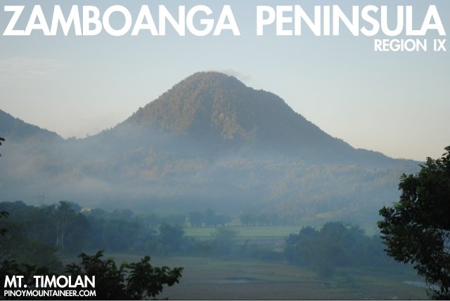
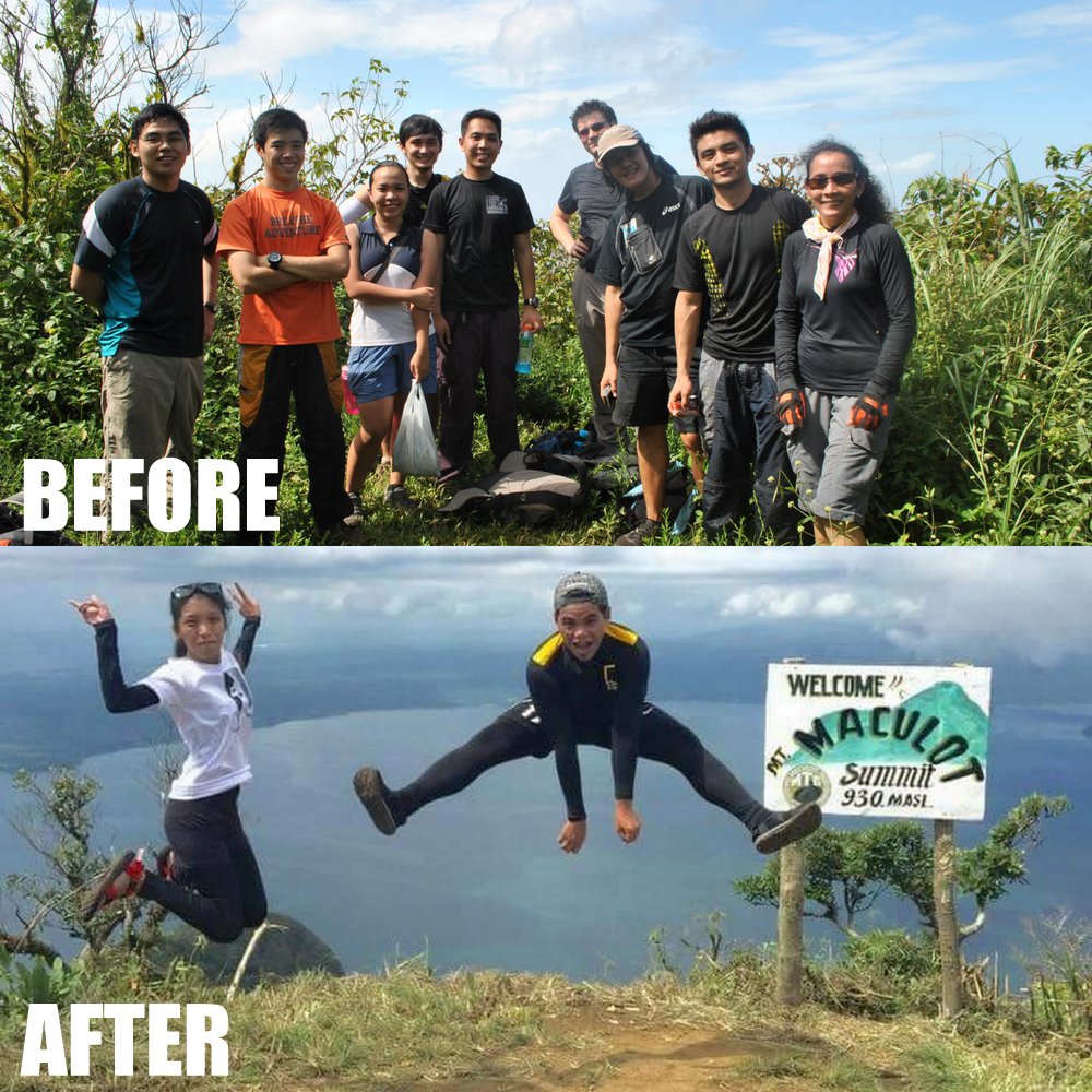
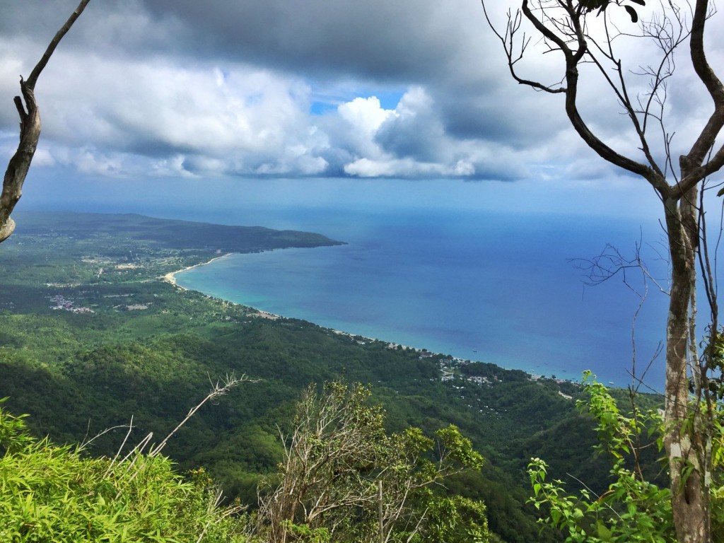
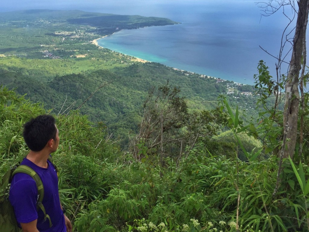
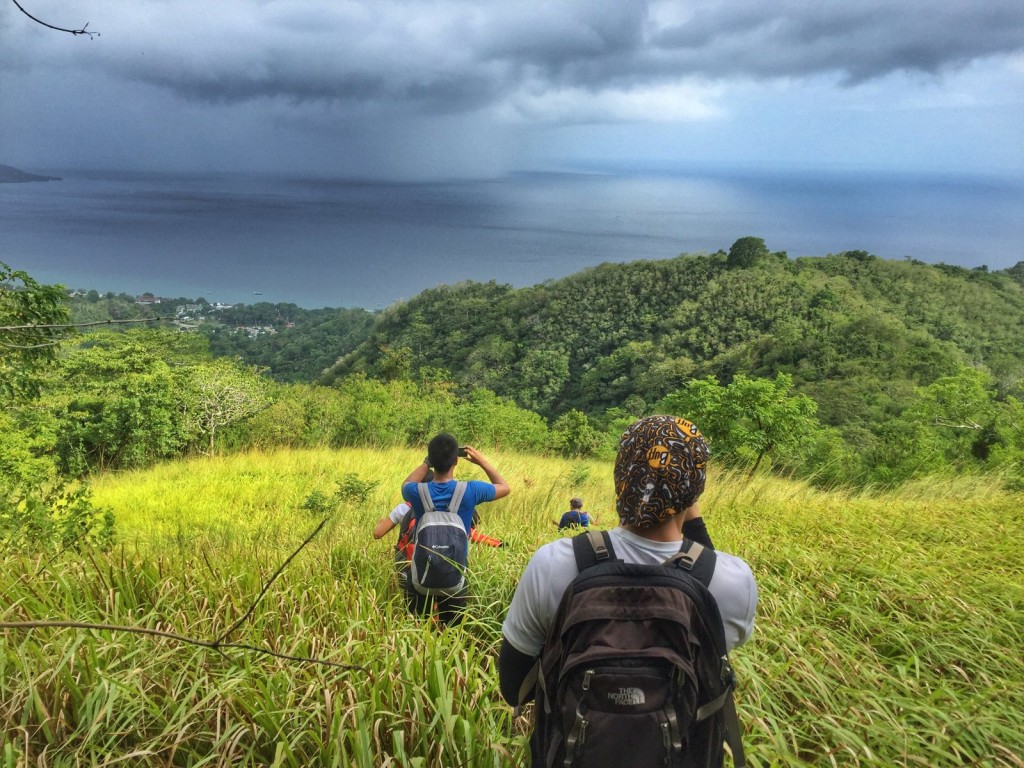
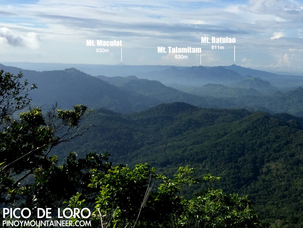
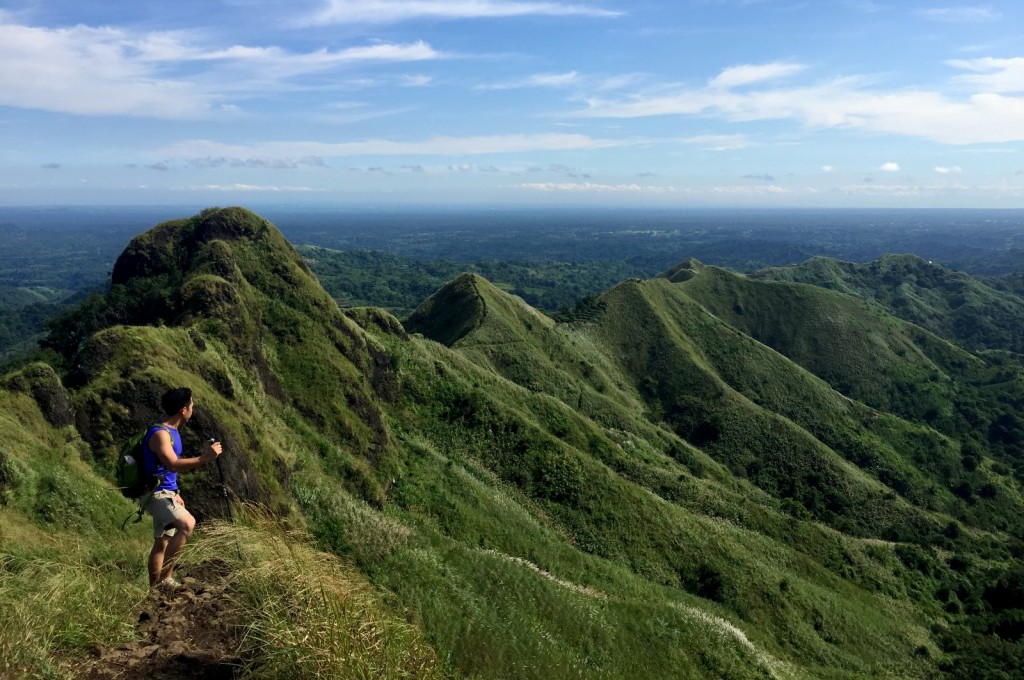
Quantcast
Channel: Pinoy Mountaineer
Viewing all 612 articles
Browse latest View live

Hiking in Central Visayas (Cebu, Bohol, Siquijor) – Region VII

$
0
0

1-IMG_5787-1025

MOUNTAIN INDEX
Mt. Babag: Cebu / 752m
Mt. Kan-Irag / Sirao Peak: Cebu
Mt. Lanaya: Cebu / 700m
Mt. Manunggal: Cebu / 1003m
Osmeña Peak: Cebu / 1013m (highest)

Regional correspondentScarlet Su-Villamor 

DESCRIPTION
Central Visayas (Region VII)
includes the islands of Cebu, Bohol, and Siquijor. Though there are no peaks higher than 1100 MASL, there’s still plenty of hiking in Cebu, and there are also short treks in Bohol and Siquijor.

COVERAGE UPDATES
PinoyMountaineer will try to document more of the treks of Cebu as well as identify hikes in Siquijor and Bohol.

The post Hiking in Central Visayas (Cebu, Bohol, Siquijor) – Region VII appeared first on Pinoy Mountaineer.


Hiking in Leyte and Samar (Eastern Visayas – Region VIII)

$
0
0

DSC_1012

MOUNTAIN INDEX
Alto Peak: Leyte / 1332m
Mt. Magsanga: Leyte / 655m
Mt. Tres Marias: Biliran /1315m

Regional correspondentVacant 

DESCRIPTION
Eastern Visayas (Region VIII) includes the provinces in Leyte and Samar, and the island province of Biliran. Hiking in Leyte and Samar remains poorly documented but Alto Peak and Tres Marias are well-established destinations. There are many hikes which are also of interest to biologists given the rich flora and fauna.

COVERAGE UPDATES
PinoyMountaineer will try to document more of the mountains of Leyte and Samar, as well as those of Biliran.

The post Hiking in Leyte and Samar (Eastern Visayas – Region VIII) appeared first on Pinoy Mountaineer.

Hiking in Ilocos Region (Region I)

$
0
0

DSCF5830

MOUNTAIN INDEX
Mt. Palemlem: Ilocos Norte / 1271m
Mt. Sicapoo: Ilocos Norte / 2354m
Mts. Simagaysay-Tumarid Traverse: Ilocos Norte / 1560m
Tirad Pass/Traverse – Sagada: Ilocos Sur / 1700+m
Tirad Peak: Ilocos Sur / 1388m

Regional correspondent: Agnes Pinzon (honorary) 

DESCRIPTION
Ilocos Region underwent a “hiking renaissance” through the efforts of Agnes and Archie Pinzon and the One Degree Mountaineering Group based in Laoag, with whom PinoyMountaineer.com collaborated to feature various mountains in the region, most notably Mt. Sicapoo. The legacy of this effort can still be seen in the Invitation to Ilocos series that Agnes Pinzon authored.

The Cordillera Range actually extends all the way to Adams, Ilocos Norte, hence this region is full of possibilities. On the other hand there is also a sense of history with Tirad Pass, home of the famed battle.

COVERAGE UPDATES
PinoyMountaineer will seek to document more of the Ilocos Norte mountains, building up on the early attempts of One Degree Mountaineering Group.

The post Hiking in Ilocos Region (Region I) appeared first on Pinoy Mountaineer.

Standard questionnaire for making a Pinoy Mountaineer itinerary

$
0
0
DCIM101GOPROGOPR1434.
Trekking in Mt. Nangtud, Antique (PinoyMountainer.com)

Is there a mountain you’d like to share that’s not yet on the Pinoy Mountaineer database? We are inviting fellow mountaineers to contribute to our pool of knowledge by sharing itineraries! Simply by answering the questionnaire below, you can author or help write an article that would be a big help to others. Simply email to news@pinoymountaineer.com!

STANDARD QUESTIONNAIRE FOR MOUNTAIN DOCUMENTATION 
PinoyMountaineer.com

Mountain Name:
Alternate names, if any:
Route/Trail taken:
Jumpoff point:
Coordinates, if any:
Barangay and town:

HIKING TRAILS
1. How long is total trek time to reach the summit or endpoint? Are guides necessary for this climb, and if so, how much would they cost? Where can we contact them?
2. How is the trail like? How wide is it? Are there parts that are steep, difficult, or confusing? Are there remarkable landmarks, flora, and the like? Are there wild animals?
3. Does the trail lead to the summit? What mountains and views can be seen at the summit? Are there special landmarks in the summit?
4. Where are the jump-off points? Where are the campsites/ places to stay and are there water sources? Is there cellphone signal in the peak and along the way?
5. Do you know of any alternate trails / traverse routes with other destinations?
6. Aside from the summit, what are the significant points of interest during the climb? What are the names and characteristics of the waterfalls, river, and other bodies of water?

CULTURE AND LOCAL INFORMATION
7. Are there tribes and ethnic groups residing in the mountain? What are the names of these groups and could you share us interesting facts about their culture?
8. What are the names of the mountains? Do the locals have an explanation why the mountain is named as such? Are there special legends/tales/superstitions about the mountain?

LOGISTICS/CONTACTS
9. Are there contact numbers of guides/contacts who can be of help in climbing the mountain?
10. What is the easiest way to go to the jump-off point from the nearest city? How many days does it take to climb the mountain on the average?

SAFETY CONCERNS
11. Are there armed groups in the mountain?
12. Are there flashfloods, landslides, and other natural phenomenon to watch out for in the mountain?
13. Have there been reported deaths/injuries in the mountain?

FOR THE ARTICLE
14. Can you draft suggested itineraries, as well as a budget breakdown, for this mountain?
15. Could you also share pictures that you think would capture the mountain best?
16. Could you rate the mountain according to the Difficulty scale of 9?
17. Please let us know also the people who deserve acknowledgment for this article.

The post Standard questionnaire for making a Pinoy Mountaineer itinerary appeared first on Pinoy Mountaineer.

Hiking in Zamboanga Peninsula (Region IX)

$
0
0

blogger-image-1771783193

MOUNTAIN INDEX
Mt. Pinukis / Zamboanga del Norte
Mt. Pulunbato / Zamboanga City
Mt. Timolan / Zamboanga del Sur

Regional correspondent: vacant

DESCRIPTION
Although Zamboanga Peninsula is not noted for hiking, the topographic maps suggest that this region has a lot of potential. From the foothills that flank Zamboanga City to the upper reaches of the peninsula that border Mt. Malindang, there is much to be discovered in the region. Hiking in Zamboanga is one exciting possibility for Mindanao!

COVERAGE UPDATES
PinoyMountaineer will search for a regional correspondent who can help us document this region. If you are interested, contact the blogger at gideon@pinoymountaineer.com!

The post Hiking in Zamboanga Peninsula (Region IX) appeared first on Pinoy Mountaineer.

Gear Review: Vaude Minimalist 25 daypack

$
0
0

11412233_10153853376053912_2429877665896435092_n

A relative newcomer to the outdoor scene in the Philippines, Vaude is offering a wide range of bags that cater to a wide range of outdoorsmen. I’ve had the opportunity to try out some of their offerings in recent months and I would like to share my initial thoughts.

The Vaude Minimalist 25 daypack stakes its claim on being “minimalist”, and at less than 800g,  think it succeeds – it is much lighter than the Deuter bags of the same volume that are usually available in the Philippines (in fairness to Deuter, its Pace 26 is comparable at 830g, but it’s not available here). I like the fact that it has a top loader, which is for me is convenient for putting essential items like headlamps, a bandana, etc.

One thing that people might look for are mesh sides where you can put your water bottles – but given its minimalist approach, this is a detail that I’ll forego. The drawcords and gear loops are always helpful to customise the shape of the bag a bit depending on what’s inside, and to attach trekking poles.

Most other brands have a similar offering, but so far I am impressed by the no-nonsense comfort of the Vaude daypacks. Unlike Ospreys, Vaude has a characteristic simplicity which makes sense for the outdoors. I will have to see for myself what its other bags – including overnight packs – can offer.

The post Gear Review: Vaude Minimalist 25 daypack appeared first on Pinoy Mountaineer.

Mt. Napulak (1,239+) in Igbaras, Iloilo

$
0
0

IMG_1807
MT. NAPULAK
Igbaras, Iloilo
Entry point: Brgy. Bagay, Igbaras
Exit point: Brgy. Tigbanaba, Igbaras
LLA: E, 1239 MASL (+1030m)
Days required / Hours to summit: 1-2 days / 4-6 hours
Specs: Minor climb, Difficulty 4/9, Trail class 1-5
Features: Tropical rainforest, scenic views of Igbaras, rock formations
Article history: Created 4-Nov-2015 by Gideon Lasco

BACKGROUND
At the southern tailend of Panay island’s great mountain range – home to mighty Mt. Madjaas, Mt. Nangtud, and Mt. Baloy Dako – lie the mountains of Igbaras, Iloilo. Forested in their slopes and mostly exposed in their upper reaches, many of these mountains are still awaiting documentation: Mt. Taripis, Mt. Opao, Mt. Loboc, among others.

But the most famous among them is one of the oldest hiking destinations in the Visayas: Mt. Napulak. Meaning “nipple” in the local language because of the rounded rock that sits at its very summit, this mountain is the most popular hiking destination in Panay, given its easy access from the university town of Miag-ao and the major commercial centre in the region, Iloilo City, where many local mountaineers are based.

Luzon-based hikers will find Napulak a melange of dayhike destinations in Manila, having the forest of Manabu, the grassy slopes of Batulao, and the limestone formations of the Montalban mountains. Less than an hour away from Iloilo, it is a worthy dayhike – either as a sidetrip to one of the big Antique hikes – or a destination in itself.

ITINERARY

Mt. Napulak Traverse Dayhike

0500 Take Ceres bus from Iloilo to Igbaras crossing
0600 ETA Igbaras crossing. Log in at police station
0630 Take habal-habal to Brgy. Bagay.
0700 ETA Brgy. Bag-ay. Start trek
0815 Enter forested part
0915 Rest at last water source 🚰
1030 Arrive at  grassland part
1100 ETA Summit / Early lunch ⛺📶
1200 Start descent via Brgy. Tigbanaba
1500 At Brgy. Tigbanaba; end of trek
1530 Take habal-habal back to Igbaras
1600 Take bus / van / jeep back to Iloilo
1730 Back in Iloilo

PRACTICALITIES: MT. NAPULAK

Transportation Public (1) Bus, Iloilo to Igbaras crossing [P50; 30-45 mins]
(2) Habal-habal to trailhead, Brgy. Bag-ay [P50; 20 mins]
Approximately 1.5-2 hours travel time from Iloilo Private (1) Take the Iloilo-Antique highway, passing by the towns of Oton, Tigbauan, and Guimbal, then making a right turn to Igbaras. From Igbaras municipality, take habal-habal to trailhead (see above)

Approximately 1-1.5 hours travel time from Iloilo 

Note: It is also possible to rent an entire jeepney from Iloilo. The guides (see below) can help arrange transportation from the airport if coming from Manila.

Registration (1) Logbook at the Igbaras police station.
No fees 
Guides Available P500/day
Contact numbers Jaime (Guide) – 09262972165
Campsites and waypoints ⛺ Campsites:
(1) Near the summit 📶
Water sources 🚰 Several sources along the Bag-ay trail.
Last water source: 10.764556 N, 122.193726 E, 805 MASL
Cellphone signal 📶 Present in most parts of the trails.
River crossings None
Roped segments None. However, the climb up the summit rock can be difficult and dangerous during the rainy season. Bringing ropes is highly-recommended.
Limatik None
Lipa None
Rattan None
Hiking notes The climb up the summit rock can be difficult and dangerous during the rainy season. Bringing ropes is highly-recommended.
Sidetrips Plenty of hiking possibilities in the area including Mt. Taripis, Mt. Opao, Mt. Loboc, Mt. Pulanbato etc.
Alternate trails None other than the two trails mentioned above.
Dayhikable Yes (3.5-5 hours up, 2-3 hours down)
Facilities at jumpoff (+) Sari-sari stores – very basic
Estimated budget P300-400 from Iloilo City for a group of 5 (500-700 if overnight)

MT. NAPULAK PICTURES

IMG_1618
On the way via the open fields of Brgy Bag-ay
IMG_1727
The blogger at the summit of Mt. Napulak
IMG_1786
We were very lucky to see rafflesia in bloom in November 2015. This photo  was taken at the Tigbanana trail.

TRIVIA
A painting of Mt. Napulak was given the blogger by Iloilo-based mountaineer Daive Embargo in 2014.

The post Mt. Napulak (1,239+) in Igbaras, Iloilo appeared first on Pinoy Mountaineer.

Cebu: your next dayhike destination

$
0
0

“Sea to Summit” or vice versa– is a phrase which has become one of the travel goals in exploring a place, most especially for people who love outdoors and adventures.

While Cebu has long been popularized by its beautiful and white sand beaches, it has now become one of the many destinations for short hikes near the city or municipal areas here in the Visayas. Cebu City and its neighboring municipalities now includes peaks and mountains as part of their eco-tourism bandwagon and the creation of outdoor groups has also started to be rekindled, forming groups from schools, offices and even among common peers or “barkadas”, while opening its doors to island visitors as well.

Planning a visit to Cebu, even on a weekend or on limited time only, can now offer you more than just the buzz of the booming city and the calming breeze of the sea.

One can visit the following peaks on just a day hike and be back to the city on the same day for a great socials dinner or for a planned flight at night.

  • Sirao Peak – also known as Mt. Kan-irag is just a 6-hour hike from Barangay Budlaan, Cebu City where one can be offered the challenging boulders tracing the Budlaan river, the refreshing dip at Kabang Falls and the wonderful city view from the Peak itself. One can also visit Sirao Peak thru the much easier, 30-minute to an hour hike from Kan-irag Nature Park via a jeepney ride from Lahug, Cebu City.
Sirao Peak/Mt. Kan-irag
  • Guadalupe to Babag Ranges – commonly known as the training ground of Cebu’s local mountaineering groups and enthusiasts, it offers several trails from easy to difficult levels which can be done on a day trek, too. Assembly place for these hikes are usually done at the Parish Church of Guadalupe, Cebu City, just a few minutes of jeepney ride from the Cebu Provincial Capitol. The trails on these ranges can also offer the wonderful city view, as well as the challenging heat and steep ascends, that are necessary parts of training.
Babag Ranges
Trails at Babag Ranges
Babag Trails
Trails at Babag Trails
  • Mt. Manunggal and Mauyog Peak – known to be part of the Philippine History, Mt. Manunggal can also be a great destination for a day hike in Cebu. Taking the easier way in, one can reach Mt. Manunggal and Mauyog Peak via an hour of jeepney ride from Lahug, Cebu City. For a more challenging and longer hike, one can take the Tabunan trail, taking river trekking and steep ascents towards Mauyog Peak where one can be mesmerized by its wonderful view and then to Mt. Manunggal where one can reminisce the past, recalling history while feeling the cold air and seeing the beautiful pine trees surrounding the area.
Mt. Manunggal, Cebu
Mt. Manunggal, Cebu
Mt. Manunggal, Cebu
Mt. Manunggal, Cebu
Mauyog Peak
Mauyog Peak

For those who can spare a night in Cebu, one can visit its municipalities offering hiking tours as part of their eco-tourism campaign.

  • Osmeña Peak – is the highest point in Cebu at 1,013MASL. Though part of the Municipality of Badian, it is much accessible via the Municipality of Dalaguete, South of Cebu, where the LGU offers tours from their famous Mantalongon Market dubbed as the “Vegetable Basket of Cebu” to Osmeña Peak. From the Peak, one can spend a night and does a 6-hour traverse hike the next day to the famous Kawasan falls in Badian plus a short visit to the beautiful white sand beaches of Matutinao and Lambug, Badian, Cebu to complete the “Summit – to – Sea” experience.
Osmeña Peak
Osmeña Peak
  • Mt. Lanaya – the Municipality of Alegria can be found on the western side of Southern Cebu, next to Badian, that is offering eco-tourism tours including a trip to its ranges in Mt. Lanaya. The peak stands at 700MASL which offers a breathtaking view of Tañon Strait and the neighboring island of Negros where one can also see the shadows of Mt. Kanlaon and Mt. Talinis at the horizon. From the ranges of Mt. Lanaya, one can spend a night in its campsite and spend the rest of the 2nd day visiting Alegria’s beautiful beaches or go for an adventurous canyoneering from Canlaob river to Kawasan Falls.
Summit of Mt. Lanaya
Mt. Lanaya trail
  • Mt. Kapayas – locally known as “Torre”, it is dubbed as the second highest point in Cebu at around 800MASL and can be found at the north of the island, in the Municipality of Catmon. One can avail a hiking tour from the municipal hall where they provide guides and access to transportation towards the jump-off area. The hike towards the peak is only 3-4 hours and you can opt to spend a night on the campsite below the peak or at beaches of Catmon with clean and clear waters, as well as having some refreshing dip at the Esoy Hot Spring before going to the beach.
Mt. Kapayas
Peak of Mt. Kapayas, Catmon, Cebu
Mt. Kapayas, Catmon, Cebu

Cebu has still more to offer for a day or weekend tripper. Anyone can call the local municipalities to inquire for their eco-tourism tour packages or simply ask a local friend from the island; for sure he/she knows a way leading to these beautiful paradise and escapades.

In the coming articles, we will be featuring other hiking destinations in Cebu and its neighboring islands in Central Visayas. Like Cebu, Siquijor and Bohol also have wonderful treats to offer for those adventurous at heart.

The post Cebu: your next dayhike destination appeared first on Pinoy Mountaineer.


Mt. Klomono and Marawir Peak: Mountains in Sultan Kudarat

$
0
0


12227311_138870516471379_1119883971_o 12218377_138870583138039_384658845_o
Sultan Kudarat is not really well-known for hiking but local officials are beginning to explore and promote their mountains. Mt. Klomono in Brgy. Villamonte, Lebak, as well as Marawir Peak in Brgy. Salumping, Esperanza, are two such destinations, as shared to us by Mr. Benjie Flores. When asked whether the mountains are already open, he replied:

yung sa marawir peak po, annual invitational climb po, just this nov 6 and 7. yung jan po is the LGU Esperanza, then yung sa mt klomono, wala pa tlaga peru CVO groups are willing to help peru wala pang contacts tlga like phone numbers

For more information on Marawir Peak you may contact Mr. Renato of the tourism office in Esperanza at 09196137635.


The post Mt. Klomono and Marawir Peak: Mountains in Sultan Kudarat appeared first on Pinoy Mountaineer.

Mt. Maculot summit gets “shave” and other updates

$
0
0

12243927_10206433044898112_279987011_n

Guides in Mt. Maculot, Cuenca, Batangas cleared off the once-overgrown summit to create a view of Taal Lake, sparking uproar in social media over the soundness of the act from an environmental perspective. As of this posting the extent of damage is unclear, and we are receiving conflicting reports as to how many plants or trees were cut. One hiker, Karlo Hiwatig, who hiked on Saturday, Nov 14, reported:

Disappointed ako sa nakita ko.. Oo maganda yung view nya kaso manmade yung clearing.. Nasisira yung natural na ganda ehh.. Paakyat ng summit may mga puno pa akong nakitang pinutol.. Hindi sya shrubs na maliliit kundi puno talaga.. Mga 4-5 inches ang diameter nung trunk nya.

On the other hand, sources from the local government of Cuenca, Batangas have denied that any tree was cut.

While there are some who have insisted that it was mostly tall grasses that was cut, others have pointed out that it is the idea of having to “change the mountain” that is objectionable, especially if it for the primary purpose of attracting more tourists. Downloads26-001

Our initial statement was posted in the Pinoy Mountaineer Facebook page:

To the LGU of Cuenca, Batangas: The view – and hikers’ enjoyment – is secondary only to keeping the mountain the way it is. I love Maculot, but if trees were cut to make this view I will have to boycott the mountain until the trees have been planted to restore the summit to its original state.

We have since called on local officials and mountaineers alike to join together in reforesting” the mountain:

On Mt. Maculot summit: I join the call to reforest the summit and the other areas leading to it from the campsite, and we will support tree planting and initiatives towards this end – I hope the LGU will side with us in this – even as we maintain our stance of opposing any attempts to (further) change the mountain. This is also a good opportunity for us to discuss
how mountaineers can help in reforestation efforts – and your ideas are most welcome.

Meanwhile, here are more photos of the summit, taken on Saturday, courtesy of Karlo Hiwatig:

12272824_1245039458846966_825183783_n 12243620_1245039492180296_1081330737_n (1) 12270440_1245039472180298_251059351_n

Meanwhile, they are still requiring guides, with the following rates (photo courtesy of Arnel Fajardo):

12270274_1183291281698305_1002590547_n

The post Mt. Maculot summit gets “shave” and other updates appeared first on Pinoy Mountaineer.

Hiking matters #488: A dayhike traverse of Mt. Napulak in Iloilo!

$
0
0

IMG_1727

Finally, I was able to climb Mt. Napulak in Igbaras, Iloilo – a mountain that I had been planning to climb since the Visayan Voyage in 2009! Coming after our successful Mt. Nangtud climb (another one I’ve been dreaming of for years), the Napulak hike caps a successful trip to Iloilo.

We were warmly welcomed by hikers from Iloilo, many of whom offered their assistance from the moment that I had announced our Iloilo trip. Second-generation guide Jaime Esquilarga (✆ 09262972165) accompanied us together with two Igbaras-based hikers, Ken and Peter.

IMG_1618

We started the hike very early, as Coby Sarreal still had to catch a flight in the afternoon. We started the trek at 0530H, went through some agricultural area before entering what turned out to be a really nice forest – it was like being inside the forested area of Manabu Peak. And past the forest it was all grassy, like a rainy season Batulao or Kalisungan!

IMG_2325

Finally, we had to go up the “nipple rock” that marks the very summit of Napulak, and it was a bit tricky as there is no natural hikeable entrance to the rock itself! A makeshift wooden “staircase” would be the usual means of entrance, but when we were only a precarious stick served the purpose – which didn’t feel that safe since we were hiking after a night of rain. Thankfully our guide brought some ropes and we soon – after a total of 3 hours’ trekking – we were enjoying the view at the top – which included Mt. Kanlaon itself, across the sea!

The descent via the Tigbanaba Trail was quite pleasant, and the great bonus was seeing rafflesia! These gigantic flowers have long been associated with Borneo but we actually have a number of Rafflesia species here in the Philippines. By 1200H the hike hike was done; and not long after we were having lunch in Iloilo City. Salamat gid, Iloilo! I will be back again, hopefully soon.
IMG_1786

The post Hiking matters #488: A dayhike traverse of Mt. Napulak in Iloilo! appeared first on Pinoy Mountaineer.

Trip report: 9-day “Mindanao Madness” – Lumot-Sumagaya, Kitanglad Range, Kalatungan

$
0
0

12200509_10153291177492615_1592357133_n
Blogger’s note: In the spirit of encouraging hikers to explore more of the Philippines, we welcome “trip reports” like this one! Just share the following (1) General Itinerary (short description lang of each day, jump off points, and/or sequence of the mountains); (2) Team leader/s (3) Participants (4) Guides (5) What inspired you to do the particular? (6) What are the highlights of the trip? (7) How do you feel about the experience? And email them to news@pinoymountaineer.com.

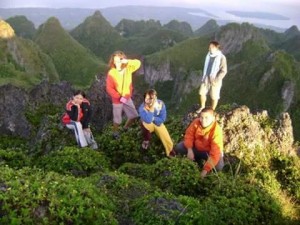
“Mindanao Madness” – Lumot-Sumagaya, Kitanglad Quadruple Peaks, Kalatungan

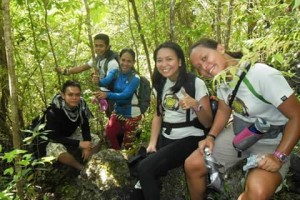
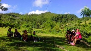
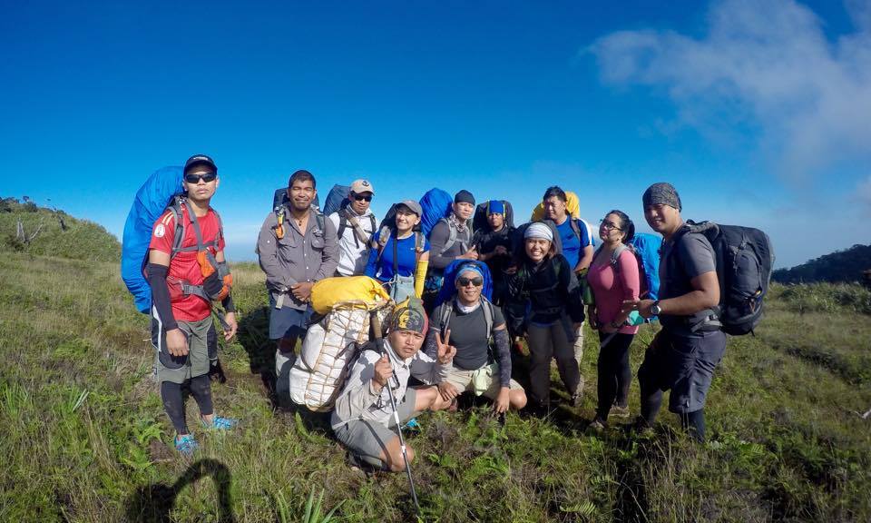
Participants: Jepoi Mansibang (TL),  Harold Mark Borja (author of this account), Eric Gavino, Andro Molina, John (Kalog) Salinde, Reginald Bucot, Gem-Era Carlos Cayanan, Abby Alcaide, Sheena Merdegia, William Pajarillo, Rion Layon, Dennis Martinez, Robert Cuya

Guides: Marvin and Porters (Sumagaya-Lumot Phase), Walter, Guides and Porters (Kitanglad Mountain Range Phase), Glenn and Porters (Kalatungan Mountain Range Phase)

“Mindanao Madness” was an eight day adventure, six and half-day of which comprises the climb proper and the remaining day(s) are mostly consumed on transferring from one phase to another. We also added one day as our buffer for the climb just in case unprecedented things may occur making it a 9 days Itinerary Climb.

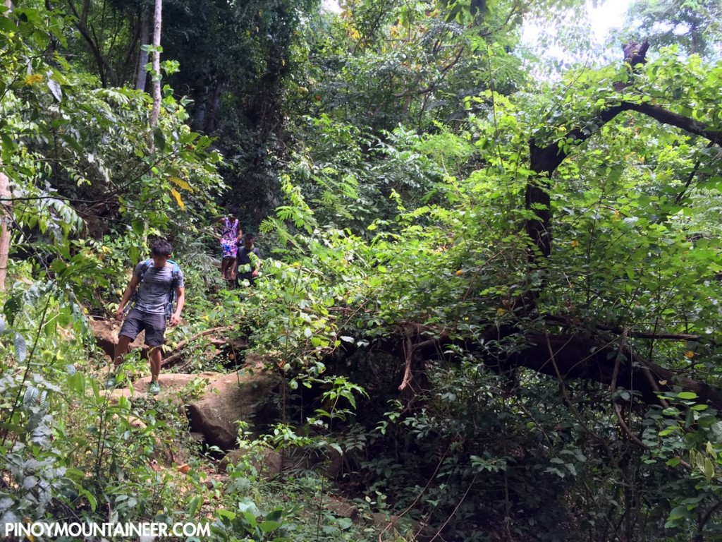
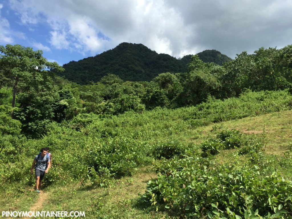
First Phase (Mt. Sumagaya Traverse Mt. Lumot) – Oct 24-25, 2015

The team started trekking at Brgy. Pambugas, Claveria at around 1:00PM. We reached our first stop over at Purok 7 at around 2:00PM. The ascent started from this point up to the campsite of Mt. Sumagaya. The team reached the campsite at around 7:00PM in the evening. The next day the team headed for Mt. Lumot. We started trekking at around 9:00AM. The team reached the crash site at around 12:30PM. At around 6:00PM we reached the end of the traverse, ending it at Brgy. Lunotan, Gingoog City. The team rested for one night at Gingoog City before proceeding to the next phase of the climb.

Second Phase (Mt. Kitanglad – Mt. Dulang-Dulang – Langkayugan Peak – Mt. Maagnaw (Oct 27-29, 2015)

The team started trekking at Brgy. Lupiagan, Sumilao Bukidnon at around 8:00AM. We reached the Kitanglad summit at around 11:30AM. The team started descending to the ridge between Mt. Kitanglad and Mt. Dulang-Dulang at arounf 1:00PM. We started our ascent to Mt. Dulang-Dulang summit at around 5:00PM and reached the campsite at around 7:00PM. The team camped in Mt. Dulang-Dulang. The next day the team is heading for Langkayugan Peak. We started trekking at around 9:00AM and reached Langkayugan Peak at around 2:00PM. The team decided to camp there and will just do an assault to Mt. Maagnaw. We started our assault at around 3:30PM and reach Mt. Maagnaw suumit at around 5:00PM. We headed back to Langkayugan Peak and reached the campsite at around 7:00PM. On the last day of the second phase of the climb we started trekking at around 9:00AM. The team reached Brgy. Songco, Lantapan, Bukidnon at around 2:00PM. The team headed directly to Pangantucan to for the last phase of the climb.

Third Phase (Mt. Kalatungan Traverse Mt. Wiji (Makaupao) (Oct 30-31, 2015

The team started trekking at Brgy. Mendis, Pangantucan, Bukidnon at around 8:00AM. We reached the Junction campsite at around 2:00PM and the team decided to camp there. The team started to assault Mt. Kalatungan summit at around 3:30PM and reached the peak at around 4:30PM. The team returned to the camp and reached it at around 5:30PM. The next day the team started trekking for the last mountain Mt. Wiji (Makaupao) at around 9:00AM and reached the summit at around 11:00AM. The team reached the end of traverse at around 2:00PM completing the Mindanao Madness.

What inspired you to do the particular?
Jepoi Mansibang, the lead of the climb initially started the Mindanao Madness last year climbing 7 peaks. With this, the initiative to do a sequel comes in play thus creating the Mindanao Madness 2. This time targeting to complete an 8 peaks all having an elevation of more than 2000MASL. The team was inspired to do this arduous climb because we want to explore the beauty and culture of Northern Mindanao.

What are the highlights of the trip?
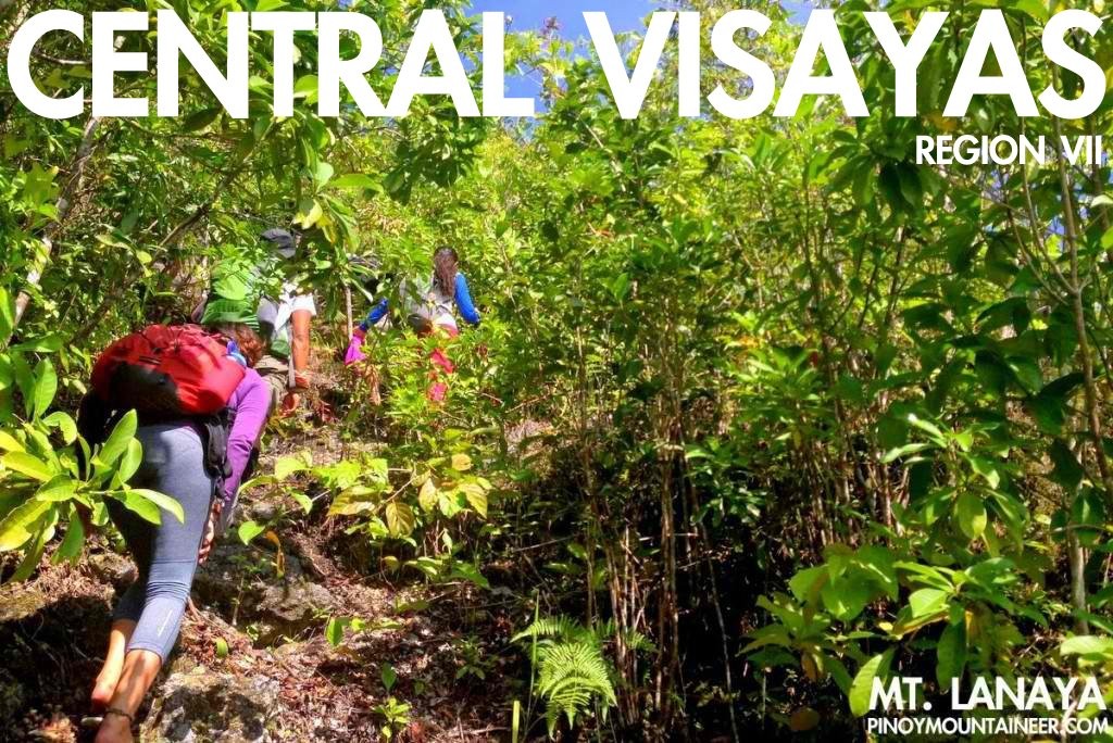
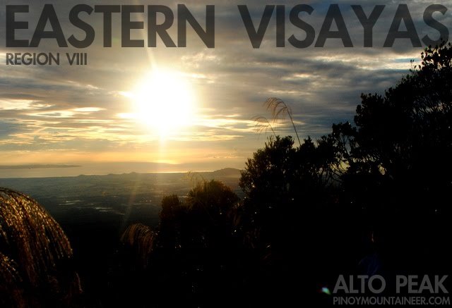
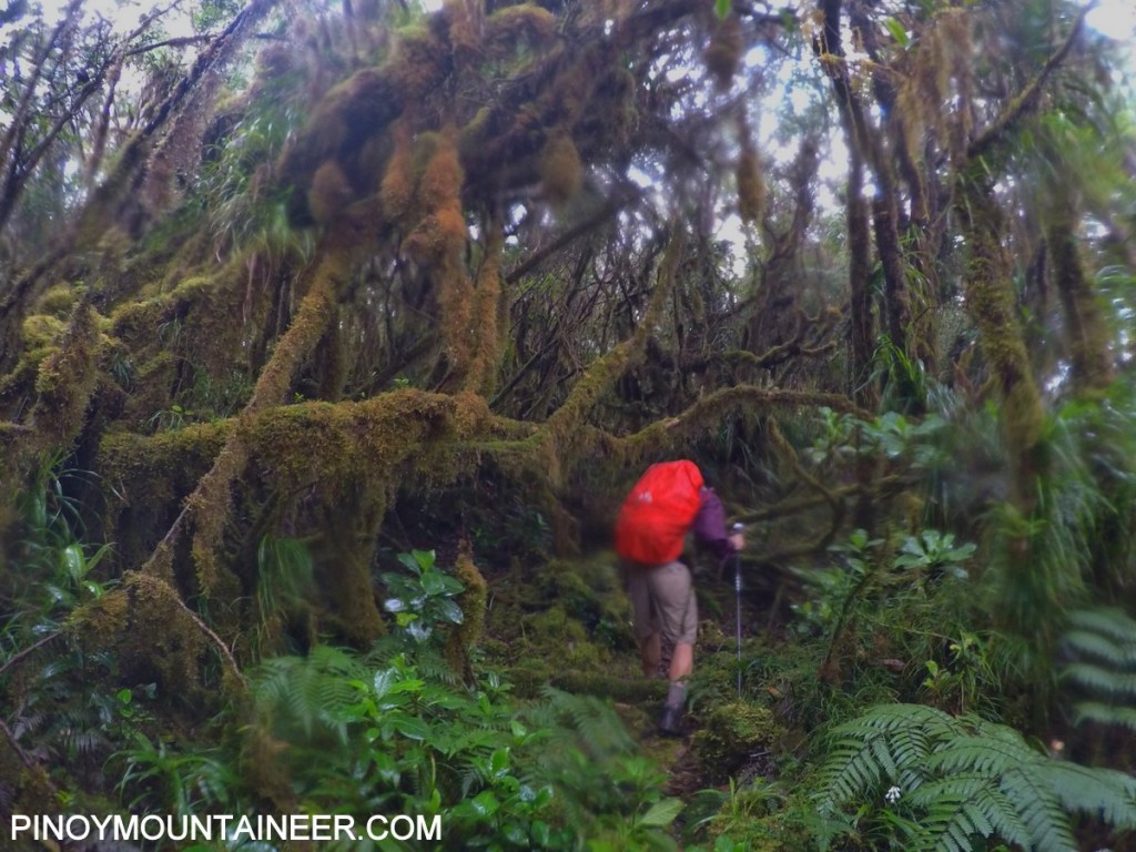
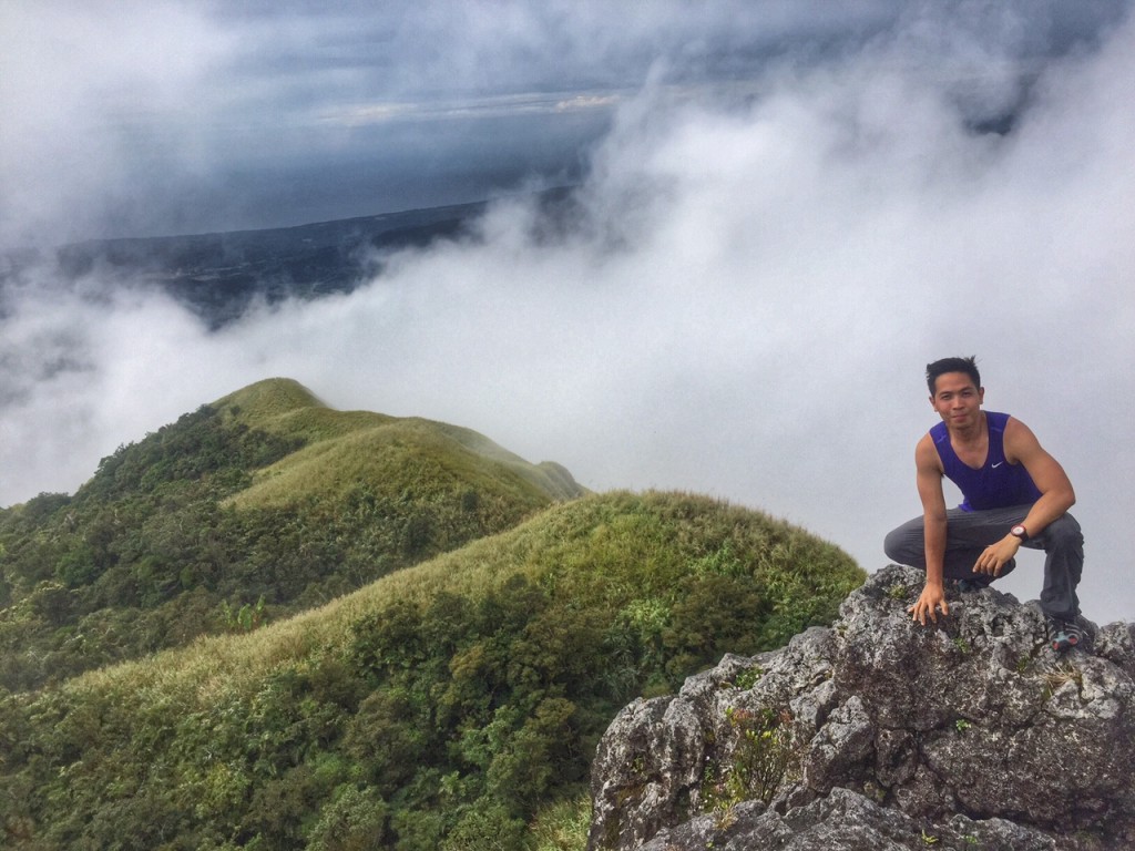
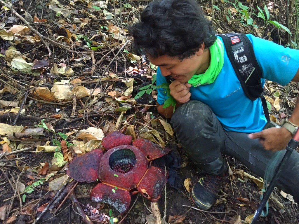
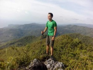
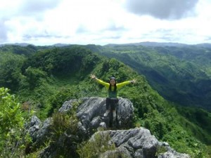
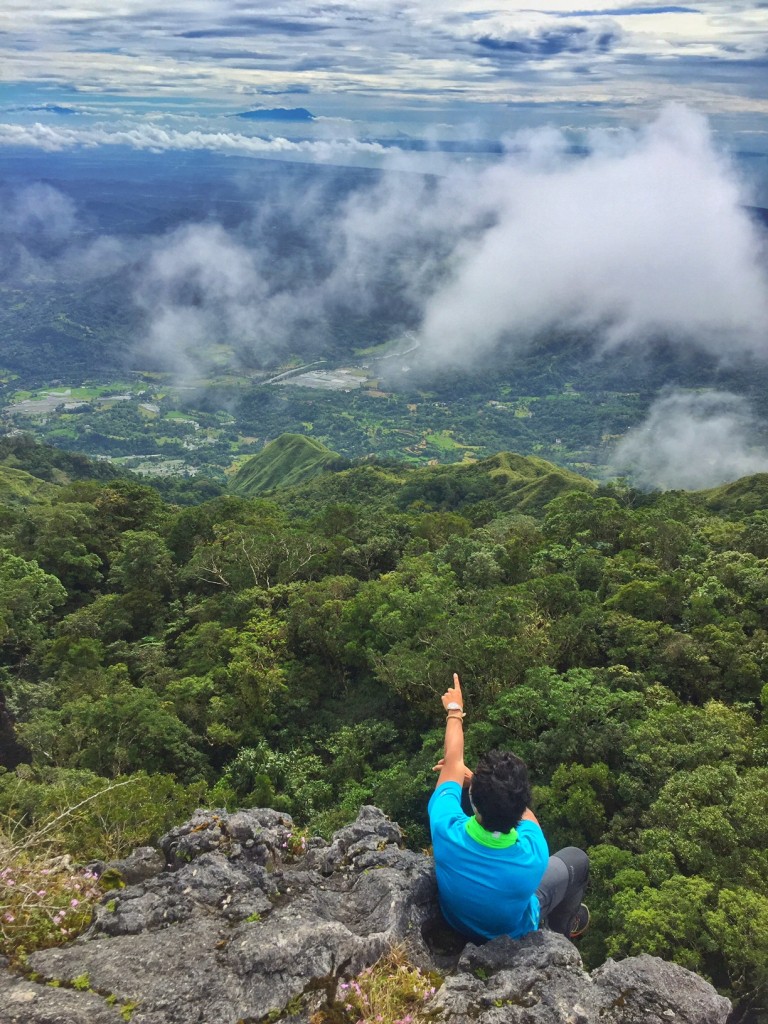
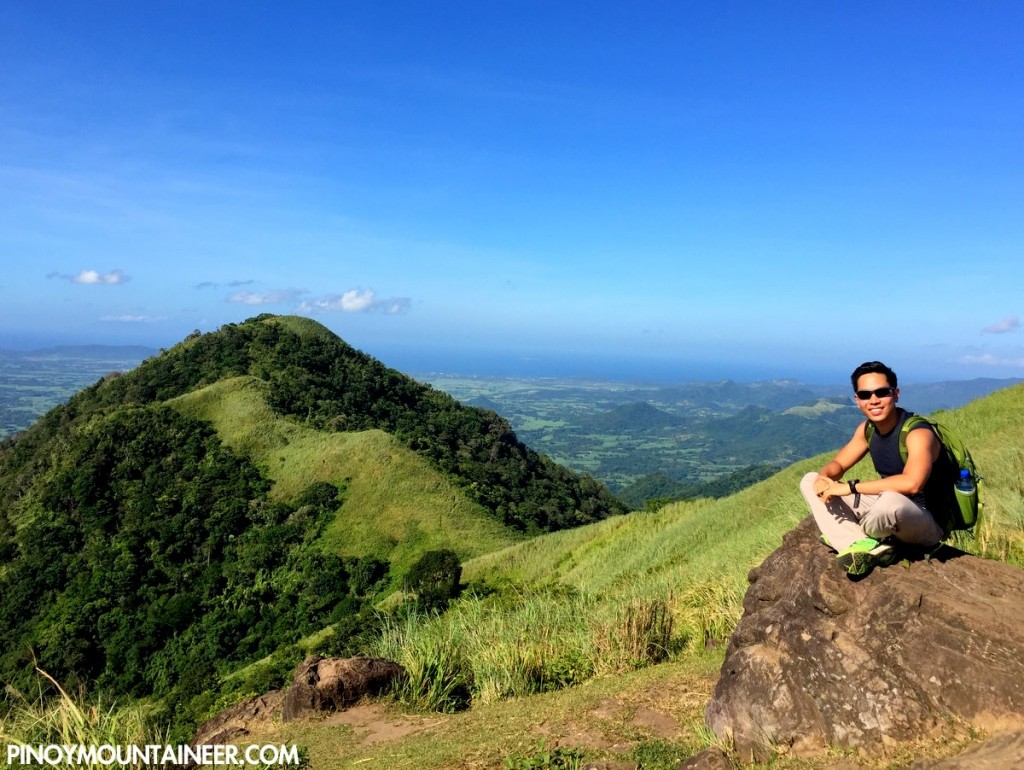
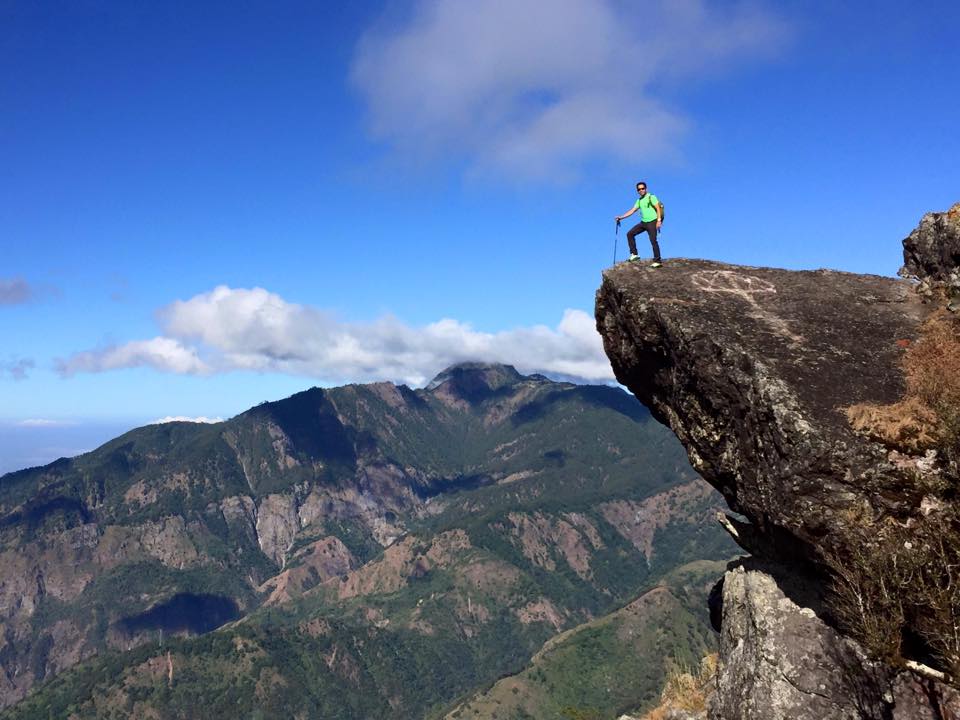
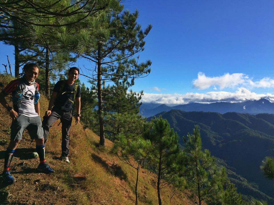
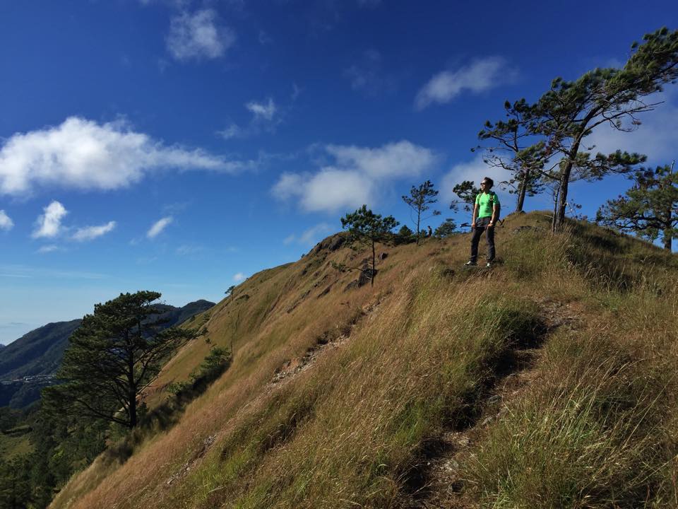
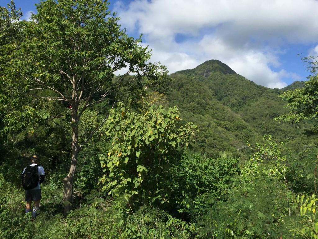
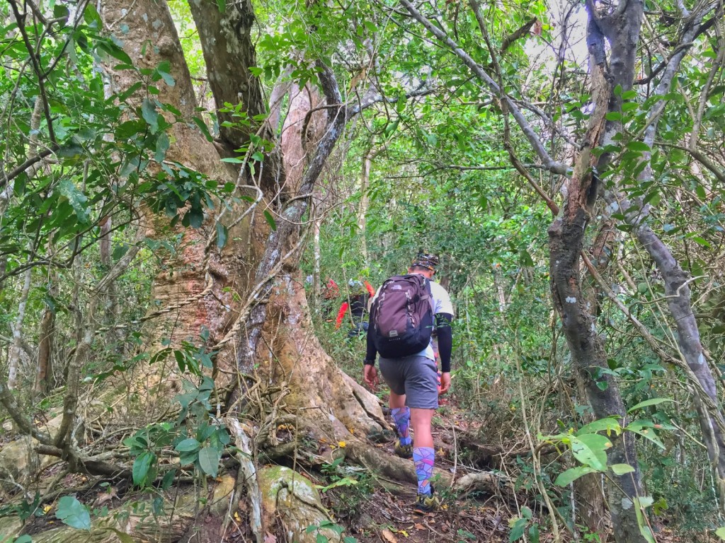
One of the highlights of the trip is climbing 8 of the two-thousanders of Northern Mindanao. During our Mt. Sumagaya – Mt. Lumot climb or the First Phase of the climb we get to see for ourselves the crash site of the Cebu Pacific plane. Most of the mountains if not all of them consist of a majestic mossy forest. Mt. Sumagaya will offer you a view of Mt. Balatucan and other peaks of the Sumagaya mountain range.Mt. Kitanglad will offer you the knee-breaking stairs to summit. Mt. Dulang-Dulang has a very enchanting mossy forest amongst the 8 peaks we climb. Langkayugan Peak will give you a 360degrees view of the mountains of Kitanglad Range and Kalatungan Range. Mt. Kalatungan has the most number of peak of deception then G2. Mt. Maagnaw is the balcony to other peaks inside the Kitanglad Mountain Range.

How do you feel about the experience?
The whole climb was an experience of a life time. A dream climb that any mountaineer can imagine. Venturing to an 8 days climb is not that easy considering the logistics and patience of everyone travelling from one point to other. It was overwhelming at the end of the climb that we even hug each other at the jump off of Mt. Kalatungan and jumping for joy that we finished this climb safely and still kicking. The whole team work together and compromise if needed. It was indeed a success and another thing that goes through history. Mindanai Madness 3 will surely happen next year.

The post Trip report: 9-day “Mindanao Madness” – Lumot-Sumagaya, Kitanglad Range, Kalatungan appeared first on Pinoy Mountaineer.

Hiking matters #489: Mt. Talamitam Traverse to Mt. Apayang

$
0
0

IMG_1977

Last week, I did a Mt. Talamitam to Mt. Apayang dayhike – these are actually two peaks in the same mountain, or perhaps sister mountains, much like Mt. Atimla and Mt. Kalisungan. I was joined by my friends Coby Sarreal, Ryan Regua, Ramel Ng.
IMG_1965

We started from the traditional trailhead of Mt. Talamitam in Brgy. Aga, taking an hour to reach the summit of Talamitam (I have already blogged extensively about this leg, see Hiking matters #391). At the summit (652 MASL) we enjoyed nice views of Batulao, and of course Apayang, the forested peak to the left of Talamitam if facing it, loomed large.

IMG_2017

The descent from Talamitam to the shoulder of both peaks is actually no more than 100 meters and the only obstacle is the overgrowth of the grass; otherwise it would take no more than 30 minutes to reach the summit of Apayang (662 MASL).
IMG_2020 IMG_2022 2
When we reached Apayang summit, I was surprised to see from my altimeter than it’s actually approximately 10 meters higher than Talamitam (662 vs. 652 MASL)! What’s more, it has nice views of Talamitam, Batulao, and the Maragondon Range, including Pico de Loro and Mt. Marami. Another attraction of Apayang is the fact that for much of the descent, it was forested – a stark contrast to Talamitam:
IMG_2052-001
Past the forest, however, there is still a long stretch of a relatively flat foot trail that must be negotiated before reaching the exit point: Brgy. Mataas na Pulo. From here, one can take a tricycle back to the highway (Km. 91) and from there a bus back to the trailhead (if you parked your vehicle there) or back to Tagaytay or Manila. The Talamitam-Apayang (or Apayang-Talamitam, if you wish) makes a trip to Nasugbu more worthwhile than just a regular Talamitam. Try it!

IMG_2057

The post Hiking matters #489: Mt. Talamitam Traverse to Mt. Apayang appeared first on Pinoy Mountaineer.

Hiking matters #491: Mt. Ulap, a perfect dayhike from Baguio!

$
0
0

12295453_10154368837273082_8354020486204341191_n

I have just come from Baguio City after a great dayhike of Mt. Ulap. I left Cubao at 0100H, started the hike at 0700H, and by 2230H today I am back in Manila. The Mt. Ulap hike itself took us just 3.5 hours and by 1300H we were having lunch in Baguio City. This amazingly brisk itinerary is made possible by the fact that trailhead of Mt. Ulap – Brgy. Ampucao in Itogon is just 40 minutes and one jeepney ride (Baguio to Philex Mines) away from Baguio City proper!

11215075_10154369261913082_8818586940398977736_n

Nevertheless, Mt. Ulap is a comprehensive and legitimate dayhike, with several kilometres of trail on pine and grassland ridges, mostly scenic, with views of Baguio and Mt. Sto. Tomas, the Central Cordilleras, and even Mt. Arayat, towering above the plains of Central Luzon. It was very much like the mountains of Taiwan, and is easily the best dayhike from Baguio that offers a glimpse of what the Cordilleras has to offer: Towards the end of the traverse to Brgy. Sta. Fe, it even features hanging bridges, mummies, burial caves, and mountain villages! What makes it even more unique is Gungal Rock, which offers a dramatic photo-op with Mt. Sto. Tomas at the background.

12308769_10154369368028082_6626146195884718733_n

The post Hiking matters #491: Mt. Ulap, a perfect dayhike from Baguio! appeared first on Pinoy Mountaineer.

Hiking matters #492: Mt. Hugom, a great dayhike in San Juan, Batangas

$
0
0

IMG_2752
Today I visited Mt. Hugom in Brgy. Hugom, San Juan, Batangas in what turned out to be a very nice sea-to-summit dayhike at the eastern end of the Lobo-San Juan Mountain Range – which includes other hiking destinations such as Mt. Nagpatong and Mt. Naguiling.

Lobo Map

IMG_2843

Sharing the same jumpoff with the more famous Mt. Daguldol, the trail veers to the right up a hill with a communications tower and enters a woodland, then a brief interlude of talahib slope, and then a forest again – all the way to the summit. The steepness of the forest trail is reminiscent of Tarak Ridge while the fauna and flora are evidently that of coastal mountain – we saw a even hermit crab as high as 450 MASL!

IMG_2841

At the summit (13.6731 N, 121.3593 E, 570 MASL) which took us 3 hours to reach at a very relaxed pace, trees give sufficiently shade, but there are also ample views of Laiya beach, and on the other side, the foothills of the Lobo-San Juan Mountain Range. Though its lack of a water source makes it as a campsite, it is the perfect lunch spot for a dayhike.

IMG_2846

Compared to Mt. Daguldol, Mt. Hugom is a more straightforward, shorter hike even if due to the steepness of the approach it might feel more difficult. The scenic views at the top are fuller than its more famous counterpart, and make for a great reward. In all, Mt. Hugom makes for a rewarding dayhike in San Juan – a great alternative to Daguldol or part of a ‘twin dayhikes’ that can be staged from the beaches of Laiya.

IMG_2845

The post Hiking matters #492: Mt. Hugom, a great dayhike in San Juan, Batangas appeared first on Pinoy Mountaineer.


8 latest updates and tips for Pico de Loro (2015)

$
0
0

1-IMG_4689

Policies in Pico de Loro keep on changing, and oftentimes what’s on paper isn’t what hikers seen in practice. Here is a list of updates that we will try to keep improving based on the best available information. If you have more updates, kindly inform us by commenting below!

1. The trail now starts from the DENR station. The old trail used to start a hundred meters or so past the station along the Magnetic Hill road, but that ‘old’ trail has now been closed, effectively shutting down the old system including the registration at the rest area which the DENR has always resented. (Note: There are unconfirmed reports that the old trail is open again but it is safe to assume that it is the new trail that’s open.) The description of the new trail can be found in Hiking matters #448.

2. Guides are NOT required. Guides are available (rather expensive at 1000 per guide for 1-5 persons) but they are not required, and the trail is easy to follow anyway without a guide. At the campsite, guides will offer their services – to the peak or to traverse – but they are really not required (this points to jurisdictional and governance issues plaguing the mountain).

3. Overnight camping is not allowed. One of the measures that the DENR-PASU approved was to forbid overnight camping, in an apparent bid to minimise impact on the mountain. In relation to this, hiking beyond 3pm is also not allowed.

4. Registration fee is P25 while a tricycle from the bus stop costs P250. Unlike the old trail which has its own ‘registration area’ in addition to the one in the DENR, there is only one registration fee in the current regime in Pico de Loro.

5. Waiting time for going up ‘Monolith’ can take a few hours. This is especially true on weekend mid-mornings. Some have reported as much as 2-3 hours of waiting. Expect an average of one hour if hiking on weekends.

6. Presence of stores have become a problem. Although overnight camping has been prohibited, the presence of stores is threatening to have the same, if not worse, effect on the campsite, exacerbating the trash problem and adding more load to the trail. Note: Pinoy Mountaineer does not recommend patronising stores beyond the trailhead, except in villages, recommending that the best place to help the locals is at the jumpoff.

7. Traversing to Nasugbu is may not be allowed. We have also been receiving reports that traversing from Ternate to Nasugbu is not being allowed – this speaks of possible disputes or disagreements between various local officials. Note that policies keep changing, so it’s best to have contingency plans in any case.

8. Weekday visits are best. Given the overcrowded nature of the mountain it is best to schedule your trip on a weekday, if possible, or very early morning on a weekend. Also, consider climbing other mountains to spread the impact of hiking activities.

The post 8 latest updates and tips for Pico de Loro (2015) appeared first on Pinoy Mountaineer.

Mt. Batulao: Hikers forced to get guides despite not being required

$
0
0

Batulao

Ten days ago it was clarified to us by Nasugbu Tourism OIC Perlita Rufo that guides in Mt. Batulao are not required, as Pinoy Mountaineer’s Facebook post on November 19 revealed:

Mt. Batulao update: I just spoke with Ms. Perlita Rufo of the Nasugbu Tourism Office this morning. She informed me that guides are NOT required in Mt. Batulao as of now, and they have already explained this to the locals just this week. You can invoke this information at the registration area, even as we advise everyone to remain being respectful to locals, regardless of how you will deal with this situation (do expect them to insist on requiring guides). We welcome more updates and feedback from those who will climb the mountain in the coming days. I thank Ms. Rufo for reaching out and promised her that we will closely coordinate with her regarding our concerns.

Looking more broadly, we need to work with LGUs and the DENR to come up with a common framework for guiding, and those who have access to local officials can help us on this. Our proposed compromise for easy mountains, including Batulao and Maculot, is to require guides for first-timers, but to make it optional for those who have already hiked them before. Guides must also be trained in various aspects (LNT, rescue, first aid). Your inputs and own ideas are welcome. We have already communicated this position to the local tourism in Nasugbu and I encourage others to do so.

Unfortunately, despite this definitive word coming from the LGU, and despite the fact that hikers have been hiking in Mt. Batulao for decades without guide requirements, the officials at the trailhead are forcing hikers to get guides. One hiker wrote to us about a hike she did on November 28:

And sabi po ni Mr. Chris Revilla na nakaupo dun s registration, hindi nga daw po required ang tour guide, pero bilang tulong sa mga nakatira dun, kelngn namin mgtour guide, tas di po sila talaga pumapayag na hnd kmi kmha ng tour guide kahit naka 100times na daw kaming nakaakyat.. 500p po ung tour guide Tapos meron png 30p n bbyrn na registration fee pagdtng sa peak 8.. Nakakapanibago lang po.. Hehe kasi 2012 po umkyat kmi dun, wala p pong ganun.. Sapilitan po talaga yung tour guide dun..

Another reported that: “Just went up today and they still required one even after I got into an argument with them already. I told them I’ve climbed batulao multiple times without a guide but they wouldn’t yield.”

Read: Pinoy Mountaineer position on guide requirements on easy mountains

On the other hand there also reports of hikers who were successfully able to hike without a guide, but the majority of the feedback points to the fact that hikers are forced to get a guide and that hikers should expect the same if they are planning to climb Mt. Batulao.


The post Mt. Batulao: Hikers forced to get guides despite not being required appeared first on Pinoy Mountaineer.

Mt. Ulap (1846m) in Itogon, Benguet

$
0
0

IMG_2648

MT. ULAP ECO-TRAIL
Itogon, Benguet
Entry point: Brgy. Ampucao, Itogon
Exit point: Brgy. Sta. Fe, Itogon
LLA: 16.2904 N, 120.6312 E, 1846 MASL (Mt. Ulap)
Days required / Hours to summit: 1 day / 2-3 hours
Specs: Difficulty 3/9, Trail class 1-3,
Features: Grassland and pine ridges, scenic views of the Cordilleras, burial caves
Article history: Created 30-Nov-2015 by Gideon Lasco

BACKGROUND
A “mini-Mt. Ugo” which showcases the best of what the Cordilleras has to offer: Pine and grassland ridges with stunning views of the mountains, and even a glimpse of culture with villages, burial caves, and hanging bridges, the Mt. Ulap Eco-Trail in Itogon, Benguet is the perfect dayhike from Baguio City, only 40 minutes away from Burnham Park by public jeepney. Spanning around 8 kilometres through several peaks along the Ampucao-Sta. Fe Ridge (not to be confused with the Philex Ridge), it is easy enough to be completed from 4-6 hours, making it feasible as a dayhike or even a half-dayhike for hikers of all levels.

The trailhead starts along from the road to Philex in Brgy. Ampucao, but as of December 2015, hikers have to make a 10-minute detour to the barangay hall to register and secure guides (required). The trail goes up a ridgeline that is immediately surrounded by pines, and soon becomes scenic with views of Mt. Sto. Tomas and Baguio City; the perennially mist-covered Central Cordilleras from Ugo to Pulag; and to the south, even Mt. Arayat.

A number of peaks and points of attraction are traversed via this relaxing trail: from the grassland slopes of Ambunao Paoay to Gungal Rock, and then to the highest point, Mt. Ulap (officially 1846m but 1856m according to our measurements). The descent from Mt. Ulap to Pong-ol Burial Caves is akin to the descent from Mt. Ugo summit to Tinongdan, with its steep, pine-forested terrain. The Burial Caves themselves are a nice attraction, and at Sta. Fe there are hanging bridge and cemented footpath that complete the experience.

Once the province of trail runners, the opening up of Mt. Ulap as a hiking destination augurs well for opening up more mountains in the Cordilleras and hopefully people realise that there is much more to the region than Mt. Pulag. Pinoy Mountaineer recommends Mt. Ulap as a dayhike from Baguio and as a sidetrip or warm-up hike to bigger hikes in the region.

ITINERARY

(0100 Take bus from Manila to Baguio)
0600 Take jeepney from Baguio to Brgy. Ampucao (P50)
0640 ETA Brgy. Ampucao. Head to barangay hall. Register / Secure guides
0700 Start trek
0930 ETA Gungol Rock
1030 ETA Mt. Ulap summit
1130 Visit Burial Caves
1300 Arrival at Sta. Fe exit point. Wait for jeepney back to Baguio
1400 Back in Baguio City (and then to Manila)

PRACTICALITIES: MT. ULAP

Transportation Public (0) Bus, Cubao or Pasay to Baguio [P460-750; 4-6 hours]
(1) Jeepney, Baguio City to Brgy. Ampucao via Philes-Bound route [P50; 40 mins]
Approximately 40 minutes travel time from Baguio City Note: It is also possible to rent a taxi from Baguio City to take you all the way to Brgy. Ampucao and back. A P1000 roundtrip would be very reasonable.
Registration (1) Logbook at the Igbaras police station. P100/person
Guides Available and required P300/day
Contact numbers Brgy. Ampucao Tourism – 0998-9589549
Campsites and waypoints ⛺ Campsites:
(1) At the Ambunao Paoay 📶
Water sources 🚰 No regular water sources in the Ridge itself.
Cellphone signal 📶 Present in most parts of the trails.
River crossings None
Roped segments / Technical parts None.
Limatik None
Lipa None
Rattan None
Hiking notes Exercise caution when taking pictures at the Gungal Rock, as carelessness can be fatal.
Sidetrips Other trails are being planned in the area. We will update this. From Baguio City, other dayhikes include Mt. Timbak and Mt. Sto. Tomas.
Alternate trails
Other trails are being planned in the area. We will update this.
Dayhikable Yes (4-6 hours for the entire traverse)
Facilities at jumpoff (+) Sari-sari stores
(+) Restrooms
(+) Parking
Estimated budget P300-400 from Baguio City for a group of 5

MT. ULAP PICTURES

At the Gungal Rock, the visual highlight of the trail
11215075_10154369261913082_8818586940398977736_n
The ridges offer easy and open trails with expansive views
12308769_10154369368028082_6626146195884718733_n
The terrain is characteristic of many Cordillera mountains including Mt. Ugo
IMG_2603
Another view of the trail and the rolling hills of the ridge
IMG_2715-001
The pine-forested descent is reminiscent of Mt. Ugo
IMG_2729
Hanging bridges in Brgy. Sta. Fe herald the end of the trail


TRIVIA
The Mt. Ulap Eco-Trail used to be part of the TNF 100, along with the longer Philex-Daynet Trail.

The registration regime came into effect on November 1, 2015. The blogger’s visit on November 28, 2015 is narrated in Hiking matters #491.

The post Mt. Ulap (1846m) in Itogon, Benguet appeared first on Pinoy Mountaineer.

Mt. Irid and Mt. Tukduang Banoi closed due to military operations

$
0
0

The status of Mt. Irid (and its neighbouring Mt. Tukduang Banoi; itinerary unavailable) in Brgy. Sta. Inez, Tanay, Rizal has always been in a state of flux, given the intermittent “military operations” in the area. As of December 1, the mountain is once again reportedly closed due for the same reasons. Hiker Paul Lopez reported:

Mt. Irid is temporarily closed due to military operations against NPA…Galing po kami dun kahapon and hinold kami…Sta Inez Brgy. Captain said it would take 3 to 5 months before the mountain would be opened again to all mountaineers.

PinoyMountaineer will try to regularly check with our contacts to determine when the mountains would be reopened. Feedback and updates are most welcome!

The post Mt. Irid and Mt. Tukduang Banoi closed due to military operations appeared first on Pinoy Mountaineer.

Climb health: Sample medical certificate for hiking

$
0
0

Screen Shot 2015-12-03 at 9.54.10 AM
Many doctors have contacted me about what kind of medical certificate Mt. Pulag National Park is requiring for hikers.

While fitness for hiking is basically similar to overall physical fitness, there are certain things that a physician should look out for, especially since hiking can sometimes take patients beyond the reach of health care for days. Thus medical advice, more than just clearing a patient for hiking, is essential. For those with pre-existing medical conditions, a physician must anticipate what medications the hiker should bring. For those with stomach problems, and diabetes, the physician must provide dietary prescriptions. Also, the physician must ask for musculoskeletal problems as well as a history of high-altitude sickness if the hiker is to go beyond 3000 meters above sea level.

To help hikers get a medical certificate, here is a sample Medical Certificate for Mountaineers that you can download and ask your personal physician to fill out. The template was designed by Pito Magno, MD of the University of the Philippine College and Medicine and myself (Gideon Lasco, MD, MSc). Please note that the template should only be filled out by a licensed physician.

The post Climb health: Sample medical certificate for hiking appeared first on Pinoy Mountaineer.

Viewing all 612 articles
Browse latest View live