Quantcast
Channel: Pinoy Mountaineer
Viewing all 612 articles
Browse latest View live

Hiking matters #399: Blue Mountains bushwalking, Part 2 - Wentworth Falls and National Pass

$
0
0
BLUE MOUNTAINS, AUSTRALIA - We are now prepared to head back to Sydney after three amazing days in the Blue Mountains. After trekking through the highlights of Katoomba yesterday (see Hiking matters #398), today we went to Wentworth Falls and found it a truly worthy trip, especially since we decided to take the National Pass which took us through another section of the cliffs that face the Jamison Valley, and countless waterfalls and cascades. Little wonder that the place is called the 'Valley of Waters'.
We took the train from Katoomba to Wentworth, which, while taking only 10 minutes, has hourly intervals. From Wentworth railway station we took the Charles Darwin Walk to the falls. Apparently, Darwin himself walked through the trail and visited the falls in 1836, making him one of the many illustrious personages to have visited the Blue Mountains.

This 2.5-km trail was very flat but scenic, passing through sclerophyll forests. Just like yesterday, I marvelled at the diversity of environments in the trail. In a matter of hours, if not minutes, one can shift from verdant rivers and cascades

We reached the mouth of Wentworth Falls then had to descend through a series of steel ladders and narrow that hugged a narrow cliff, allowing for dramatic views of Jamison Valley - we could have taken more pictures if not for the throngs of people from all over the world wanting to see the waterfalls. So we had to move along, missing out on great photo opportunities. But the falls made the slug truly worthwhile, as we were treated to one of the most spectacular sights we've seen in Australia: the Wentworth Falls.

After the falls, we continued through cliffside walks in the National Pass. To be sure, it was pretty, but with the people ahead of and behind us, there was little time to appreciate the views. At any rate it was pretty similar to the views of yesterday's hike through the Federal Pass. We marched briskly, and soon we encountered more waterfalls and steel ladders - it was time to go up again.
The possibilities are endless in the Blue Mountains and we saw some folks abseiling in Empress Falls as we hiked back to the Wentworth Falls town. The climbing opportunities are legion and that's a big reason for me to come back in the future - when I have more time and training. Meanwhile, I am very happy with this Blue Mountains retreat, which I shared with Elbrus teammates Jun Carnate and Cynthia Sy (thanks so much, both of you, for the good times!). I'm ready to go back to Manila!


AUSTRALIA 2014: MT. KOSCIUSZCKO + BLUE MOUNTAINS
Hiking matters #397: The hike up Mt. Kosciuszcko
Hiking matters #398: Blue Mountains 1 - Katoomba
Hiking matters #399: Blue Mountains 2 - Wentworth Falls

A message to the organizers and participants of the National Mountain Clean-up Day

$
0
0
As May 10 draws near, I am very excited with the prospect of having a day when we can clean up the mountains and teach, by example, others about the importance of having clean mountains for our country and for our environment.

The response from groups and individuals has been overwhelming and I appreciate all the messages of support, all the suggestions, all the offers of volunteering, and of course, all those who have signified their intent to join the activity. I am also thankful to our friends in the DENR for recognising mountaineers as a partner for the environment and assisting us in this activity. 

The list of hiking clubs who have committed to conduct clean-up climbs on May 10 are listed in my original post about the initiative - you can see the list here. This list is not all-encompassing. Please do not be disheartened if you do not see your group on the list. You do not have to be included in the list to hold your clean-up climb.  The purpose of the list is to encourage others to follow, either on May 10 or throughout the year. Indeed, our experiences in doing this collective clean-up should be fed back and thought through in order to guide future clean-ups.

While I am appreciative of the desire of many groups and individuals to join the activity, we must understand that not everyone should be in the same mountains at the same time. Another reason why we have a list is to inform everyone that there are clubs that are already planning clean-ups for particular mountains. Even as we do a collective clean-up, we must keep the number of people on the mountains to a minimum. Moreover, it makes little sense for groups to do clean-ups in places where a group has already picked up all the trash. This is why groups who are organising clean-up climbs on the same mountain should coordinate with each other. And this is also why groups who want to participate should consider picking other mountains, or other dates. But I must repeat that I do appreciate your initiative and your interest. Your support is important if we are to keep the mountains clean. 

I have also received messages from individuals who want to participate in the Clean-up Day but they cannot find any groups to join. What I can say now is I do appreciate your eagerness to be part of the activity. In future clean-ups, I would recommend coming up with a mechanism that will accept individuals to join designated hikes. At this point, however, I ask you to bear with us as this is a very new activity and it is easier to coordinate with groups. Again, the spirit of the Clean-up Day is something that should be with us throughout the year and by being responsible mountaineers, you are taking part in what we aim to accomplish for the mountains. 

We have been thinking through - with the DENR - how to best conduct the clean-ups, and I urge everyone to read the Guiding Document we have drafted for this occasion (click here for the link). This is a non-binding document and there will be specificities that we cannot account for. But I think it is a good starting point to plan your clean-up. What must be emphasised here is the importance of ensuring that all the waste collected will be turned over to a waste disposal facility. It is not enough to bring down trash from the summit to the campsite, or to the village. We want to set a good example and we want to make sure that the garbage is disposed properly. Moreover, every clean-up climb is a climb, and as such, participants are expected to be prepared according, and to follow the rules and principles of outdoor recreation.

There have been some requests for shirts but as I have said from the beginning, I do not wish for this movement to have any form of transactions - such as shipments of shirts, transfer of money, registration fees - and all that stuff. That is why I have asked my friend, Dr. Ulysses Gopez, to come with a logo that is open source (see above) and can be used by anyone for their own shirts. We are united here not by the same shirt or the same ID, but by the same purpose. 

This reflects my attitude towards this whole activity - I do not want it to be a monolithic mega-activity happening nationwide. I want it to be a movement that everyone - every participant, every group- can claim ownership of. Thus I do see myself as the organiser of an event, but merely the coordinator of many events that happen to coincide on a single day and a single goal. 

Having such a decentralised setup will have its own problems. Our partners in the DENR have already spoken of the difficulty, legally speaking, of identifying the 'entity' they are formally dealing with in coming up with the event. Moreover, we do not really have a way of monitoring how the groups will conduct their clean-ups. Some may not live up to the standards we have suggested, and this may be the grounds for others to criticise the entire activity. I can already imagine accusations of 'mass climbing' and others, founded upon pictures of people congregating upon the mountains. Like I said from the beginning I too am strongly against this. But even with these built-in complications of a decentralised 'initiative', the greater good of having many mountains cleaned up, and in a way that has the gravitas to spark a message of environmental consciousness in and beyond the mountaineering community, compels me to keep believing in the rightness and timeliness of this cause. Those who focus on the negative will of course find something negative, but in an imperfect world, we should open our eyes to the good and to the positive because there lies our hope for a better future. 

Moreover, considering the fractious history of initiatives and organisations within the mountaineering community, I think we should not be distracted by groups or individuals at the helm. We should instead be united by ideas, by things we believe in. As such, I do hope that in the coming years, the groups who organised clean-up climbs this year will make it an annual tradition to do so. 

To the organizers of the climbs, I invite you - or your representatives - to join me on our meeting with the DENR on April 23 that will also count as a sort of pre-climb for the activity. Please join the Facebook group for the organisers and volunteersfor more details, and for more updates. I urge you anew to review the Guiding Document and to coordinate with the local government, particularly for planning the waste disposal; and with other groups (if any) organising clean-ups on the same mountain so you can designate areas for different groups to clean-up. 

To the participants, be prepared physically and mentally for the clean-up day. Make sure you bring the right gear and the right mindset, and be supportive of your team leaders. Be extra careful in your actions on the mountains; remember that as participants of the clean-up day, we have to set a good example for others. I hope you will find the activity meaningful and enjoyable! 

To everyone, I thank you for the support that you have given this Clean-Up - which is the first that I have launched an initiative. Surely the success of this effort - whatever relationships that we can form here, whatever experiences and lessons we will gain - will encourage us to pursue other endeavours for the environment and hopefully allow us to be of help to the mountains that have given us so much.

Yours sincerely,

Gideon Lasco
April 19, 2014

Hiking matters #400: Sunrise hike up Gunung Batur in Bali, Indonesia

$
0
0
BALI, INDONESIA - I have come back. Nine years after I visited Bali with my father and did my first hike abroad - Gunung Batur - an early 19th birthday present before I entered medical school (see Hiking matters #18) - I found myself climbing the same mountain, this time a few days before my 28th birthday. Between now and then, a lot of things have changed, but when you climb a mountain again, it reconnects you with your past and perhaps allows you to reflect on what lies ahead in the future.
Gunung Batur, a 1707m active volcano, is easily Bali's most popular hike, attracting hundreds of visitors daily. Amazingly for a relatively small island like Bali, it is not the tallest mountain in the island - this distinct belongs to the 3000-meter Gunung Agung, which is a more formidable hike. Gunung Batur, however, offers rewarding views which is remarkable considering that is just an easy hike.
As is customary in many Asian mountains, the goal is to reach the summit by sunrise. Thus we started early, leaving Kuta by 0215H, traveling by rented vehicles, and arriving at the trailhead two hours later. There were ten of us in the group - with me were Arvin, Bong, Coby, Ed, Foncy, Genesis, Ian, Mayan, Mutya - and were given three guides - two females and one male.
We started trekking at around 0415H. As expected from an active Indonesian volcano, the trail was made of rock and black volcanic sand decked with grass and shrubs - think of Mayon's slopes. Initially, the trail is a rough road where motorbikes can pass through. It meanders up the mountain, reaching a 'halfway point' from which the trail, though similar in character, gets steeper. There were many people in the trail and oftentimes there were bottlenecks.

The stars signalled a clear day ahead, and the dawn fulfilled their promise: the outline of two mountains - Abang and Agung - in near-total eclipse as though the former were the moon and the latter the sun - gradually emerged above a sea of clouds, not unlike Pulag's on a fine February day. And further east - pale majesty bathed in the colours of dawn - stood Mt. Rinjani, on Lombok island - one of the highest volcanoes in Indonesia and a wonder to behold.
Sandy trails make for loose footing and thus can feel steeper than they actually are - and this can be a bit of a challenge especially when there's nothing to hold on to. Still, I would rate the Batur hike as an easy to mild trek - perhaps comparable to Maculot - and less than two hours after we started we found ourselves facing the beautiful sea of clouds at the summit of Batur, and on the other side, the crater rim that somewhat evokes Kanlaon or Bulusan.

There were some small vents that release steam around the crater - a subtle reminder of the volcanism  of Batur that in the past wrought havoc to the people, and today an ominous sign of the danger that lies within. We took our time enjoying views of the sea of clouds and the mountains - a visual feast and early reward at the beginning of our week-long trip. The descent was brisk; perhaps the only interruption was the sight of a troop of monkeys near one of the rest areas. After an hour we were back at the trailhead, and we passed by the cultural village of Ubud before heading back to our hotel to prepare for our next destination: Mt. Rinjani.

Hiking matters #401: Mt. Rinjani Day 1 - From Sembalun village to Plawangan campsite

$
0
0
LOMBOK, INDONESIA - The day after we hiked Gunung Batur in Bali (see Hiking matters #400), we took the eastward ferry from Padang Bai to Lombok island, to climb its paramount peak, Gunung Rinjani, at 3726m one of the highest volcanoes in Indonesia. We spent the night before the hike in the beach town of Senggigi, and the following day, we drove three hours to Sembalun village, where the hike would begin.
With me from Bali were Niel Dagondon, Foncy Conanan, John Arvin Ramos, Genesis Mendoza, Pip Maalihan, Jacob Sarreal, Mutya Bernardo, Edmund "Elbrus" Padua, Mayan Gutierrez, and Ian Tesaluna; arriving directly to Lombok were Cynthia Sy, Nong Pannaros, Belle Acasio, Dada de Silva, and Gem Cabria. We were accompanied by two guides, Sun and Nur.
Much of the trail is through savannahs with little tree cover, making for a very hot trek. It is almost reminiscent of the lower reaches of Mt. Kilimanjaro. Cows roam freely, their brass bells reminiscent of a gamelan practice session. 
We had lunch in Pos 2 (Outpost 2), where many people have gathered also to have lunch. It was like a market; the influx of trekkers give the trails of Rinjani a mugh higher population density compared to even the most popular Philippine mountains.
Unfortunately, this state of affairs make Rinjani much more polluted than even Mt. Apo - an observation I have also made in my previous hikes in Indonesia. Still, while mindful of this issue I didn't let it ruin my appreciation of Rinjani. If we focus on the trash on the mountain, we lose sight of its beauty. 
Past Pos 2, the trail was steeper, though still very manageable. We caught sight of the cemara, a coniferous-looking tree species (Casuarinas); the patches of tree were refreshing after the hot walk in the morning. The coming of the clouds helped a lot, too.
By 1600H we had arrived at the crater rim, though our campsite was still 10-15 minutes away and almost 100 meters higher. At least, we thought, this would give us a headstart for tomorrow's hike.
Before sundown everyone had reached the campsite and we had a splendid dinner, facing the crater and the colours of the sunset. We immediately slept (or tried to, at least) after dinner, excited for the summit assault that begins at 0200H that night. Meanwhile, the summit loomed like a behemoth, flanked by a saddle whose seemingly short length will be belied by the day ahead. Continued in Hiking matters #402.

BALI AND LOMBOK, INDONESIA: THREE VOLCANOES 
Hiking matters #400: Gunung Batur, Bali
Hiking matters #401: Gunung Rinjani, Lombok Day 1
Hiking matters #402: Gunung Rinjani Lombok Day 2
Hiking matters #403: Gunung Agung, Bali

Hiking matters #402: Mt. Rinjani Day 2 - To the summit and back

$
0
0
LOMBOK, INDONESIA - The summit assault is the most exciting part of every climb, because it is the moment when the hiker comes face to face with his goals and dreams. Oftentimes it is also the most difficult part of the trail: a natural consequence of its higher altitude, but also because trails tend to be steeper and narrower as you go up. All this makes it challenging, at least for me, to fall asleep on the eve of a summit assault, because of the excitement and anticipation. Fortunately, I managed to get some quality sleep for a few hours, before waking up at 0200H for the summit assault.

The nocturnal timing of the assault adds to the challenge, but it is the pragmatic choice, in many cases. Assaulting a volcano - bereft of trees - when the sun is up - will make, in Niel Dagondon’s words, “human goreng” out of us. In other places - the melting snow will be a problem. On the other hand, there are other mountains where the only reason to hike in the morning is to catch a glimpse of the sunrise - and indeed, as Gunung Batur proved, this is often reason enough.

We started trekking at 0230H, approaching the end of the rim in ten minutes and then going for a steep hike to reach the start of the long saddle, taking 30 minutes. From the saddle the hike was gradual, and the scree - volcanic rock and sand - was beginning to reveal itself. Colossal yet coastal, Mt. Rinjani's winds made the temperature much colder than the projected 8-10 degrees Celsius. But with adequate clothing, the cold can be confidently confronted.

The scree slopes culminated on the final leg, which is much steeper; here, the “one step forward, one step backward” joke is no laughing matter; one must exert extra effort in every step. It reminded me very much of the Holy Ridge in Taiwan, Stok Kangri in India, or even Fuji-san  in Japan. In Fuji, though, the trails were so wide; in Rinjani danger is just a few meters away. Hence, I would call this the crux of the trail.
By 0625H, we had reached the summit. The sun had already risen, but the soft, early morning light still made for a wonderful panorama.  The view was expansive: We could see the entire ridge whence we ascended, all the way to the crater rim campsite - with tents looking like dots of orange and yellow. Then, beneath, the crater itself - Rinjani’s child - hence Segara Anak - came upon us, still in the shadows, but already revealing itself but the visual centrepiece of the mountain.
Perhaps the islands east of Lombok were too far for our gaze, but to the West, standing proud, was Gunung Agung, the highest mountain in Bali, which we already met in Gunung Batur. A more intimate encounter is in order, I hope, when we go back in Bali!
People had already congregated at the highest point, where two detachable (funnily enough) markers were at hand for people's photos. Of course, we too had our share of photos - it was a triumphant moment for the whole team; and there was lots of reasons to find inspiration. 65-year old Edmund Padua, for instance, was at hand, inspiring Filipinos and Indonesians alike. I could see emotion in the faces of our arriving teammates: it was truly a challenging ascent but the summit made it all worth it.

The sun rose, quickly it seems, and before long instead of the chilling winds we had to grapple with the nefarious heat of the tropical sun - or, as the Indonesians call it, matahari. The scree slopes made for an easy slide down the ridge, cutting trekking time significantly; it only took hour and fifteen minutes for us to reach the campsite - and en route, the sight of Gunung Agung at a distance and the lake beside us were most encouraging.

At the campsite, we were given a light meal - and a final opportunity to enjoy the view - before we started the descent back to Sembalun village. The descent was taxing, not because of the trail but again because of the heat. It was like descending from Cinco Picos or Balingkilat on a hot and cloudless April day - the higher altitude notwithstanding.

By mid-afternoon, we started arriving back at the village, and the discomfort brought by the heat quickly gave way to the fulfilment of having completed Mt. Rinjani - truly one of Southeast Asia's most famous treks - blessed by good (at times too good) weather throughout our trek. A three hour drive took us back to Senggigi where we had a celebratory dinner and a well-deserved sleep. Thank you and congratulations to everyone who joined the hike! Terih makasih!


BALI AND LOMBOK, INDONESIA: THREE VOLCANOES 
Hiking matters #400: Gunung Batur, Bali
Hiking matters #401: Gunung Rinjani, Lombok Day 1
Hiking matters #402: Gunung Rinjani Lombok Day 2
Hiking matters #403: Gunung Agung, Bali

National Mountain Clean-up Day Message: Let's keep the mountains clean, and let's keep cleaning the mountains

$
0
0
A mountaineer picks up trash from the campsite in Manabu Peak, Batangas
Photo courtesy of Emerson Benoza (DBMS)
by Gideon Lasco
PinoyMountaineer.com

The pictures keep coming, and this time around, they are inspiring; they are positive. Instead of seeing pictures of trash lying in the campsites, we see pictures of trash being picked up, trash inside garbage bags and rice sacks, trash being brought down the mountains. To the mountaineers who have made this vision a reality, I salute you.

We were united not by belonging to the same group, nor by wearing the same ID or shirt, but by having the same purpose: To clean the mountains, and in doing so, to remind people of the importance of clean mountains. This unity proved enough for us to carry out an initiative across the nation. While this form of movement has been made possible by the connectivity of the modern age, we are indebted to the example that mountaineers before us have set. Bereft of personalities, the idea of a clean-up took center stage, and allowed everyone to claim it as their own, and act upon it.

Many mountains have been cleaned, and many people have surely been inspired. For accomplishing this, I congratulate all the groups who took part in the Clean-up Day, and thank all our partners - the local governments, the NGOs, the DENR, and all our fellow mountaineers who encouraged us to pursue this initiative. Surely the partnerships and friendships we have forged through this Day will encourage us to make this a tradition for the years to come, and with humility, embark in other projects for the environment together.

However, the task of cleaning up the mountains - and cleaning up people's mindsets - cannot be done in a single day, nor a single year. It takes a sustained commitment and a mindset that looks beyond individual rights and responsibilities, and instead sees the problems we face today as a shared responsibility, a shared project.

It is nice to hear people say “ Tapat mo, linis mo” - clean up your backyard. But what about the mountains, and what about the forests; the open spaces between your place and mine? This mentality can clean up houses and backyards, but not nations, but not mountains. We need to look beyond our little spaces and open ourselves to problems that confront us as a nation. We need to move beyond “Tapat mo, linis mo”. We need to think “Tapat natin, linis natin”.

This is the shared responsibility that I speak of, and we need to inculcate this amongst ourselves, and share to others. The time for making distinctions between mountaineers and non-mountaineers, or between the good guys and the bad guys, has come to an end. For others to listen to us, we must first of all believe that they are capable of changing, that everyone is a potential ally in our campaign to clean up the mountains. Instead of mocking people's ignorance of basic mountaineering principles, we must educate them. And as the Clean-up Day shows, one powerful way of educating people is by example: Let every climb be a clean-up climb. But there are many other ways, and often we really have to guide others with the wisdom that we too have learned, when we were still beginning our own journeys. 

We have to involve the community as well. It is not just mountaineers who need to appreciate the importance of clean mountains, but guides, members of the communities, and all the stakeholders. We must approach them with understanding, recognising their struggles to earn a living.

Today, mountaineering grows in popularity and we are concerned about its negative effects - and rightly so. If in the city, we can say "the more, the merrier", in the mountains, "the more, the messier." At all times, we must adhere to the dictum of minimising our impact and limiting our numbers. But this should not cause us to discourage people from pursuing the outdoors. Promotion and protection can seem antithetical at times but I believe that responsible outdoor recreation can serve as a bridge between the two: A form of recreation that allows appreciation of the environmental issues, which then leads to action. A form of recreation that seeks to minimise its impact, aware that it poses a risk to the very beauty it seeks to experience.

As the rainy season approaches, I think of the vulnerability of our nation to natural disasters and this should heighten our concern for the environment. What else can we as mountaineers do for nature, and for the nation? Let us keep thinking, and encouraging each other to have an open mind for ideas. And let us be mindful that there are larger issues out there affecting the mountains that we mountaineers should find a voice in - like the illegal logging and mining that takes place in many parts of the archipelago.

The road is long, but we are on the right track. May the spirit of the National Mountain Clean-up Day live on in our every climb, throughout every year. Let's keep the mountains clean, and let's keep cleaning the mountains.

Los Baños, Laguna
May 11, 2014

Hiking matters #403: Hiking up Mt. Agung in Bali, Indonesia via the Pasar Agung trail

$
0
0
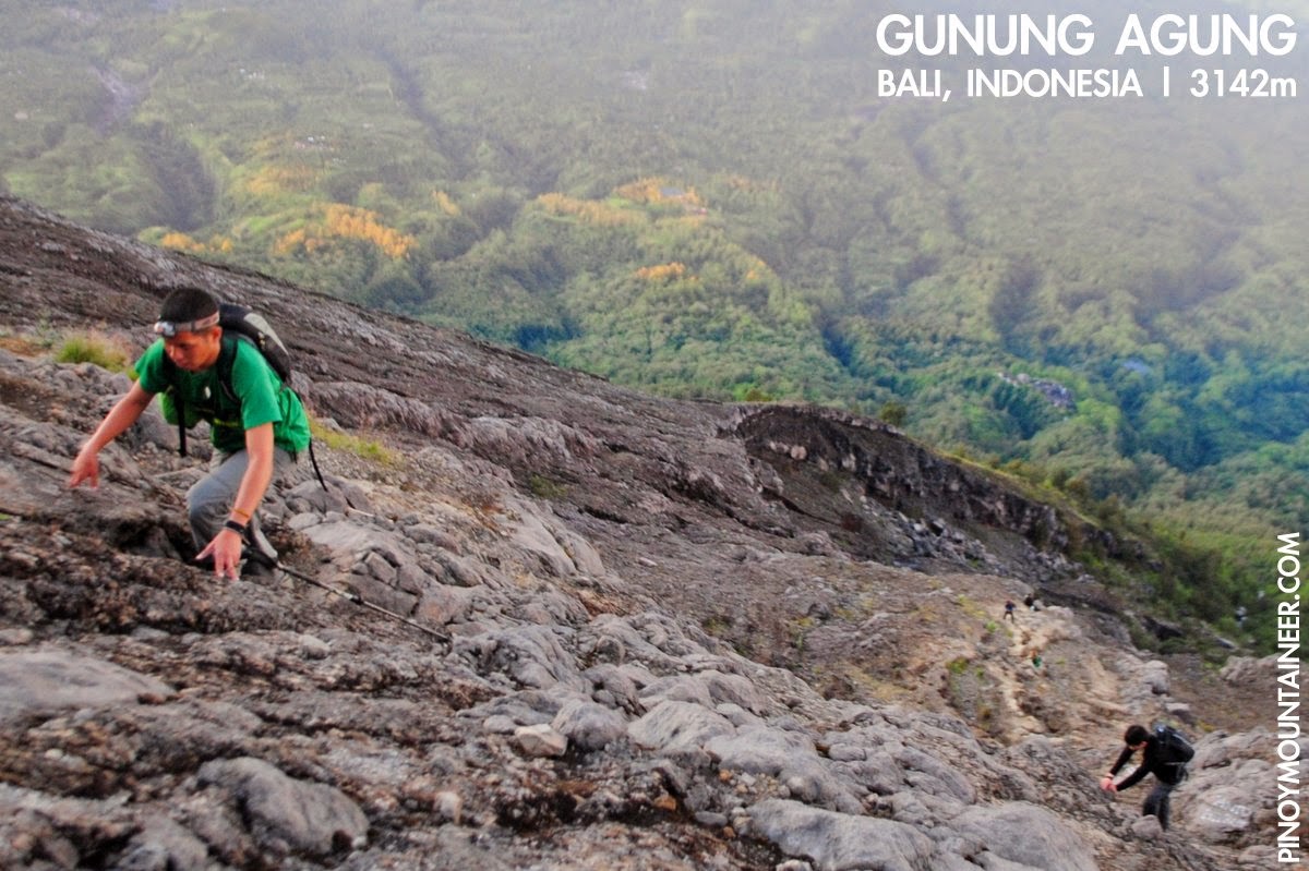
 BALI, INDONESIA - After the successful hike of two volcanoes - Gunung Batur in Bali (Hiking matters #400) and Gunung Rinjani in Lombok (Hiking matters #401-402) - we climbed the mountain that has showed up beautifully in these two hikes: Gunung Agung, the highest mountain in Bali and as such, holy to the Balinese Hindu culture. Unfortunately, the trail coming from Pura Besakih - which would have taken us to the very summit - is closed due to a religious ceremony and so we opted for the alternate, more southern route originating from Pasar Agung temple.

By this time, our group has dwindled in number; others already had to fly back to Manila or elsewhere while the rest wanted to enjoy Bali in other ways. With me were Coby Sarreal, Ed Padua, John Arvin Ramos, Niel Dagondon - and we were joined by Niel’s wife Nicole - a welcome addition to our group. Trevor, from Canada, and Lisa, from France, joined the group as well and we were all guided by a Balinese guy named Roon.


We started trekking at around 0300H. The trail starts from the left of the temple, and we couldn’t help but compare the trail to that of Mt. Maculot: An initial forested ascent, followed by grassland, and rocks throughout. The only difference is that Agung’s grassland-cum-rock is much longer, and it transitions into mostly volcanic rock, reminiscent of Mayon.
Because all you have to do is scramble up the volcanic rocks, there’s plenty of options as to exactly what route to take, which made the ascent fun. Unfortunately, the "trail signs” were vandalisms - mostly of red and white paint. The three rocks, one of top of the other, in Mayon and elsewhere in the Philippines - are more to my liking.

We reached the summit at around 0700H, or after four hours of trekking and scrambling. “You’re late for the sunrise!” one hiker exclaimed, but I explained that we wanted a bit more sleep, having just climbed Rinjani. My mention of Rinjani reminded me to look for the mountain, and surely enough, there it was, to the East, partially eclipsed by a rocky outcrop but still beautiful, made all the more special with our time there.

On the other side, to the West, rose a massive Gunung Raung - at 3332m famous for its challenging trails (the trail to the highest peak is technical). I had already heard about this mountain from the late Malaysian mountaineer Zaidi Bidin and someday I would like to climb this mountain as well. As for Gunung Batur, it is obscured by the summit of Agung. Someday, I’d like to take the Pura Besakih trail, if only for the sight of these mountains.

We took our time at the summit; Roon and his assistant had some breakfast delights for us, including a generous serving of mangoosteen - one of my favorite fruits. Amazingly, there were monkeys at the rim - not so much, it seems, for the love of the views but for the food that hikers bring with them. A tiny shrine on the rim - painted with golden yellow - reminds us of the place Agung has in Balinese cosmogony: as the throne of the gods it is seen as the centre of the word, the 'navel of the universe', the earthly replica of the heavenly Mount Meru.
After breakfast - and more philosophical musings from our guide Roon - we started descending. It had become very hot - like Rinjani, Agung had little tree cover - and I went down briskly, wanting to have some time observing the Hindu temples, and hoping to maximise our last full day in Bali. Tomorrow - my 28th birthday - we will return to Manila, the image of a distant Gunung Raung another compelling reason to go back. There are others: Kerinci, Semeru, Arjuna...the list is long, but I am very happy that we were able to hike three volcanoes in this wonderful trip. Terih makasih to  everyone who joined me! Jumpa lagi! 


BALI AND LOMBOK, INDONESIA: THREE VOLCANOES 
Hiking matters #400: Gunung Batur, Bali
Hiking matters #401: Gunung Rinjani, Lombok Day 1
Hiking matters #402: Gunung Rinjani Lombok Day 2
Hiking matters #403: Gunung Agung, Bali

Hiking matters #405: Beautiful Mt. Beaufort in Puerto Princesa, Palawan

$
0
0


PUERTO PRINCESA - I have often lamented that I couldn't find time to go hiking in Palawan, where the mountains largely remain unexplored and undocumented, by mountaineers and scientists alike. It has been six years since my unforgettable climb in Mt. Mantalingajan - a little-known peak back then and now a mecca for serious hikers; this was the last hike I did before I began the Hiking matters blog series which continues to this day. Three years later, Iron Lady Jo Steven and I did Mt. Thumbpeak, which was also a very nice hike.

Fortunately I have a new opportunity to explore the mountains of Palawan, and to begin with, I did a very nice dayhike of Mt. Beaufort, accompanied and guided by my newfound friends from Puerto Princesa: Jessa, Ronald, and Edgar - environmentalists all from Puerto Princesa. At 1148 MASL, this mountain is north of Thumbpeak, flanking it on the right if you are from Puerto Princesa's Baywalk.

We met up at the entrance of Irawan Eco-Park - reachable within 20-30 minutes from Puerto Princesa city proper; and took motorbikes for several kilometres more of roads, rough roads and trails. The motorbike ride through mountain trails - and several streams - is an experience in itself, requiring driver and passenger alike to duck when low hanging branches are upon us - reminding me of a scene in Return of the Jedi.

Completely covered by forest from the trailhead to the summit, Mt.Beaufort is teeming with flora and fauna; to begin with we saw a freshwater crab crossing the trail; this was followed by sightings of birds, snakes, and of course, so. Edgar became our resource person for the identities of the. The wildlife slowed down our pace; if you go too fast you'll miss the fauna lurking in the trees and on the ground - but it kept us going.

The trails are gentle at first, and it gets a bit steep past the junction where the trail diverges - the original trail goes on the northwest, down a Batak village by the West Philippines sea; while the trail on the left leads to the summit. As we ascended it, I was reminded of Mt. Thumbpeak and its verdant peak. Unusual plants and tree frogs greeted us as we breached past 1000 meters.
We reached the summit at 1130H, after four hours of trekking. There we were rewarded with views of Honda Bay and Puerto Princesa Bay, as well as the other mountains of Puerto Princesa. There was Mt. Thumbpeak (WNW), Mt. Pinamunuan, Mt. Tapyas (not to be confused with its Coron counterpart) flanked by Mt. Bahile (N), and further, the mountains of Sabang (NE),  including the mystical Mt. St. Paul as well a distant Cleopatra's Needle.
We had lunch at the summit, sitting under the shadow of the repeater station that sits atop the mountain. We were ready to descend by 1300H, and were back at the motorcycles by 1540H. Another exciting ride brought us back to Irawan, and by 1700H we were back in the city. Thank you Jessa, Ronald, and Edgar for this wonderful hike...Looking forward to more!


Gear Review: Osprey Kestrel series

$
0
0
Hiking with the Osprey Kestrel 38 in Vall de Nuria, Spain (Jun 2013)
Now that Osprey is available in the Philippines (in R.O.X. Philippines at the Fort), I think it's timely to write a review about one of its main series.

Over the past year I've had the opportunity to use three different Osprey Kestrels - the Kestrel 38, the Kestrel 48, and the Kestrel 58. In this review I will share my thoughts on these bags, focusing on the Kestrel 38 - which I bought in Taiwan in May 2013. This bag ended up as my main medium-size pack - perfect for dayhikes when you need to pack a down jacket (as in the Pyrenees in June 2013) or for overnight packs when you will be staying in a hut and thus not require a tent (as in Cilai Ridge in Taiwan).

The great thing about the Kestrels is that they're light. For example, the Kestrel 48 weights 1.58 kgs, which compares favourably with a Deuter Futura Vario 40+10, which weights 2.2 kgs. The high-quality design affords this lightweight construction: the straps are thinner, and the fabric lighter.

Another feature I want is the ease of adjusting straps. Even the position of the chest strap can be adjusted, so you can really make the pack fit your body, reducing stress in your back and shoulders. Even when you are trekking, you can make adjustments easily - like tightening the hip belt or adjusting the length of the back straps.

Because of the straps, even when I am using the pack for day hikes I can easily compress the bag so it doesn't look bulky. On the other hand when I have to put it more things, it can also accommodate them easily.

Cons: While hiking, I sometimes need to adjust the straps from time to time because of pack sway. Also, the slot for the hydration pack is also a bit cumbersome to access (actually right now I am no longer using hydration packs, preferring to bring water bottles - but this. However, given the pack's performance on the trail, I consider these as minor inconveniences.

One important thing to note with the Kestrels is that one mustn't use them beyond their recommended weight capacity. For the 48, 15-18 kgs is the maximum load, while for the 38 it's 10-15 kgs. Beyond capacity, you will begin to feel the straps in your back and it's not good for you and for the pack. However as long as you stick within the recommended capacity, you should feel comfortable with these packs on.

Altogether, I recommend the Osprey Kestrels and would continue to use them in my hikes.

Hiking matters #406: Mt. Bloomfield in Sabang, Palawan: The mountain at the gateway to Puerto Princesa Underground River

$
0
0
PUERTO PRINCESA - Palawan is truly a hiker's paradise. Yesterday, two weeks after I did the beautiful Mt. Beaufort (Hiking matters #405), I hiked up Mt. Bloomfield in Sabang. Visitors to Palawan's famed Underground River would recognise this mountain as the one that sits right behind the shops and beaches of Sabang - and the mountain you would see looming in front as you return from the River. In fact, Mt. Bloomfield is within the Puerto Princesa Subterranean River National Park and is thus within a World Heritage Site.
This time I was accompanying my Dutch friend, Jip op den Kamp, and I was joined once again by Puerto Princesa environmentalist Jessa Garibay, who organised the hike for us. Leaving Puerto Princesa at 0540H, we arrived in Sabang at 0700H, then made arrangements with the helpful staff at the Visitors' Center, who provided one of the park rangers, Kuya Aying, as our guide.
The hike starts at level - from the beach of Sabang. The trail enters ultramafic forests and much of the trail is rocky - featuring greywacke and peridotite with intermittent hiatuses of gentler forest soil. Gradual at first, the trail passes along and through a stream where hikers on rainy months could see a  seasonal waterfall. We, however, had to content ourselves with the river - which inaugurates a view of Sabang beach that would grow in beauty as we went higher.
Past the stream - which also counts as the only water source for the mountain, the trail gets steeper, but there are always branches to hold on to. I can imagine, though, that the rocky parts would be more difficult when it's raining. Kuya Aying says that there are no limatiks in the mountain, so the challenge would be more of the slippery trails. 
Though there are steep parts, the trail is straightforward, albeit a bit overgrown: be prepared for the occasional rattan and other thorny plants. One can peek through the trees and see the beautiful coastline: a foretaste of the best views that are yet to come. After three hours, we reached the viewpoint, which at just over 700 MASL is the final rest stop before approaching the summit.  
There, the view was fantastic - the beaches, the islets, and the sea - extending all the way to the town of San Vicente. To the north, meanwhile, the karst mountain, Mt. St. Paul, within which lies the Underground River and its caves, stands majestic - its complex contours defying description and inciting the imagination (there is, once again, a 'Susong Dalaga'). 
I am also pleased to report a sighting of a distant Mt. Capoas in Taytay municipality - at 1030 MASL one of the highest peaks in Northern Palawan. Though the aerial distance is only 80 kilometres, I can imagine that this mountain at the Malampaya Sound is quite a trip from Puerto Princesa - I hope I can also climb this distant peak someday! 
It took us another 15-20 minutes to reach the summit, gaining 80 more meters in a rather steep trail - again, through ultramafic rocks. There was nothing much to see at the summit - though we saw a traverse trail that could potentially make this mountain an even more exciting hike! We descended, had lunch at the viewpoint, and by 1600H we were having ice cold beers in Sabang. What a refreshing hike! Dank je wel Jip for initiating this hike and driving; and thank you Jessa for this second hike during my Palawan stay! Looking forward to more!

PINOYMOUNTAINEER IN PALAWAN (ongoing)
Hiking matters #406: Mt. Bloomfield, Sabang, Puerto Princesa

Hiking matters #408: Mt. Mantalingajan Traverse Day 1 - From Brgy. Ransang to Cabugan campsite

$
0
0
PUERTO PRINCESA - Six years after I first climbed Mt. Mantalingajan, the highest mountain in Palawan, I came back, this time to do the much-celebrated traverse from its original entry point in Rizal town to Brooke's Point, virtually a crossing of Southern Palawan's horizontal axis. I was joined by my hiking buddy Coby Sarreal, who flew from Manila to join me here in Palawan, which for me is becoming more and more of a hiker's paradise.

The municipality of Rizal, Palawan is 5 hours away by van from Puerto Princesa's San Jose terminal (P300). En route, and with the kind permission of the Charing van driver, we stopped by the DENR-CENRO office in Quezon town, where we paid P100/person registration fee and met the affable  Ma'am Claris Pador, the PASU for the Mount Mantalingajan Protected Lanscape.
The long travel time and the lack of night trips necessitate a Day 0 where you can stay either in Rizal proper, or if there's still time, you can do the 45-minute trek to Balin-Balinvillage to have a headstart. We opted for the former, staying at the Mountaineers' Lodge in Rizal (P500 per room), which boasts of a nice view of the Mantalingajan Range. Prior to having dinner in one of the carinderias by the public market, we registered at the tourism office and the police station.

The next day, we were brought by motorcycles to Brgy. Ransang, where we did a fourth registration, this time with the barangay officials, who also collected a P100 registration fee. Then we were met by Binoy and Abner, local guides. Binoy is particularly famous among mountaineers as the guide that has joined most of the hikes, particularly the traverses, in the past four years.
Like the initial trail of Apo via Kidapawan, or Kanlaon via Wasay, the initial trek is quite typical of big Philippine mountains - grassland to woodland, some ups and downs, on mostly narrow trails - but there are special attractions in Mantalingajan, such as the indigenous villages that one has to pass through. Balin-Balin is a very nice village that hikers can reach within an hour, and past it, some smaller clusters of huts, or even isolated huts. In 2008, I remember visiting the house of a Tau't Bato man who had two wives - he showed me his blowpipe with its poisoned darts, and gave me a wood carving of a beetle as a souvenir.

The flora and fauna was impressive at the onset: blue-headed racket-tails chirped and hovered around us as we began the trek, and there were blue-green mushrooms, not to mention the tall, stunning forest trees. One of them had fallen and served as a bridge that one had to cross along the trail - very reminiscent of the traverse from Talomo to Apo.
The altitudes ranged from 600-800 MASL - we were only in the lower slopes of the mountain range, and seemingly very far from the 2037 MASL altitude of Mantalingajan's summit. We had to cross several streams - water sources aplenty - though in some streams drinking water is a Tau't Bato taboo.  Midway through the morning trek, it started to rain. Later, it would seem to us that the rain was a fifth companion, following us all the way to the summit, and though wet shoes are one of the great nuisances for a hiker, it was not entirely unwelcome, since it made us walk faster, unaffected by heat or humidity.

We had lunch in Magtangob, a forested hill that doubles, taking shelter from the rain in the house of a certain 'Bulldog'. Thinking that we will end up camping in Baluin, and not wanting to cook in the rain after the hike, we decided to do some pre-emptive rice cooking while having lunch, and resumed the trek at 1300H, after two full hours of rest.

From Magtangob, we continued to experiences the trails characteristic of Mantalingajan: Almost narrow, oftentimes loose, and sometimes precarious. The trails are a bit more established now but little has changed since I did the hike in 2008. For a while, the rain stopped, momentarily opening up a view of some of the peaks in the Mantalingajan Range. Distant as these peaks were, I didn't know that we were actually to pass through some of them on the traverse to Brooke's Point!

The day ended at Kabugan campsite, which we reached by 1600H. According to Binoy, this campsite was abandoned by villagers who were once overwhelmed by the sight of too many mountaineers: a sad reminder of the impact hikers can have not just on the environment, but on indigenous peoples. We based ourselves in one of the huts, ate hearty servings of beef tapa, and had a long and restful sleep for the days ahead. Continued in Hiking matters #409.

MT. MANTALINGAJAN TRAVERSE 
Hiking matters #408: Day 1 - Brgy. Ransang to Cabugan campsite
Hiking matters #409: Day 2 - Cabugan to Paray-Paray campsite
Hiking matters #410: Day 3 - Mt. Mantalingajan summit assault
Hiking matters #411: Day 4 - Traverse to Brooke's Point 

Hiking matters #409: Mt. Mantalingajan Traverse Day 2 - From Cabugan to Paray-Paray campsite

$
0
0
PUERTO PRINCESA - Continued from Hiking matters #408: Hiking in the rainy season makes one conservative in terms of the itinerary; extra days must be allotted for times when the weather does not cooperate. Though we could have pushed for a three-day Mantalingajan Traverse, I wanted to take my time and watch the birds in Paray-Paray campsite, and make sure we have some clearing during the summit ascent. With these considerations in mind, Day 2 turned out to be a brief, half-day ascent - and a relaxing afternoon.
This time, the trails were steeper, the ascents longer, and fittingly so: from the 700-meter Kabugan campsite we had to go up to around 1500 to perch ourselves at Paray-Paray, which is just 70-100 minutes away from the summit itself. Here, we passed through some really stunning forests with tall, majestic trees; and as we ascended the trees became more stunted - characteristic of the ultramafic mountains. 
Before reaching Paray-Paray, a preview of what the assault to the peak looks like, with limestone trails and stunted rhododendrons, emerged in Pulanggok Peak, offering a view of the summit, with vertical streams of water emanating from the high reaches - reminiscent of Mt. Halcon as viewed from the Aplaya campsite. 
We arrived in Paray-Paray campsite at 1300H. Finding the weather, and with the upper reaches obscured by clouds and fog, we decided to defer the ascent for Day 3. Meanwhile, we took our time having lunch and enjoyed being in Paray-Paray, a lovely campsite where we would end up spending two nights. Continued in Hiking matters #410. 


MT. MANTALINGAJAN TRAVERSE 
 Hiking matters #408: Day 1 - Brgy. Ransang to Cabugan campsite Hiking matters #409: Day 2 - Cabugan to Paray-Paray campsite Hiking matters #410: Day 3 - Mt. Mantalingajan summit assault Hiking matters #411: Day 4 - Traverse to Brooke's Point

Hiking matters #410: Mt. Mantalingajan Traverse Day 3 - Paray-Paray campsite and the summit assault up Palawan's highest peak

$
0
0
PUERTO PRINCESA - Continued from Hiking matters #409: At Paray-Paray campsite (In 2008 I used ‘Palay-Palay’, which was how my Tau’t Bato guide pronounced it), we waited for the weather to improve: We didn’t want to do the summit assault covered with fog and clouds. But when we woke up the next day, it was raining heavily, pounding on our tents. We decided to wait until the afternoon.

What to do inside a tent while waiting? I used to always bring a book - usually from world literature or fantasy - and read it while in camp. Yasunari Kawabata, Gabriel Garcia-Marquez, V.S. Naipul, and even Hemingway have joined some of my hikes. When hiking in Japan, I always bring a Murakami book with me. Tolkien would make me want to leave the tent and keep hiking through the night, just the Fellowship through the Misty Mountains, while the Japanese authors always make me reflect on the ephemeral nature of life.

I also used to always bring a notebook which counts as my journal. The National Artist F. Sionil Jose gave me a pen that I used - with great care - to scribble my thoughts while traveling. Before I began Pinoy Mountaineer, I kept a journal, and some of them I posted in this website.

Technology - for better or for worse - has changed all that. Now, I make do with an iPhone - which counts as my book, notebook, and many more. Alongside a powerbank that packs thousands of maH and a surprisingly brisk 3G signal, I was emailing and chatting with people: a sure way of killing time - though for my next hike I realise that I should restore my old habit of having a book at hand.

***
We started trekking at 1330H, after lunch. “Let’s not wait any further - I don’t think a couple of hours can make a difference,” I told them. And so we headed for the summit. A short way up from Paray-Paray campsite the 'Knife Edge' begins - it is not really a 'knife edge' in the sense of having distinct razor-thin ridges. The rocks, however, are quite sharp-edged, and there are portions where there's nothing to hold on to, save for the rocks themselves. This is the reason why I suggested that Mantalingajan, Halcon, and G2 can be conceived as a 'Knife Edge Trilogy'.

There is a forested intermission between the knife-edged rocky slopes, which I enjoyed: I see this as having a bit of a parallel in Mt. Halcon, where there is a bit of a forest between the ‘Azalea’ and the final leg prefaced by the wooden ladder.

Because there weren't any views and thus no opportunity to take pictures, it took us just an hour to reach the summit. It was raining very hard when we arrived, the rain like pellets pounding on our jackets. My Nikon D3000 had conked out the day before and I only had my phone, protected by a small Ziplock - to take some photos - and videos - during the summit assault. Fortunately, it sufficed.

When you hike up the summit, you do so with the expectation that there would be nice views up there. But when you reach the summit, the absence of views does not diminish the joy and triumph of having reached it. We were relieved that we had accomplished our goal, even as the traverse to Brooke's Point loomed as a final challenge.
We were expecting an quick and unremarkable descent to Paray-Paray, and we were almost there when suddenly the skies cleared up, revealing the views that were long denied us. Thrilled with this good fortune, we lost no time in taking pictures, making the most of that ephemeral glimpse of the beautiful terrain: - from the summits to the seas in a narrow sliver of an island called Palawan. Continued in Hiking matters #411.


MT. MANTALINGAJAN TRAVERSE 
Hiking matters #408: Day 1 - Brgy. Ransang to Cabugan campsite
Hiking matters #409: Day 2 - Cabugan to Paray-Paray campsite
Hiking matters #410: Day 3 - Mt. Mantalingajan summit assault
Hiking matters #411: Day 4 - Traverse to Brooke's Point

Hiking matters #411: Mt. Mantalingajan Traverse Day 4: Crossing the mountain range to Brgy. Malis, Brooke’s Point

$
0
0
The view of Magringgit Peak is a visual souvenir of a challenging day
PUERTO PRINCESA - Continued from Hiking matters #410: After another restful night in Paray-Paray campsite, the time came for us to traverse to Brgy. Malis in Brooke's Point - touted as the most challenging portion of the hike. Since the traverse didn't exist yet when I did Mantalingajan in 2008, I was very excited to try this trail for the first time. As it turns out, my excitement was warranted, for it was truly an exhilarating trail!

It would be a mistake to think of the traverse to Brooke’s Point as a mere ‘descent’, as it is full of ups and downs, with several peaks to be negotiated - so I would characterise it more as a crossing through a good section of the Mantalingajan Range. It is like the traverse from Dulang-Dulang to Kitanglad - but it is longer, and with narrower, more precarious - and indeed fragile trails.

The initial descent, from Paray-Paray to Lapong Campsite, is quite steep, walking through sharp, at times slippery rocks, similar to those at the summit, but this time enmeshed in forest. It is difficult to find trails of that demand this level of sustained agility: Talomo-Apo comes to mind, and Pantingan-Tarak, but coming at the final day of the hike, this leg of the Mantalingajan is a thriller indeed.

From Lapong campsite, a series of peaks have to be negotiated. The hike through (and not up) Magringgit Peak is just the first in the series, and it is notable for its fragile violaceaous rocky trails. The trail literally collapses off your feet, requiring brisk, surefooted steps - else, grasping some grass.

When one writes about an adventure, it is easy to understate its difficulty, even there is always the writer's tendency to exaggerate. Hence, I think it would suffice to say that it was really a long and challenging day: to reach Lapong Campsite took us four hours; we were at Magringgit at high noon, and more peaks came, with names like Karim and Kawang-Kawang - the later one a nice viewpoint. The trails were relentless.

By 1500H, we reached the village of Pirataw, which signalled that the end is near - but still with several hundred meters to descend! Here, the weather improved considerably, and we could see Sulu Sea in front of us, as well as the coastline of Brooke's Point and Bataraza: it felt more and more like Sembrano and then Tagapo, as the labyrinthine trails of the mountain proper gave way to more familiar grassy slopes, and bamboo- and coconut-strewn woodland.

Finally, just before 1800H, after almost 11 hours of trekking, we reached the National Highway in Brgy. Malis, south of Brooke’s Point town proper. Fed up with waiting for vans or buses to Puerto Princesa, we instead stayed in the house of one of the villagers, a chicken was hastily prepared for a celebratory feast. The next day, I woke up early to catch the first trip back to Puerto Princesa. The Mantalingajan Range on my left remained until it receded in Española, giving way to Mount Victoria in Narra - the mountain that we would climb next (see the forthcoming Hiking matters #412-413)!

Farewell, Mantalingajan! Six years ago, leaving Rizal for Puerto Princesa, I had no idea that I would one day be coming back, and today is no different. As the van from Brooke's Point headed north I kept looking at the peaks to my left: Maruyog, Gantung, and many others, nameless but no less beautiful.


Hiking matters #407: The new 'Jungle Trail' from Sabang to Puerto Princesa Underground River in Palawan

$
0
0
PUERTO PRINCESA  - One of Palawan's top attractions is the Puerto Princesa Underground River, and the two trails leading to it from Sabang beach - the 'Jungle Trail' and the 'Monkey Trail' - were popular among tourists. These trails, however, have been replaced by a new Jungle Trail, which opens this month after a hiatus of about a year. Upon the invitation of the park officials, I visited the trail together with Jip and Jessa, my Mt. Bloomfield companions (see Hiking matters #406), and our Puerto Princesa friends Jared and Brenton, who also joined me in Mt. Victoria (Hiking matters #412-413).
The roughly five-kilometer trail starts in Sabang Beach, passes through a lowland forest in the shadow of Mt. St. Paul, and ends where the Puerto Princesa Underground River tour begins. First, you have to cross a small stream where mangrove paddle boat tours take off: just ask the boatmen to transport you for the short crossing. 
The forest is typical of Philippine lowland forest: the Malipunyo Range comes to mind. For foreigners not used to the tropics, this will be a delightful environ, while local mountaineers would find themselves on familiar ground. In any case, the trail is nice to walk on, being well established, but beware of mosquitoes and their friends: I think this is one of the trails where insect repellant is a must.  
It is the limestone cliffs, however, towards the end of the trail, that count as a highlight of the walk, that can easily be done in 1-2 hours. Some are cavernous, and can be explored with your guide (they will make guides a requirement). As in many national parks around the world, wooden planks and stairs have been installed to protect both the hikers and the rocks. 
Monkeys dwell in the karst forests. While it is always nice to see animals in the wild, these monkeys are notorious for preying on hikers' food, so you better be careful. Past the limestone cliffs, as you reach the end of the trail, you can see the Palawan water monitor (Varanus palawanensis), an endemic species of monitor lizards.
In our case, since we've all seen the Underground River, we decided to have a 'take 2' of the Jungle Trail, diverting a bit to the Ranger Station and a good section of beach to break the monotony of the jungle trail. In all, it turned out to be a 10-11 kilometre day. Not bad for the legs at all! I recommend the Jungle Trail for folks who are going to the Underground River. And for hikers wanting something more substantial and scenic, there is Mt. Bloomfield - which invitingly looms ahead for those coming back from the Underground River - or, as in our case - the Jungle Trail. 


Hiking matters #412: Mount Victoria in Narra, Palawan Part 1 - To the high camp

$
0
0
At the beginning of the trail with the twin summits at the far right
PUERTO PRINCESA - After traversing Mt. Mantalingajan, the highest mountain in Palawan (see Hiking matters #408-411), and going on a pitstop at Puerto Princesa, my hiking buddy Coby Sarreal and I proceeded to the municipality of Narra to climb Mt. Victoria - also known as the Victoria Peaks - the second highest mountain in the island. Joining us was young Palaweño hiker Brenton Tan. Arriving mid-afternoon, we didn’t miss the opportunity to visit the Estrella Falls, whose clear and cold waters turned out to be a great refreshment.

The next day we were welcomed by Jehson Cervancia, longtime Mt. Victoria advocate with whom I have corresponded in the past. He endorsed us to Kuya Julius who would be our guide for what is usually a three-day hike that would take us to the summit of Mt. Victoria and back.
Estrella Falls, an excellent sidetrip before the Mt. Victoria hike!
We rented a tricycle to Brgy. Princess Urduja - a thirty-minute ride away from the town proper - and started the hike at around 0700H. The weather was not promising to begin with: forecasts were dire and it had rained heavily the previous night, so we expected to get wet as soon as start. We were pleasantly surprised, thus, to see the two-pronged summit of Mt. Victoria ahead of us - among the many peaks in the Mount Victoria Range.

From the onset, the trail environs were impressive. A prairie-like grassland comes first - reminiscent of the trails of Mt. Kilimanjaro - with unique plants and shrubs, including pitcher plants - and butterflies and stick insects hovering. Every forest has its music - of birds, rivers, insects, winds - and that of Victoria is animated, suggesting that it is full of life. Indeed Mt. Victoria's biodiversity attracts scientists from all over the world.
Crossing the Buhawi River
Then, the thirteen crossings of Buhawi River - that limpid stream where we did some unplanned swimming, enthralled by the waters. The traditional way to do the trek is to begin with flip-flops or sandals, then don the hiking shoes after the half-day crossing is done. We did just that, but while that approach was rewarding while crossing the rivers, I found it challenging to trek the slippery, oftentimes overgrown trails along the river with slippers.

We finished the crossing by 1100H, and had early lunch by the 'Huling Sapa' - the last stream. From that point, it was a forested ascent, a bit steep but happily straightforward - a welcome break from the ups and downs of Mt. Mantalingajan. The trails, too, were surprisingly well established. While we were hiking, we spotted a Palawan blue flycatcher - with its pretty orange neck - perched in one of the trees.
More river trails with the lush jungle up ahead
We arrived at the High Camp - which is around 1400 MASL - at 1500H. The Palawan style of camping is just using a mix of tarpaulins and hammocks - and at the High Camp this approach is understandable, considering that there are no really flat areas, and we had to pitch our tent on a sloped surface.

We still couldn’t believe our good fortune - it didn’t rain the whole day, even as Narra and Puerto Princesa both experienced heavy rains. That night, we prayed that the next day would be as fortuitous. Continued in Hiking matters #413. 
At the High Camp, around 1400 MASL
MOUNT VICTORIA, NARRA, PALAWAN (JUNE 2014)
Hiking matters #412: To the high camp
Hiking matters #413: To the summit and back

Hiking matters #413: Mount Victoria in Narra, Palawan Part 2 - To the summit and back

$
0
0
PUERTO PRINCESA - Continued from Hiking matters #412: After a cold and restful night at the High Camp of Mount Victoria, we woke up early to do the assault up the summit. It was cloudy, but as our guide Julius says, you can never tell the weather at the top, until you're at the top.
As we emerged from the forest to reach the rocky slopes, we were greeted by a Palawan striped babbler (Zosterornis hypogrammicus), and I was blessed to have seen this bird in its two habitats: Mantalingajan and Victoria - in a matter of days. The babblers are unafraid of human beings, probably having never been exposed to those who do them harm. Hopefully, this bird sanctuary stays the same.
Past the forest, we were back in familiar ground: ultramafic rocks, the same ones you would see in Mantalingajan, Thumbpeak, and even Mt. Beaufort. The trail required some scrambling, but freed of our heavy packs it did not present any bigchallenge. Writing this post, I have to admit that I am mixing up memories of Mantalingajan and Victoria, as their summit assaults look similar, especially in the greyish weather we had to content ourselves with on both occasions. 
Still, there was a bit of a cleaning when we were going up, and even at the summit we were able to behold the 'Tooth' - the other peak of Mt. Victoria which can be sidetripped by alloting an extra 3-4 hours return. 
And even without the clearing, the sight of the unique flora, not least of which is the endemic pitcher plant found only in the range - Nepenthes attenboroughii (see the left and center images in the collage) as well as the Palawan-endemic Nepenthes philippinensis (right).
We were back to the High Camp, and from there began the descent back to the river, and then to Narra, and finally to Puerto Princesa. But with Mount Victoria vast and full of promise, not least of which is Sultan Peak as well as the countless waterfalls, I will surely be back. Meanwhile it is time to celebrate what has been an action-packed week with the back-to-back hikes of Palawan's two highest mountains, Mantalingajan and Victoria!

Hiking matters #414: The trek to Nagsasa Cove via Mt. Cinco Picos and Mt. Dayungan in Zambales

$
0
0
SUBIC, ZAMBALES - The Zambales Coastal Mountains and Coves in Subic and San Antonio, Zambales deserve more attention, beyond the popular Anawangin Cove and its emerging counterparts Silanguin and Nagsasa Coves. A series of interconnected trails make for endless possibilities in the area, allowing hikers to customise their itineraries - from short, two-hour treks to multi-day, multi-mountain adventures - else, extended dayhikes.
In 2011, I had the privilege of experiencing these trails by doing Mt. Balingkilat and Cinco Picos in one weekend, traversing the latter towards Silanguin Cove (see Hiking matters #145-147). Because the mountains are exposed to the sun and are notoriously exhausting due to the heat, we nighttrekked and dimtrekked both mountains, but still found the sun-kissed descent to Silanguin Cove very taxing.
In Hiking matters #147, I wrote: "Tommy, our 15-year old guide, spoke enthusiastically about a possible Mt. Dayungan Traverse to Nagsasa Cove, which would parallel the Balingkilat-Anawangin and Cinco-Picos-Silanguin." Today, I met Tommy again - he has grown - and finally managed to do exactly his recommendation, this time with his uncle Joseph, who served as our guide. Joining me were Coby Sarreal, Pam Aquino, Jenny Aggangan, Elijah dela Calzada, Osep Reyes, Dandan Real, and Cynthia Sy (the lady wearing green) - one of the most prolific hikers in the country, having climbed Halcon 18 times, and other major peaks with similar, mind-boggling frequency. 
The initial part of the trail is actually exactly same trail leading to the Cinco Picos campsite, so it is like hiking Cinco Picos. In fact, this hike virtually includes the entire Cinco Picos hike - save for the traverse to Silanguin Cove and the peaks that are still inaccessible. Ten minutes before reaching the campsite, we made a right and northward turn towards Mt. Dayungan.

It was a pleasant walk; the slopes are gentle throughout and the green grasslands were a welcome view. Actually, this chacterterizes the hike throughout the trek. Save for the river crossing at the onset, and the forested approach to Nagsasa Cove - plus another stream towards the end - it was mostly grassland.
We raised the possibility of going up to the peak of Mt. Dayungan, but our guide vetoed it, citing the poor visibility and the uncertainty of sea conditions in the afternoon. Lending additional excitement to the hike is the need to take a boat to San Antonio - but of course, this step makes the hike all the more contingent on the weather.

As we descended to Nagsasa Cove, I realised that hiking in the Zambales Coves area can be perilous during the rainy season - but with caution - i.e. avoiding the mountain when there's a storm and listening to the assessment of your guide - it can also be very rewarding, having none of the heat that bedevils a regular hike up any of the mountains there. 
Nagsasa Cove came into view as we lost altitude, but I can imagine that it would have been better glimpsed from the peaks of Dayungan - and, as I can remember - at the summit of Balingkilat. When the sight of Nagsasa ends, the woodlands - and the menace of the mosquitoes -  begins, followed by a couple of streams that you have to cross.

By 1300H, we had reached the greyish sands of Nagsasa. Not knowing how the weather will turn, and still having to take a boat to Pundaquit, I didn't insist on hiking up the hill called Mt. Nagsasa - which would have offered a nice view of the cove. But, as I always tell myself, one can always hope for a next time.

As in previous hikes in the area, we stopped by Subic for dinner, and then headed back to Manila. Thanks to everyone who joined me in this trek! It proved to be a refreshing break from my work in Palawan.


Hiking matters #415: The mountains of Lobo, Batangas, Part I: Mt. Tibig, easy and refreshing

$
0
0
At one of the summit viewpoints of Mt. Tibig, overlooking Lobo beach
I spent the past two Saturdays exploring two mountains in Lobo, Batangas, which is turning out to be a very promising hiking destination, with a (surprisingly) vast mountain range with several peaks, some of which have yet to be documented. Traveling to Lobo is a logistical challenge, requiring a minimum of four hours even with private transport from Manila - but it is a worthy endeavour, especially for those looking for something new.
The first mountain I visited was Mt. Tibig, which is actually a minor peak that flanks Mt. Banoi. Just a few weeks ago, my curiosity about this mountain got piqued by the efforts of mountaineer Ramon Gayas who wrote a comprehensive itinerary for Mt. Tibig (see this link).

The trip is a bit long for a dayhike: it takes a minimum of 3.5 hours to get there by private transport from Manila. We registered at the municipal police station at Lobo, Batangas, and were met there by our guide Kuya Gabino (09264916824; P500). Then we proceeded to the trailhead at Hulong Banalo, some 30 minutes away from the poblacion.
After walking through the final section of a rough road, the trail enters a woodland, with the typical mix of fruit trees, coconuts - as well as the occasional cow dung inevitable in mountainous communities. The trail was surprisingly well established, and before long, Lobo beach and the Verde island passage came into view, and refreshing winds enabled by the mountain's proximity to the coast.

Eventually, reached a hut which counts as a rest stop and halfway point reminiscent of Mang Pirying's hut in Manabu Peak. After an hour - or even less - of going through woodland, we reached the grassland, and here one can see the higher reaches of Mt. Tibig opening up to the sea, connected like a saddle to the easterly Mt. Banoi. I am convinced that a Mt. Tibig to Mt. Banoi traverse is very possible, and should make things even more exciting!
Verde Island with majestic Mt. Halcon behind it, left
Mts. Pulot Ibabaw and Pinamucan as viewed from Mt. Tibig
As one comes through the grassland, more beautiful views emerge: Verde Island, like a slug, lies on the passage that bears its name, and behind it stands majestic Mt. Halcon, its uppermost reaches covered with clouds, and to its west the other mountains of Mindoro, including the distinctively dome-shaped Mt. Malasimbo.

With plenty of time to spare, we enjoyed the views of Mt. Tibig, before doing the 45-minute descent back to the jumpoff. The long travel time notwithstanding, we were in Manila by 1700H. Though I regretted not attempting to explore Mt. Pinamucan or other nearby peaks, we felt that the day was rewarding enough, just with Tibig alone. A charming and easy hike, Mt. Tibig is a highly recommended destination in Lobo, Batangas -- and in our case, one that will be followed by another, more challenging one, the following week. Continued in Hiking matters #416.
My hiking companions (L-R): Elijah dela Calzada, Vinci Berris, Ryan Tuiza,
Christine Fernandez, Arisse Tumandao, Cynthia Sy, Ivan Cultura,
Daryl Comagon, Danmark Inductivo, Jenny Aggangan
THE MOUNTAINS OF LOBO, BATANGAS
Hiking matters #415: Mt. Tibig
Hiking matters #416: Mt. Naguiling

Hiking matters #416: The mountains of Lobo, Batangas, Part II: Mt. Naguiling, the highest in the range

$
0
0
At the Mt. Naguiling's Balatikan campsite with
the summit (~1000m) at the background
Continued from Hiking matters #415: The following Saturday, we found ourselves following the
familiar - and kilometric - route to Lobo, this time to climb Mt. Naguiling, the highest peak in the range - and with Malipunyo, a candidate for Batangas' tallest mountain. We were joined by Lobo explorer Ramon Gayas, Jr., who wrote itineraries for both the previous week's Mt. Tibig as well as Mt. Naguiling itself (see itinerary here).
Mt. Naguiling is a relatively new hiking destination and to better appreciate its spatial relationship with the other mountains in the area, check out the illustration I created (above). As the paramount peak of the Lobo Mountain Range (also referred to as the Lobo-San Juan Mountains), Mt. Naguiling was bound to be longer and more challenging than Mt. Tibig, and so we left Manila early - at around 0230H. Even so - and even with private transport - it was already past 0730H by the time we got to start trekking. (Note: Your own vehicle will have to do a 'river crossing' to get the jumpoff - and it can be one hell of a ride!)
The Magnaye brothers (09488572737) served as our guides, and I found them very accommodating. They told us that no one has gone up Naguiling since Typhoon Glenda came, thus the trail is likely to have some obstacles. Fortunately, while there were some fallen trees and branches, the damage was minimal and the trail was more established that I expected.
The trail starts in the rice fields of Brgy. Jaybanga and goes through typical agricultural heartland, with coconuts, bananas, other fruit trees, root crops, and and lowland shrubs and trees. It is very much akin to Mt. Daguldol, which is not surprising, San Juan being just on the other side of the mountain - and as the map above shows - a traverse is very possible. From these slopes, the rugged lowlands of Rosario can be seen. I also saw some birds - including some kingfishers and sunbirds.
What makes Mt. Naguiling a multi-faceted hike is the forest that comes after the woodland.  It shares the same character as the Bataan mountains - or perhaps Malipunyo: forested but not with the same density as Makiling or Cristobal. Thankfully, the mosquitoes were on leave. Though generally straightforward - you won't use your hands too much - the trail occasionally passes through slanted portions of the slopes, reminiscent of the fragile paths of Pantingan-Tarak. There are no water sources past the communities, but there are a number of rest stops in the forest.
The view at the summit, featuring Verde Island
and the passage that bears its name
We had lunch at around 930 MASL and reached the summit (13°39′50.7′′N 121°18′0.5′′ E 1007m) shortly thereafter, clocking past the 1000-meter mark at around 1230H. High noon is the worst time of the day for pictures, but even so, we had nice views of the Verde Island Passage, with some of the Mindoro mountains, including the veritable Halcon (S dome-shaped Malasimbo, to its left (SW) and the Lobo-Batangas City Mountain Range mountains to its right (W). Try climbing one of the trees to see more wonders - including Maculot (NW) and Makiling (NNW)!

On the way down, we detoured to the Balatikan campsite (13°40′18.1′′N 121°11′39.4′′ E, 548m), which offers nice views of the Southern Tagalog mountains. This is the traditional campsite of the two-day Naguiling hike, and we deliberately let the sun come down a bit so we can appreciate the scenery here.
From Balakitan campsite, the trailhead was just an hour away and we had a final side trip to a mini-falls with a nice pool where we all took a short but refreshing dip. Fifteen minutes after, we were back at the trailhead, delighted in what turned out to be a very nice dayhike - definitely more substantial than Mt. Tibig. As we headed back to Manila, I felt thankful that we got to spend two Saturdays in Lobo -- and there are still plenty of reasons to come back!
My hiking companions (L-R): Mon Gayas, Melo Balugo, Niel Dagondon,
Jenny Aggangan, Pat Labitoria, Cynthia Sy, Ryan Tuiza,
Christine Fernandez, Daryl Comagon
Viewing all 612 articles
Browse latest View live