Quantcast
Channel: Pinoy Mountaineer
Viewing all 612 articles
Browse latest View live

Announcing the position of Pinoy Mountaineer Junior Blogger

$
0
0
After seven years of blogging all by myself, I am pleased to announce that the position of Pinoy Mountaineer Junior Blogger is now open, and I am now accepting applicants and nominees for this post.

 Responsibilities include helping me maintain and update the Pinoy Mountaineer website, develop new features, create new articles, and social media management. The Junior Blogger will also be invited to join my hikes and expeditions as part of my hiking team.

 Just like me, the Junior Blogger is a voluntary, unpaid position and should not be thought of as a job, but a hobby and applicants should not harbour any expectation of financial gain. However, the Junior Blogger will receive a number of perks, including, but not limited to, free hiking gear, subsidies in trips and expeditions,

 The position is open to anyone , male or female, with mountaineering skills and experience, and with aptitude in writing and doing research. Further details will be disclosed to short-listed candidates. The application period will run until November 30, 2014. Short-listed candidates will be notified by email and invited to join a dayhike that will count as an ‘interview’. If a candidate is chosen, he or she will be announced next year.

 Interested applicants are requested to send the following information to Daniel at info@pinoymountaineer.com:

 Name:
 Age:
 Place of current residences:
Provincial hometown, if any:
 Occupation / Profession:
Educational attainment:
College / Univeraity attended:
Clubs joined:
 Hiking experience:
 Blogging experience (if any):
 Outdoor skills:
Digital media or web skills, if any (i.e. video editing, programming, etc.)
:Other hobbies or interests:
Languages spoken:

 Optional: Please attach or include URL of a sample of your creative work (i.e. blog post, photography, video)

Hiking matters #435: Mt. Apo dayhike via Kapatagan

$
0
0
After climbing two major mountains in southeastern Mindanao: Mt. Candalaga in Compostela Valley (see Hiking matters #432-433)and Mt. Mayo in Davao Oriental (Hiking matters #434), I had planned to just relax in Davao City, but when Davao-based mountaineer Ian Tesaluna suggested that we do a Mt. Apo via Kapatagan dayhike, we couldn't say no, and before I knew it, I found myself beholding the country's highest mountain from Brgy. Kapatagan, Digos, Davao del Sur.
Given the mountain's popularity and its place as the country's highest, it's understandable that some might be surprised that Mt. Apo is actually dayhikable. I am sure, however, that many others have done a dayhike before. Our host Ian has done it just a months ago, and so did Iron Lady Jo Steven. Certainly, Koi Grey can do it in a few hours if he wants to. A Mt. Apo dayhike isn't really as much of a big deal as a Guiting-Guiting dayhike (see Hiking matters #388) or a Lumot-Sumagaya Traverse dayhike (Hiking matters #268). Still, after two major hikes, an Apo dayhike would be a worthy challenge for us. 
We left Davao early, and after waiting for quite some time for a habal-habal in Kapatagan Central (P100 per person), we started the hike at 0710H from the farthest point that habal-habal can reach at Sitio Mainit . The roads were in disrepair and we still had to hike a good kilometre or two to reach Sitio Paradise, the last village before entering the forest. Before entering the forest we were treated to a glimpse of Mt. Matutum in South Cotabato, another nice (day)hike (see Hiking matters #135)! 
The forest was very beautiful, mossy, and soothing to the senses. Lots of birds made me regret that I didn't bring my bins. Coming from the overgrown, hyperdense, rarely-climbed trails of Candalaga and Mayo, the very established Kapatagan Trail seemed like a walk in a park - and a big reprieve to our arms and legs.
I had actually expected that it would take 4 hours to reach Godi-Godi campsite, at the earliest, but to our surprise, we were already there before 1000H! This campsite is bashed for being one of the dirtiest campsites in Mindanao but the garbage situation has greatly improved, enabling us to appreciate its beauty more (If you focus on the mountain's trash, you will lose sight of its beauty). 
After a two-minute break in Godi-Godi, we resumed the hike, entering the Boulders, taking the western route, left of the sulphuric vents, to avoid the sulphuric steam that in my observation seem to have grown bigger and more menacing. 
This route, though much steeper, offers a direct access to the summit, and by 1150H, after 4 hours and 40 minutes of hiking and scrambling, we found ourselves standing at the highest point in the Philippines, 2956 MASL.
It was great to be there for the fourth time! My last Apo hike was a Talomo-Apo traverse - almost exactly two years ago! (Actually I realised that all my Apo summits are during the first week of November. Someday I should try climbing it on another month!)
On the descent we took the eastern route down the Boulders, but the sulphuric steam forced us to take a detour further east, delaying us a bit. After a quick bite at Godi-Godi campsite, we scrambled down the forest trail. By this time, my legs began to feel the toll of the three major hikes we've done and it seemed more challenging that it looked during the ascent, especially since from Godi-Godi onwards it was raining. 
By 1620H we were in Sitio Paradise, and by 2000H, after waiting for a return habal-habal ride to Kapatagan and driving back to Davao, we were having a well-deserved  barbecue chicken dinner in the city. Thank you Sir Ian Tesaluna for organising this hike for us! And since this is the concluding hike of my latest Mindanao adventure, I'd like to thank everyone who helped us in all our hikes and adventures in between! Hangtud sa sunod na tuig!

PINOYMOUNTAINEER IN MINDANAO 2014
Hiking matters #432: Mt. Candalaga, Day 1: To the campsite
Hiking matters #433: Mt. Candalaga, Day 2: To the summit and back
Hiking matters #434: Mt. Mayo in Tarragona, Davao Oriental
Hiking matters #435: Mt. Apo via Kapatagan dayhike

Gear Review: Ray-Ban Folding Wayfarer

$
0
0
Recently I got a new pair of glasses from Glasses Online and I was reminded of the need to write an article about how important wearing sunglasses are when climbing mountains or going outdoors.

The American Association of Ophthalmology recommends that "Sunglasses should be worn anytime you are outdoors." It adds that too much sun exposure to the eyes can cause macular degeneration, cataracts, growths in the eye, and even cancer.

Plus, the glare can affect your hiking performance, making your eyes tired and preventing you from enjoying the view - or seeing possible dangers on the trail. This is especially as you reach higher altitudes.

Since the Visayan Voyage in 2009, I have always favoured wearing a Ray-Ban Folding Wayfarer - a classic - whenever I'm on the mountains. It is very portable and easy to keep on your pocket or bag. After more than five years of use, having brought it on the mountains so many times - including Kilimanjaro, Elbrus, and the 6143-meter Stok Kangri - I would really say that it's one of my most worthy purchases. I've lost so many things in my journeys and I'm very grateful that somehow my sunglasses managed to cling on to me!

The Folding Wayfarer offers 100% UV protection and this is an important feature of sunglasses that you have to consider when making a purchase, in light of the above-mentioned risk of sun exposure. There is also the option to get polarised lenses, which offers more glare protection and improves contrast. I have a second pair of Ray-Bans that offer this feature but I'm not really too stressed about not having it.

Of course, your choice of sunglasses will depend on comfort and style which would in turn depend on the shape and size of your head, among other considerations. Personally, I think that since you only need one pair of sunglasses, investing on one good quality pair is a smart move. With Glasses Online (Glassesonline.com.ph) now available in the Philippines, offering discounted glasses, good sunglasses are now more accessible for outdoor enthusiasts!

Hiking matters #432: Mt. Candalaga, Compostela Valley Day 1: To the campsite

$
0
0
For several years I have dreamed of climbing Mt. Candalaga, certainly of the more notable mountains in Mindanao. Along with its neighbour, White Peak, it has made me mindful of Compostela Valley and the possibilities this little-explored area has to offer for mountaineers. This month, I finally had the opportunity to visit, once again with hike buddy Jacob Sarreal. We were hosted and accompanied by Davao-based Ian Tesaluna, who had also joined me in Indonesia and Cebu recently.
It was a roadrip: Sir Ian drove us from Davao City to Mati, passing through a section of Compostela Valley as well as San Isidro, the major staging-off point for Mt. Hamiguitan. We met with the tourism officers of the town who told us that the newly-proclaimed World Heritage mountain is not for opening until next year at the earliest. Then we passed through Mati's most famous landmark, the Sleeping Dinosaur that beautifully faces Pujada Bay.
From Mati, we took the shortcut to Maragusan, taking our chances for a Mt. Candalaga hike. Fortunately, we were allowed by the tourism officer, and we decided to stage the hike the following day, spending the intervening night in Haven's Peak Resort, which offers nice views of the town. We were told that it would be the first time for a couple of years that there will be a hike in Mt. Candalaga, after its trails were damaged by Typhoon Pablo - the strongest typhoon to hit Mindanao - in 2012.
There are two trails up Mt. Candalaga, which can be combined in a  two-day traverse. In the past, most hikes originated from Marangig Falls, which features a series of waterfalls leading up to Camp 1, the usual campsite for Day 1. However, we were told by our guide that this trail is still "not passable" at the moment, and so we opted for the alternate route via Tagbibinta Falls in Brgy. Coronobe.
We started trekking at 0731H. It was immediately forest, interrupted only by pockets of talahib. Amazingly, there was a sea of clouds hovering above the valley as we went up! Giving us a warm welcome were some limatiks, some of which were relatively big but not as aggressive as the ones in Mt. Makiling.
To our surprise, before 1100H we were already at Camp 2, the main campsite (7.3229 N, 126.1827 E, 1574 MASL)! Surrounded by ferns, it was big enough to comfortably fit six or seven tents, and though not used by hikers in a long time, is also a resting area for hunters and other locals. With the summit projected to be just two hours away, we could have aimed to visit already, but we decided to just chill out in the campsite for the rest of the day, hoping for better weather the next day.
Camp 2 of Mt. Candalaga. We did a clean-up of the campsite the following day

PINOYMOUNTAINEER IN MINDANAO 2014
Hiking matters #432: Mt. Candalaga, Day 1: To the campsite
Hiking matters #433: Mt. Candalaga, Day 2: To the summit and back
Hiking matters #434: Mt. Mayo in Tarragona, Davao Oriental
Hiking matters #435: Mt. Apo via Kapatagan dayhike

Hiking matters #433: Mt. Candalaga, Compostela Valley Day 2: Up the summit

$
0
0
Walking through fallen tree trunks en route to the summit of Mt. Candalaga
Continued from Hiking matters #432: From Camp 2, we woke up early, hoping to reach the summit in time for an early morning clearing. It was estimated to be a 2-3 hour hike, but given the fact that the mountain hasn't been climbed in over two years, we took that estimate cautiously, hoping that there weren't fallen trees obstructing the trail.
Starting early for the summit
Our fears were realised, with some landslides and eroded sections, some of which render the trail practically impassable, save for tree trunks that act as 'bridges'! Fortunately, the trunks were still large enough to be comfortably crossed by all of us - but I have to admit that it did raise my heart beat a bit!
At the summit of Mt. Candalaga (around 1761 MASL)
We reached the summit at 0615H, after 1.5 hours of trekking. The summit was surrounded by a nice mossy forest. There used to be a stone that served as a landmark but it has been completely buried by fallen trees! We hung around for a while, hoping that the clouds would clear, and when it didn't we decided to head back.
Majestic Mt. Apo as viewed from Mt. Candalaga
On the way back, however, we were treated to a view of Mt. Apo, across the Davao Gulf! I immediately recognised the massif on the right as well as Mt. Talomo on the left - truly the grandfather of Philippine mountains. For the first time, I am seeing its eastern face - and has a fan of how the mountains stand in relation to each other, I was thrilled.
Tagbibinta Falls: the reward at the end of the trail
By 1130H we were back at the trailhead, and Tagbibinta Falls awaited us as our postclimb reward. On the same time, we made our way back to Mati, where we prepared for our next climb.  Thank you to the Maragusan Tourism Office for accommodating us! And to Sir Ian for driving us all the way to Compostela Valley. With White Peak still closed at the moment, there's still at least one more reason for me to go back in this beautiful place.
At the summit of Mt. Candalaga with Coby Sarreal (L) and Ian Tesaluna (R)

PINOYMOUNTAINEER IN MINDANAO 2014
Hiking matters #432: Mt. Candalaga, Day 1: To the campsite
Hiking matters #433: Mt. Candalaga, Day 2: To the summit and back
Hiking matters #434: Mt. Mayo in Tarragona, Davao Oriental
Hiking matters #435: Mt. Apo via Kapatagan dayhike

Hiking matters #434: Mt. Mayo, a major forest climb in Tarragona, Davao Oriental

$
0
0
When one thinks of hiking in Mindanao, Mt. Apo and the now-famous mountains in Bukidnon come to mind. But I have always been attracted with the idea of pursuing lesser-known destinations, which provide me the opportunity to learn more about our country by allowing me visit other places. And of course, there is always the curiosity in what lays within those distant peaks. There are times when in retrospect I may have gotten too far - as in my successful climb up Mt. Ragang last year - but

The Davao Oriental - Compostela Valley area has always been on my mind, and truth be told we have attempted to visit several times, only to be thwarted by landslides, impassable rivers, and mountain closures. For instance, in 2011 we were already in Davao City preparing for a White Peak hike when we were told by the tourism officer than the rains have all but shut down the roads, and we instead headed to Mt. Matutum - on the other side of Davao.

High in the pantheon of southeastern Mindanao are Mt. Candalaga, White Peak, and the newly-minted World Heritage Site, Mt. Hamiguitan. But there's more to this trilogy in the region. Mt. Mayo, for instance, has long been famous among local hikers, taller than Mt. Hamiguitan and home to a nice mossy forest. Fresh from our successful Mt. Candalaga hike, we decided to do it - but still hoping to maximise the trip further, we decided to attempt a dayhike. We were guided and accompanied by local explorer Alex Paguyan,

The habal-habal ride from Mati was arduous - and oftentimes downright scary. Ian said it best when he quipped that his soul must have fallen off the motorbike in the rugged, often precarious ascent! It was already 0830H when we finally managed to start trekking from the village (7.04864 N, 126.28274 E, 395 MASL) - way behind schedule in what would turn out to be a long day ahead.

With its overgrown rough roads that gradually wind into even-more-overgrown forested trails, Mt. Mayo reminded us of Mt. Labo, which we also did as a (very long) dayhike a year ago. Abaca workers and hunters passed through the trails, giving us a slice of life in a mountain that has been inhabited by the local Mansaka tribe for centuries. The trail tot he summit, however, is barely trodden, and we were told that we were only the third party to visit in as many years.

As we went higher, the trails became denser, with the forest maintaining cover throughout. Fortunately and crucially, we reached the campsite (7.0930 N, 126.30658 E, 1372 MASL) by 1130H - which suggested that it might be doable to reach the summit before our cut-off time of 1400H.

Past the campsite, however, en route to the ridge that ultimately connects to the summit, the trails have all but disappeared. We had to descend through three creeks, with the trail fragile and badly eroded, necessitating the application of climbing skills. I began to wonder if we would reach the summit at all!

Fortunately, the trails cleared a bit once we were up the ridge. The forest has turned mossy - not as mossy as the primeval jungle of Kalatungan or Dulang-Dulang - but still lush and charming. By 1401H, or just one minute past our scheduled time, we reached the summit (7.0885 N, 126.31719 E, 1761 MASL) It was already raining at the time and we just rushed some photos and after a few minutes began our descent.

With the adrenaline gone, the descent seemed even longer than the ascent and the thick rainclouds plummeted us into darkness as early as 1500H. The rains seemed to have animated the limatik, which came upon my feet with a vengeance. The limatiks (or, in Cebuano, alimatok) in Halcon are still more aggressive, but the ones in Mayo are close enough. Mud, leeches, thorns, rain, darkness: these are not nice things, but they are the stuff that jungle adventures are made of. As 18-time Halcon climber Cynthia Sy later told me: "You cannot imagine how many nights I have spent without sleep, walking in the mud and the rain."

Finally, by 1900H we found ourselves being warmly welcomed in this house of our Mansaka guide. We didn't want to risk riding a habal-habal at night - and under such muddy conditions - so we gladly accepted the invitation to spend the night there.

The limatik wounds would linger for a while, but I was thankful that we managed to climb Mt. Mayo, truly a major climb, and a worthy challenge in Davao Oriental. En route to Mati the next day, I had a habal-habal injury which forced us to return to Davao. Fortunately, my condition improved and we still managed to climb Mt. Apo. Sadly, we couldn't explore the still-inaccessible Mt. Kampalili and the more manageable Mt. Puting Bato but that would be for another time. Thank you Alex for guiding us - and a big thanks too to our Mansaka guides for finding our way through the dense jungle, and for the hospitality. The native chicken cooked in bamboo was unforgettable!

PINOYMOUNTAINEER IN MINDANAO 2014
Hiking matters #432: Mt. Candalaga, Day 1: To the campsite
Hiking matters #433: Mt. Candalaga, Day 2: To the summit and back
Hiking matters #434: Mt. Mayo in Tarragona, Davao Oriental
Hiking matters #435: Mt. Apo via Kapatagan dayhike

Announcing the 2015 Mt. Kerinci (3805m) Expedition in Sumatra, Indonesia on April 29 to May 5, 2015

$
0
0
Exactly a year after our successful trip to Mt. Rinjani, the highest mountain in Lombok, Indonesia, I will be organising a trip to Mt. Kerinci, at an impressive 3805 MASL the highest mountain in Sumutra, Indonesia and one of the country's great volcanoes. As part of the  Rainforest Heritage of Sumatra, Mt. Kerinci is also a UNESCO World Heritage Site, home to various tropical species including the Sumatran tiger and 375 bird species.

GENERAL ITINERARY

Day 0 (April 29)
Arrival in Kuala Lumpur or Jakarta en route to Sumatra
Early arrival in Padang*

Day 1 (April 30)
Arrival in Padang - Must arrive by 0800H*
Proceed to Kersik Tuo Village

Day 2 (May 1)
Trek to Mt. Kerinci Base camp

Day 3 (May 2)
Summit assault
Descent to village

Day 4 (May 3)
Sidetrip/hike: Lake Gunung Tujuh 

Day 5 (May 4)
Travel back to Padang

Day 6 (May 5)
Head back to KL or Jakarta then Manila 

HOW TO JOIN THE EXPEDITION
For inquiries, contact Daniel at expeditions@pinoymountaineer.com. Please send the following information:

Name:
Age:
Hiking experience:
Occupation:
Address:
Contact number: 

Hiking matters #437: Sultan Peak Traverse to Atong Lake in Nara, Palawan, Day 1: Up the Sultan Falls campsite

$
0
0
Atop Sultan Falls in Sultan Peak, Mt. Victoria Range in Narra, Palawan
PUERTO PRINCESA, PALAWAN - Five months after climbing Mt. Victoria, the second highest mountain in Palawan, I returned to Narra, Palawan to do the Sultan Peak to Atong Lake Traverse - a climb that was highly recommended by local explorer and botanist Jehson Cervancia. Taking three days, the hike - my 11th in Palawan - turned out to be a wonderful, multi-faceted, and challenging trek, worthy to be mentioned in the same breathe as Cleopatra's Needle or Mantalingajan.
Joining our original Mt. Victoria crew of myself, my hiking partner Coby Sarreal, young Palaweño hiker Brenton Tan, and our guide Julius were our good friend Daryl Comagon and Davao-based Ian Tesaluna, as well as Kuya Julius' 11-year old son John Rey and nephew Elmer. Just like what we did for Mt. Victoria, we arrived in Narra the day prior, spending the night in Gorayon Lodge along the national highway, and taking tricycles to Sitio Mariwara, Brgy. Princess Urduja - the same jumpoff as Mt. Victoria.
We started trekking at around 0830H, spending our first morning crossing the Batang-Batang River. Five big river crossings comprised the initial challenge - fortunately it hadn't rained too hard in the past few days and the water was just waist-deep at most. We took a nice dip on the last major river crossing, taking our lunch there as well, before doing more crossings but this time in smaller streams.
Past the streams, we entered a forest typical of Palawan mountains, with majestic almaciga trees - and some limatik and rattan. The altitude gain was rapid, and by 1600H we arrived at the High Camp (9°18′57.2′′N 118°13′30.2′′ E 930m) - where we spent the first night. It was raining when we pitched our tent but fortunately the rains subsided a bit before dusk, allowing us to explore the area.
Less than five minutes away from the camp, one can reach the very top of Sultan Falls, one of the major attractions of the hike. Peering down from the precarious rocks atop falls is a breathtaking experience, especially since we could also see, beyond the verdant forests of Mt. Victoria Range, Sulu Sea and Rasa Island. Back at the campsite, we wondered what else lay ahead of us in what was turning to be a beautiful hike.


PINOYMOUNTAINEER: HIKES IN PALAWAN
Mt. Mantalingajan (2008, 2014) 408 409 410 411
Mt. Thumbpeak (2011) 180
Mt. Beaufort (2014) 405
Mt. Bloomfield (2014, 2014) 406 427
Jungle Trail to Underground River (2014) 407
Mt. Victoria (2014) 412413
Mt. Bahile (2014) 417
Mt. Salakot (2014) 418
Cleopatra's Needle (2014) 419420421422
Mt. Magarwak (2014) 428
Mt. Kalbo (2014) 429 
Sultan Peak (2014) 437 438 439

Hiking matters #438: Sultan Peak Traverse to Atong Lake in Nara, Palawan, Day 2: To the summit and down the lake

$
0
0
PUERTO PRINCESA, PALAWAN - Continued from Hiking matters #437: We started Day 2 of our Sultan Peak hike in relaxed fashion, taking our time to appreciate the views up Sultan Falls, and not breaking camp and starting the ascent until past 0900H. From our 920-meter campsite, we still had 400 meters to gain in order to reach the summit.
The ascent begins with a surprisingly fairly-established forest trail which ends up to the ultramafic peak, very much similar to the summit of Mt. Guiting-Guiting (seeHiking matters #388). As in Romblon's famous peak, the final bit requires delicate footing, as some of the rocks are loose. 
We reached the summit area (9.311985 N, 118216578 E, 1318 MASL) at 1110H. 9 (Note: To be precise, this is not the true summit, which is around 20 meters higher -- but there is not trail going up there.) 
The trade-off of taking it easy in the morning is not having a clearing at the peak (in general, for tropical mountains, the earlier the ascent, the better view at the summit). But the clouds did not dampen our enthusiasm and joy for having reached a major peak in Palawan.
At the summit, we came across three giant pitcher plants belonging to the Nepenthes palawanensis. Jehson, our contact in Narra, is himself a co-discoverer of this rare plant and we were delighted to see the fine, kingly plants perched on a rock, as if they were a welcoming committee to the mountain where they are endemic.
Less than a hundred meters past the pitcher plants, we were surprised at seeing another attraction - the view of Atong Lake, its turquoise waters interrupting the verdant forests of the Mt. Victoria Range. This beautiful view motivated us to keep going, even though the trail itself proved challenging: at times steep, at times slippery, oftentimes both, and never neither. To accomplish the altitude loss of 500 meters, one had to boulder down the slithery, often loose, rocks of a dead creek. It is only after a reaching a plateau that the river becomes flat, until it 'empties' into the lakeshore that counts as our campsite.
Upon arriving at the lake, I went swimming for a good one hour in the lake's tranquil waters. Being there was a wonderful experience - one of many that Palawan has gifted me this year. The bivouac at the lakeshore was equally relaxing, giving us a lot of energy for the final day of the hike. Continued in Hiking matters #439.


PINOYMOUNTAINEER: HIKES IN PALAWAN
Mt. Mantalingajan (2008, 2014) 408 409 410 411
Mt. Thumbpeak (2011) 180
Mt. Beaufort (2014) 405
Mt. Bloomfield (2014, 2014) 406 427
Jungle Trail to Underground River (2014) 407
Mt. Victoria (2014) 412 413
Mt. Bahile (2014) 417
Mt. Salakot (2014) 418
Cleopatra's Needle (2014) 419 420 421 422
Mt. Magarwak (2014) 428
Mt. Kalbo (2014) 429 
Sultan Peak (2014) 437 438 439

Hiking matters #439: Sultan Peak Traverse to Atong Lake in Nara, Palawan, Day 3: The descent through the rivers

$
0
0
At the lakeshore of Atong Lake, where we camped on our second night
up Sultan Peak (D. Comagon)
Continued from Hiking matters #438. The next morning, the weather was benign, and I was able to swim in Atong Lake again. Once again, we took our time and enjoyed our time with the lake and the mountain.
One of the small creeks along the trial (D. Comagon)
We started descent at 0930H - which actually involves ascending up one of high points around the lake, and then making our way through dense forest to reconnect to the Batang-Batang River, which we would have to cross anew. This forest trek is quite challenging - reminiscent of the Pantingan-Tarak traverse.
Batang-Batang river has very wide portions (D. Comagon)
Back at the rivers, we were thankful that the water level has not gone up, and after more river crossings, we were finally back in the familiar plains of Sitio Mariwara. Thank you again to Jehson Cervancia for arranging the hike, and to Kuya Julius and family for another great adventure in Narra, Palawan!
One final group shot at Atong Lake with Kuya Julius, son John Rey, and
nephew Edgar
PINOYMOUNTAINEER: HIKES IN PALAWAN
Mt. Mantalingajan (2008, 2014) 408 409 410 411
Mt. Thumbpeak (2011) 180
Mt. Beaufort (2014) 405
Mt. Bloomfield (2014, 2014) 406 427
Jungle Trail to Underground River (2014) 407
Mt. Victoria (2014) 412 413
Mt. Bahile (2014) 417
Mt. Salakot (2014) 418
Cleopatra's Needle (2014) 419 420 421 422
Mt. Magarwak (2014) 428
Mt. Kalbo (2014) 429 
Sultan Peak (2014) 437 438 439

Hiking matters #440: An easy walk up Mt. Timbak In Atok, Benguet, the third highest mountain in Luzon

$
0
0
Mt. Timbak (2717m) in Atok, Benguet is doubtless one of the most important mountains in the Cordilleras, being the highest of the mountains along Halsema Highway and the range that it straddles. It is the third highest mountain in Luzon, next only to Pulag and Tabayoc. These distinctions make a trip to Timbak a worthy excursion, even if the hike itself is very easy, taking just fifteen minutes or so.
Last Saturday I accompanied 18- time Halcon climber Cynthia Sy - a living legend - and my childhood friend Jenny Aggangan, in what turned out to be my third visit to the mountain. My first was on a rainy day in 2007, and my second was in 2013, on the day of Pope Francis' election (we heard the news while at the summit, courtesy of a local farmer's radio). 
To get to Mt. Timbak, one has to take any Halsema-bound jeep, bus, or van from Baguio and get off at the waiting shed at KM. 55 that leads to Timbak Elementary School, then walk up the road. Or, as in our case, rent a vehicle to take you all the way up the road, past the elementary school, and within 15 minutes of the summit. 
We were accompanied by young trail runner Josiah, who lives in Lake Tabeyo. He told me about his father Santiago, the guide up Mt. Tabayoc, and his recollection of my visit to their place in 2008, in what turned out to be one of the inaugural hikes up the true summit of Tabayoc (see Hiking matters #10). 
At the summit of Mt. Timbak stands three crosses and other religious figures. It would have been an excellent viewpoint for Tabayoc, Pulag, Purgatory, and Ugo -- indeed the Central Cordillera spine - but it was a cloudy day and we didn't see them, but the views of the Halsema Highway and occasionally of Mt. Sto. Tomas was still nice. 
Aside from the views, the attraction of Mt. Timbak is seeing a 'slice of life' in the highlands: upland vegetable farming, friendly locals tending to their daily routines, and cool mountain air (it is probably one of the coldest residential areas in the Philippines). Our 'real' hike would have to wait for two more days - an Akiki-Ambangeg Dayhike (see Hiking matters #441) but the visit to Timbak was still well worth it.

Hiking matters #441: Akiki-Ambangeg Dayhike of Mt. Pulag

$
0
0
The Akiki Trail of Mt. Pulag is one of my favourite hikes in the Cordilleras, as it is straightforward, and features three different environments: pine forest, mossy forest, and grassland. With a 1700-meter altitude gain, it is also an excellent training climb. Having done a three-day Akiki-Ambaguio Traverse in 2010 and a two-day Akiki-Tawangan Traverse in 2013, I thought it would be great to do an Akiki-Ambangeg Traverse, this time, a dayhike. In this endeavour I was joined by Koi Grey, Jenny Aggangan, Christine Fernandez, and Vinci Berris: we met at Victory Liner at 0300H.

Three and a half hours later we were having breakfast at the Akiki jumpoff, and after registering at the Ranger Station, we started the hike. Following park rules, we got a guide, Oswald (we would still have to pay him P1800, the guide fee for the Akiki-Ambangeg traverse regardless of how many days it takes). We started trekking at 0707H.

Eddet River, the traditional campsite for Day 1 of three-day Akiki-Ambangeg Traverse, came up not long afterwards - the end of a 'warm-up' hike that features a moderate ascent and a gradual descent to the river. We rested here for a few minutes, before starting the steep ascent through a pine forest that once earned for Akiki the monicker 'Killer Trail'.

It took less than two hours for us to negotiate this trail before arriving at Marlboro Country, the second campsite and water source of the Akiki Trail. We spent the night here during our Akiki-Tawangan last year, and I was glad to see it again: it already has a shelter for guides (and needful hikers).

Past Marlboro, the trail enters a beautiful mossy forest. Unfortunately, it started to drizzle as we commenced the forested trek and I couldn't take pictures. After an hour, we emerged from this mossy forest to reach the grassland of dwarf bamboo: the beautiful and unique environment that earns for Pulag its ancient name, which in the native tongue means 'bald mountain'.

Bereft of the trees, we were exposed to the chilling winds, and the temperature dropped to 10-11 C. There was still a good 250 meters of altitude to gain before reaching the summit, and with the rolling slopes and slightly thinner air, it was still a bit of a challenge. I was delighted to reach the Saddle Campsite at 1140H; we had some snacks there before proceeding to the summit.

The final push took 15 minutes, fortunately by this time the moist fog had cleared, allowing me to take some photos. Even without the sea of clouds or the views of the Cordilleras, it was still a beautiful sight: golden-brown grassland on grey-white sky, and colourful hikers slowly making their way through the slopes.

We were at the summit by 1245H. It felt great to be back. "Been there, done that" is an expression that does not apply to mountains, because every hike is different, and there is always something new that awaits you in every climb. In this case, the novelty was doing it as a dayhike, reaching the summit at noontime, and of course climbing with a different set of people. I've climbed Pulag 11 times now, but I'll keep coming back!

From the summit, though, it was still an 8-kilometer walk to Babadak Ranger Station, and given the temperature and the time pressure (we had to catch the 2210H bus in Baguio) we couldn't really hang out that long, so we started the descent after 15 minutes at the summit. The walk down to Camp 2 was a slog through wide and muddy trails - the unfortunate consequence of too many visitors coming on weekends. The consolation, though, is seeing so many birds and experiencing a peaceful Mt. Pulag, since we were hiking on a weekday.

By 1537H, or exactly 8 hours and 30 minutes since we started the hike, we reached Babadak Ranger Station, concluding what had been an exciting trek. For me it has been a year of great dayhikes - Pantingan-Tarak, G2 Traverse, Apo, to name a few, and I'm glad I will be able to conclude the year on a (literal) high note. Thank you Mt. Pulag for inspiring me once again to keep going further. Until we meet again! 

Letter to a young mountaineer V: Wise words from an old man

$
0
0
NOW I WILL tell you the story of a young hiker who met an old man in the mountains. Learn from old man's words! And learn from how the young hiker responded to the encounter. Realize from the story the power of a single encounter to change and inspire your life:

***

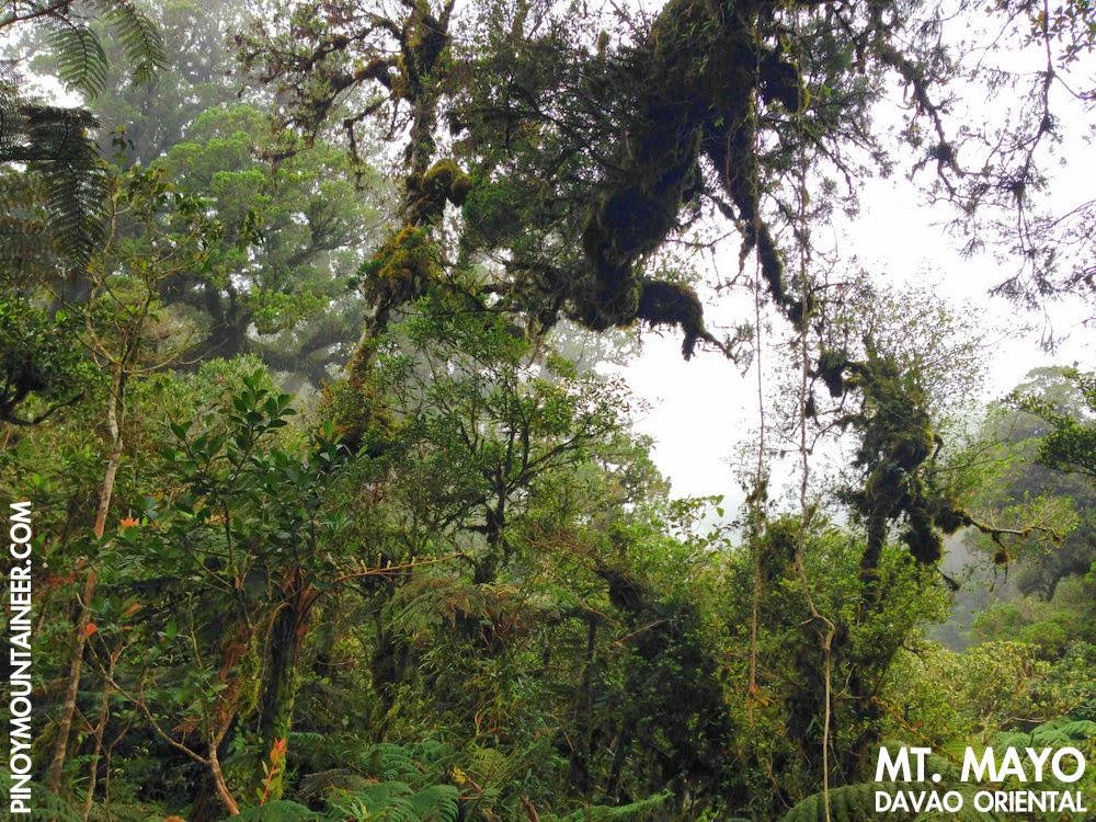
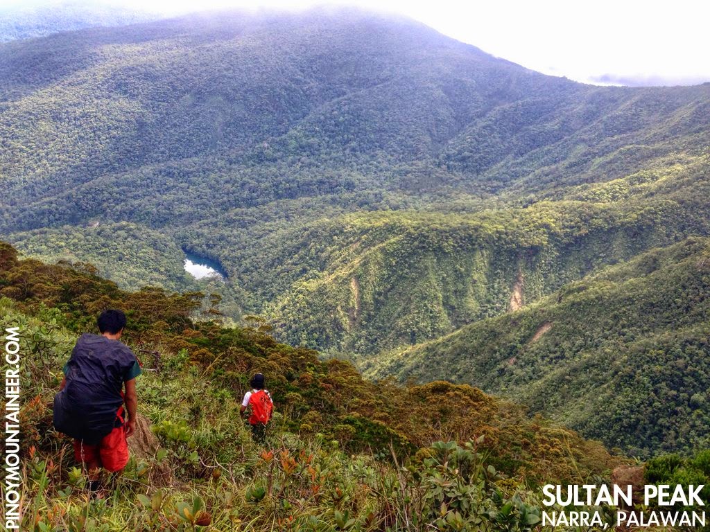
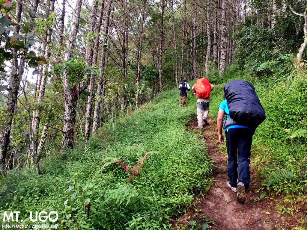
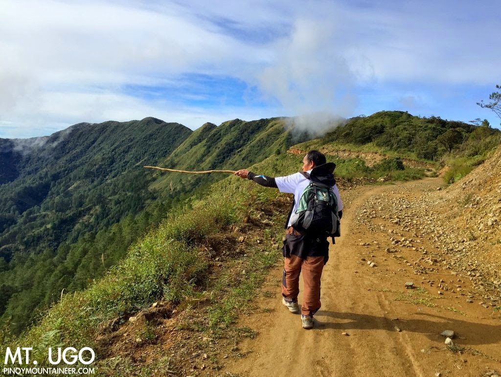
ONCE, THERE WAS a boy who was climbing a mountain. He was part of a group who had traveled far to hike in the North, where many mountains lie together, connected by rolling slopes covered with pine trees and mossy forests. Many of them saved up for several months in order to join the hike. They trained hard by running, swimming, and climbing the mountains near their hometown.

Being young and eager, the boy was tireless, and in his first hikes he was always walking ahead of everyone, wanting to be the first to reach the peak. But as he kept hiking, he grew to appreciate being behind everyone else. Being the last man meant he had more time to look around, and to retrace the steps that helped him more aware of the trails. Oftentimes he would end up helping the others who were already too tired, and that too, he saw as a learning experience.

While were hiking, they encountered an old man along the trail, walking slowly in the same direction. He had long, flowing grey hair, and a big backpack, like the ones he used to see in the faded pictures in the old outdoor shops.

"Good morning sir," the mountaineers greeted him.

"Good morning sirs," the old man responded in kind.

The boy, who was the last to encounter the man, observed him carefully. He saw a tattoo on his legs that could only have been made by that famous tattoo artist who lived in the mountains. He saw a necklace whose strap bore the pattern of a unique cloth made by the dreamweavers from the south. He saw legs like tree trunks: built for long walks deep into the wilderness.

He knew from the beginning that this man had a vast wealth of experience, but was too humble to betray signs of it.

He decided to walk with the old man.

"Go ahead, you might get left behind by your companions," the old man warned.

"It's okay. The trails are easy to follow. And I'm sure they'll put up trail signs when I need them," the boy said, rather eagerly, adding: "Besides, it's not everyday that I meet an experienced mountaineer like you!"

They kept walking. The old man was initially reluctant to talk, but the eagerness of the boy made him open up to him, and he began talking about his life. The mountains, he said, were a source of living for his family who grew up in the hinterlands. And then it became a source of refuge for him, for he was once a rebel and he hid in the forests, spending nights without food or water, or at the mercy of the elements.

He had seen the mighty eagles' nests in mountains - they with their mighty birdcalls; he had seen them fly above the mossy forests of the south - until the chainsaws arrived and silenced them forever. He had seen tribes perform rituals that have vanished, because the tribes too, like the eagles, have dispersed; their rituals disappearing forever.

And he also spoke nostalgically of the mountains of the past. "The roads of today were the trails of yesterday," he said, recalling the mountains that used to take much longer to climb.

"The mountains mean different things for different people - and it can also mean different things for the same person in different stages of his life," said the old man, concluding his short narrative.

Presently they heard the shrill cry of cicadas, foreshadowing the coming of dusk.

"Sooner or later, we will have to part ways. But because you showed amity to an old man, I will reward you. I do not have gold or silver, but having climbed mountains all over our land, ask me anything you want to know about mountains."

The boy replied: "Share with me what you've learned from the mountains. Give me rules to follow, lessons to live by."

***

THE OLD MAN paused for a while.

"I have climbed all the mountains and you could have asked about the secret paths I have trodden; the mountains with the most beautiful forests; or those with the most challenging trails. But what you ask will allow you to climb all of them."

The old man gazed at the mountain ahead of them. They could see the boy's companions climbing steadily and slow, their colourful backpacks standing out in the green of pines.

"The first lesson is this: The mountain will always be there but the people you climb with will not always be around. Treasure them. Plant good memories in the hearts of people you meet on the mountain, and open your own heart to them; allow them to plant memories in yours. These memories will keep you warm even during the coldest and darkest nights.

"Secondly, never underestimate the mountain. It has been said many times, but we still need to be reminded. Sometimes, our own experience can be our enemy if it makes us proud or overconfident. The strongest hiker cannot withstand the force of a raging river. We can fight many battles, but we can never win against hunger, thirst, cold, wind, and flood. Be prepared not just for sunshine, but for a storm. Be prepared not just for yourself, but for others. Be prepared to say no, to back out, to accept defeat. There will be times when you will come close to your dream, only to have to turn back. Accept it with dignity, and learn from it. Success will be sweeter the next time around.

"Thirdly, open up your senses to the here and the now of the mountain. When I was young, I felt happy whenever people would talk about the explorations I have done, the mountains I have climbed. Today, with the world more connected than ever, it is easy to share a beautiful photo of you and get praises from others. But in our rush to share our experiences, we sometimes forget the experience itself, relegating to cameras what should be foremost for our eyes. Engage your senses; feel the life of the mountain! Many people have been surrounded by butterflies and serenaded by birds without noticing it. Countless shooting stars have passed without anyone making a wish, but surely they are visible to those who open eyes to the beauty of the world."

The old man paused as they entered a dense forest. He seemed to look at the trees with familiarity, and called them using the names known only to the tribes. He recognized the birds by their songs, mimicking their calls with his voice. Even with their camouflage, he spotted insects and reptiles. The boy was amazed at how much of the forest he had hitherto failed to see.

The old man spoke again: "The fourth lesson goes back to your pledge to love the environment. The mountain cannot speak, and oftentimes, it suffers in silence. But a mountaineer ought to know how to feel its pain. When the time comes that you have to be its voice, you have to be willing and ready.

"Lastly, and perhaps most importantly, you have to root your love for the mountains deep within you. You will hear people say that hiking is a matter of strength, of speed, of time and money. But ultimately, it is passion that will keep you going. Never let go of the sense of wonder and the spirit of adventure that keeps you dreaming and keeps you walking. Remember, the heart of mountaineering is mountaineering with the heart."

***

THERE WAS SILENCE, as the boy tried to absorb the meaning of what the old man had just said. They emerged from the forest into a grassy slope and he could once again see his companions up ahead, like tiny ants in the vastness of the mountain. The sun had began to set, casting a different light on the mountains.

A wave of emotions swept through him, and he was lost in his thoughts.

And then he realIzed that he was hiking alone.

He looked around, his eyes retracing the trail he had been following. There was no trace of the old man. Perhaps he had taken another trail. Or did he stay in the forest? The boy wondered if he had derelict in not detecting the old man's disappearance. He wanted to ask him about many things, he wanted to hear him tell tales of various mountains, of how the mountains were in the past.

Then again, perhaps the old man deliberately left without a trace to teach him a final lesson: that of the evanescence of moments, the fleetingness of the encounters we have with the people we meet along the trail.

At least, he thought, I should have thanked him and bade him goodbye.

But the boy realized that true to his wise words, the old man had already planted something in his heart. And as he chased after his companions, he knew that he would keep it there as he keeps climbing.

Suddenly the mountain seemed larger, its summit more beckoning than ever before, and the trails seemed to extend beyond the distant blue peaks in the red horizon.

Gideon Lasco
Baguio City
December 13, 2014

LETTERS TO A YOUNG MOUNTAINEER
by Gideon Lasco

MountainTalk #14: Canada-based Filipino mountaineer Dean Perez on alpine climbing

$
0
0
Filipino alpine climber Dean Perez at the summit of Pico de Orizaba,
the highest mountain in Mexico (D. Perez)
One of our privileged correspondences is that with Dean Perez, a Canada-based Filipino who has done some amazing climbs all over the world - for instance, the famous Ama Dablam in the Himalayas - and a solo unsupported climb of Mt. Aconcagua, the highest mountain in South America. Follow his adventures on his Facebook page! Here are some questions for 

PinoyMountaineer: How long have you been staying in Canada?
Dean Perez: I have been living in Canada for 14 years.

PM: What's hiking/climbing in Canada like? 
DP: Where I live (Vancouver, British Columbia), hiking/climbing is one of the most popular activities in summer. There are hundreds of hiking trails in British Columbia (BC), and they are located in spectacular natural settings. We are surrounded by oceans of mountains, from jagged to glaciated peaks. In BC alone, it has more than 850 parks and protected areas. Most of the established trails do not require permit and free to use. A lot of mountains are very remote, either it takes several days of bushwhacking to get to the base of the climb or use a helicopter to get dropped in. Sometimes, you can roam away in the backcountry for several days without seeing anyone.

Hiking never stops in winter, we still do go out to the mountains. We use either snowshoes or skis as a floatation device on the snow.

In North America, hiking and mountaineering are two pursuits that share many common features and consequently there are many different opinions as to what distinguishes one from the other. “Hiking is a pursuit that can be followed without the need for any specialist or technical equipment, whilst mountaineering will require the use of technical equipment such as rope, a harness, crampons and ice axes. Generally, hiking is a pursuit open to almost anyone, of any age or fitness level, and requires little in the way of specialist knowledge and training to get started.Basic navigation skills are easy to learn and are essential as you should never rely on one person to guide a party.

"Mountaineering however, will usually be more physically challenging and a degree of knowledge and training must be attained before attempting any mountaineering routes. This knowledge might include navigation, rope techniques, crampon and ice axe use, basic first aid and understanding mountain weather.”

PM: How did you discover the outdoors?
DP: I started hiking back in 2008. I was just bored and looking to do something on my spare time. Since then, I’ve done several 6000m and 5000m mountains international and I have climbed over 400 mountains since I started in 2008.

PM: What are your most memorable climbs?
DP: I have a lot! Huayna Potosi in Bollivia, because it was my first 6000m mountaineering climb. My solo unsupported climb in Mount Aconcagua where I almost lost 3 of my fingers from frostbite. Ama Dablam, amazing technical mountain to climb in Himalaya. Recently, I did a 14 day solo traverse in British Columbia and was able to do 17 mountains in that expedition!

PM: What are your future plans?
DP: Denali (the highest mountain in North America) and If I have enough skills, I would like to go back to Patagonia to get some mountaineering objective. Nowadays, I’m more focused on ultra races.

PM:Any advice to Filipino hikers who want to pursue big mountains?
DP: Stop dreaming, Do it! If you have time and money, go for it. Kadalasan laging ganito ang comment na nababasa ko sa mga Filipino, “Pangarap kong maka-akyat” . Bakit puro pangarap nalang, bakit hindi mo gawin? It really depends on your objective mountains. Some high altitude mountains do not require technical skills. But you can’t just climb a big mountain without proper knowledge, otherwise you’ll fail. Learn mountaineering skills and train hard!

Hiking matters #426: Mt. Lanaya, a beautiful hike in Alegria, Cebu

$
0
0
At the summit of Mt. Lanaya in Algeria, Cebu
CEBU CITY - The day after visiting Mt. Manunggal (Hiking matters #424) and Mt. Kan-Irag (Hiking matters #425), we proceeded to Mt. Lanaya in Alegria, Cebu, accompanied by mountaineers from Cebu, once again led by Scarlet Su-Villamor of the Cebu Outdoor Adventure Team and her clubmates. We took the Bato-via-Barile bound bus and after over three hours, got off at Brgy. Legaspi, the major jumpoff for the hike. Along the way, we see the jagged hills of Osmeña Peak, bringing back memories of my first hike in Cebu (see Hiking matters #53).
There were 19 of us in the group and the barangay assigned four guides; including the registration fee we each paid P150. It was already past 1130H when we managed to start the trek. Scarlet compares it to the initial ascent up Talinis from Dauin, and I agree with her. Moreover, it reminds me of Tagapo and Sembrano: pleasant coastal views and open slopes which can get scorching hot on a clear day - as in our hike. If on Sembrano the views are that of Laguna Lake, in Lanaya, you have the eastern side of Negros - complete with the mountains that reminded us that Negros has so much to offer beyond the usual Talinis and Kanlaon! 
There is also that bucolic touch as when the guides offer buko juice a little past the 'Windows XP' section - so named because of its green slopes and blue skies akin to the default wallpaper of the Microsoft software. Fortunately, the trail becomes forested, and once again the feeling is that of being in familiar ground. What makes Lanaya unique, however, are the rocky ground that become more and more prominent as you go higher. Indeed, it vaguely reminds me of the ultramafic peaks in Palawan.
Past the forest, a plateau ensues revealing Mt. Lanaya's peak - a little bump atop a verdant ridge. At 720 MASL, its elevation is modest but considering that we started at sea level, the altitude gain is considerable, even though you would not really feel too much of it during the hike, the trails being generally moderate in slope.
Through the plateau the trails are a little bit overgrown, but the peak's presence allows you to orient yourself, making navigation easier. After walking for 15 minutes we finally reached the summit. It was beautiful, offering coastal views of Cebu and neighbouring Negros and Bohol islands - including the former's majestic mountains.
The descent to Sitio Lumpan was much faster, requiring no more than an hour, and clearer, having none of the overgrown parts in the upper reaches of our ascending route. Instead, there were open patches of grassy slopes with guava trees - and a view of Cebu's interior. Before nightfall we were waiting for the habal-habal that brought us back to the highway, where we waited for a bus back to Cebu City. What a great day of hiking! Thanks everyone for joining!


Letter to a young mountaineer, VI: The Philippines that I know, the Philippines that I love

$
0
0
YOU READ AN article somewhere, in which someone writes about how much he or she hates our country because of all the bad things that are happening, and you have mixed feelings about it. On one hand, you agree about the things that the article says. But on the other hand, you feel hurt, because as a Filipino, it is always painful to read or hear someone, especially coming from one of our own.

When emotions compete inside you, always side on the positive. It needs your help more, because it takes more mental strength to think positive than to think negative.

When you think of the Philippines, ask yourself of how much you actually know about your own country. You cannot know what you have not learned or experienced for yourself; you cannot appreciate what you do know, and you cannot love what you cannot appreciate. This is why we mountaineers are passionate about protecting the mountains: we have seen their beauty with our eyes and have experienced their grandeur for ourselves. When you cannot love your country, emotions like hate, indifference, and frustration can easily set in. As Aristotle once said, "Nature abhors a vacuum."

Learn more about your country. Look beyond the Spanish period to see the glory of our past, of the kingdoms of Butuan, Maguindano, and Sulu, of the brave and proud people of the Cordillera. Look beyond the heroes and villains and see the ordinary folk, the heroism of the everyday. There is more to celebrate than Rizal, though there also is more in Rizal to celebrate.

Look beyond what you read in the newspapers. Many of our country's problems - and triumphs  - never make it to the news. Look around you - what are the issues that are going on your community? What is at stake for the people you encounter? Do not be rely on a media which counts “Bad news sells” as one of its maxims. Instead, keep a listening ear because everyone has a story to tell.

As a mountaineer, do not forget that you are also a traveler. When you climb mountains, think of it as an opportunity to expand your knowledge about the country and the world. When you climb Mt. Apo, it is not just the summit that your reach. You experience Mindanao and all its natural wonders; its rich bounty, its cuisine, its durian and mangosteen, the personalities of its people, a diversity of language, each fascinating in its own way.

Similarly, when you climb Mt. Pulag, you also meet the mountain peoples of the Cordilleras, their quiet fortitude and dignity; the precarious roads of Halsema and the other highways, the unique culture that finds physical form in awe-inspiring rice terraces. See this diversity, and make it the basis of your opinion of what the country is all about.

When people read my blog, they see images of the mountains, and read my narratives of my hikes. But what they do not see is how much I learn about our country in the process, by listening to the stories of the guides and locals, by observing what is going on in the cities and villages. These are the intangibles that make for an invaluable education. When it comes to civic consciousness and cultural knowledge, your country is your classroom.

***

IT IS EASY to hate your country when you focus on the negative. But when I think of the Philippines, I do not think of the corrupt officials, the roads, the disasters, the tragedies and what-could-have-beens, the mentalities that have often been ascribed to us. Yes, I have seen these things, and more. I have seen the sad plight of indigenous peoples; I have heard the sound of falling logs. I have heard moving stories of justice delayed, and justice denied. These things are real, and they are painful at times. But I do not allow them to be my view of what the Philippines is - and what the Philippines can be.

Instead, I think of my family, my friends, and the people across the archipelago that better represent what our country is all about.

I think of my parents in Los Banos, and their passion for their church, their family, and for the environment. I think of the football field with its stately acacia, the long drive surrounded by pili trees, and the confirming presence of Mt. Makiling’s beautiful slopes. I think of the grandparents in San Pablo, the rambutan and lanzones trees, and the tranquility of the Seven Lakes.

I think of my friends all over the country, all of whom have made my life memorable. I think of the open seas in Batanes, and the interminable tagay with the freshest sashimi as pulutan. I think of that morning in Tawi-Tawi when I woke up to the call of morning prayers coming from the mosque.

I think of the honest woman in Maguindanao who picked up the cellphone I left on a jeepney, and when she returns it, says: “I’m just being a good Muslim.” I think of the Batak family in Palawan - one of forty left - who showed us hospitality on a stormy night, letting us stay in their house even at the expense of their comfort. When I think of everyone in the country who has touched my life, I am overwhelmed by the goodwill they have shown, and it is the same goodwill that I vow to share to others.

I think of my teachers and mentors who have dedicated their lives to success of the younger generations. I think of my classmates who are doctors in different parts of the country, caring for them in their own ways. There are those who leave behind the country, and I think of their silent heroisms, their waves of longing, their sojourns in strange lands. There are also those who stay, and I think of their sacrifices, their convictions, their courage. I think of my family members abroad, and our joyous reunions, and the things that keep us connected.

And of course, I think of the mountains, the beautiful mountains that have given me so much memories, brought me so much joy and taught me so much wisdom. I think of the sunbirds in Dulang-Dulang, and the deer that once crossed our path in Sicapoo, and of the lovely fireflies that greeted us on the way back from Tenglawan to Bakun. And yes, I think of the lovely ridges of Guiting-Guiting, the of dwarf bamboo of Mt. Pulag, the unfathomable depths of Mt. Kanlaon and Mt. Bulusan. I think of that emotional night in Mt. Apo, when I as a teenager almost lost hope, only to find out that what i thought was a thunderstorm was just a raging river underneath a magnificent array of stars.

Every country, like every family and every person, has a dark side. But this should never lead to frustration, not just because of the brighter side that we sometimes refuse to see, but also because we can always do something to make our country a better place. When things seem hopeless, we need the optimism of a child.

Believing in the power of a single act is far better than refusing to act at all. We have already shown the world that it is possible to even remove a dictator from his power. As in the Olympics, anthems are sung, flags were raised, by the act of a few - or even an individual, as when Pacquiao's victories lift our pride and our spirits. The dawn that Rizal had imagined is yet to come, but there are also stars in our history that should serve as glimmers of hope for the days to come. We have braved the fiercest of storms, and the most tragic of calamities. We have suffered much, but like the indefatigable sun that rises every morning, our smiles - and hopes - have not wavered.

***

AH, THE BEAUTIFUL mountains, the captivating islands and beaches, the sunset of passion, the sunrise of hope, the hands and hearts that make me feel at home, the smiles that light up even the darkest and stormiest day, and the promise of a brighter future: This is the Philippines that I know, the Philippines that I love.

Gideon Lasco
Manila
January 1, 2015


LETTERS TO A YOUNG MOUNTAINEER
by Gideon Lasco

My Top 10 hikes of 2014

$
0
0
Mt. Agung in Bali, Indonesia (May 2014)
Following my tradition for the past seven years, I have selected the top 10 hiking trips that made my 2014 a very memorable year of adventure. My year pretty much turned out to be divided into a "overture" of two exciting traverse dayhikes: Pantingan-Tarak and Guiting-Guiting, followed by a first movement of international climbs from Switzerland to Sydney, and from Taiwan to Indonesia. The second movement covers a fruitful time in Palawan, where I managed to do four major climbs. And finally, as an encore, visits to Apo and Pulag - again as dayhikes!

Note that these hikes are in chronological order and I make no attempt to further rank these hikes:


1. Pantingan-Tarak Traverse - To start off the year my good friends Coby, Koi, Jeshua, Daryl and I went on a "dayhike" of Pantingan to Tarak, going up and down - and up and down again - the caldera rim of the great Mt. Mariveles in Bataan. We started at 0400H from the jumpoff of Pantingan and we saw the sun setting in Tarak Ridge. Injury and rest time included, the hike took 20 hours - a very long dayhike indeed. Narrated in Hiking matters #386: Up to Pantingan Peak and the crater rim and 
2. Guiting-Guiting Traverse - It's been several years since my first G2 and since I hadn't done the traverse yet, I decided to do it in February, also as a dayhike. Sadly, I failed to see Mt. Mayon from the summit as we were hiking at the tailend of storm. Still it was a great hike, and I relished every moment of the Knife Edge crossing. Thanks Dandan, Martin, and of course Tatay Remy for this adventure!  Narrated in Hiking matters #388: Olango to G2 summit and Hiking matters #389: Knife Edge to Mayo's Peak and down.
3. Mont Noble, Switzerland - I spent a month in Europe for my studies and one weekend I returned to the Swiss mountains, hosted once again by my good friend and mountain mentor Leo Oracion. We snowshoed our way up the worthy Mont Noble. Despite the biting cold, we managed quite well and had a great French dinner after, courtesy of Leo's wife Vanessa. Narrated in Hiking matters #393.
4. Jade Mountain, Taiwan - The odds were 1 in 10 that time, but our team got lucky: our permit got picked in the raffle drawn to decide who gets to climb Taiwan's highest peak! My sixth hiking trip in Taiwan turned out to be another fantastic one, as we had a great view at the summit. Narrated in Hiking matters #394: From Tataka trailhead to Paiyun LodgeHiking matters #395: Ascent to Yushan Main Peak, and Hiking matters #396: Back to Tataka trailhead
5. Mt. Kosciuszko and Blue Mountains, Australia - a very easy hike but a symbolic victory was our reaching Mt. Kosciuszko, the highest mountain in the Australian continent and one of the Seven Summits according to the Bass List. Of course we didn't go all the way Down Under just to do a dayhike so we headed to the Blue Mountains, caught a glimpse of the visiting Prince William and Duchess Kate, and had a great time bushwalking. Narrated in Hiking matters #397: The hike up Mt. KosciuszckoHiking matters #398: Blue Mountains 1 - Katoomba, and Hiking matters #399: Blue Mountains 2 - Wentworth Falls.
6. Mt. Rinjani with Mts. Batur and Agung, Indonesia. I celebrated my birthday with three Indonesian volcanoes, starting from Gunung Batur - my first international hike way back in 2005 - culminating in the fantastic Mt. Rinjani - and ending in another Bali hike, Mt. Agung. Narrated in Hiking matters #400: Gunung Batur, BaliHiking matters #401: Gunung Rinjani, Lombok Day 1,
Hiking matters #402: Gunung Rinjani Lombok Day 2, and Hiking matters #403: Gunung Agung, Bali
7. Mt. Mantalingahan Traverse - Six years after I first documented this great mountain, it's not become a mecca for serious hikers and as in G2, I wanted to experience the traverse. With my hiking buddy Coby and guided by the cheerful Kuya Binoy, we did the traverse and had four wonderful days in Palawan jungle. Narrated in Hiking matters #408: Brgy. Ransang to Cabugan campsiteHiking matters #409: Cabugan to Paray-Paray campsiteHiking matters #410: Mt. Mantalingajan summit assault, and Hiking matters #411: Traverse to Brooke's Point 
8. Mt. Victoria - After climbing Mantalingajan, we decided that we still have enough time and energy to do another mountain and fortunately Jehson Cervancia helped us decide a guide for Mt. Victoria, the second highest in Palawan. An additional two days in Palawan jungle - and two dozen river crossings to boot! Narrated in Hiking matters #412: To the high camp and Hiking matters #413:To the summit and back.
9. Cleopatra's Needle - Two months after Mantalingajan and Victoria, I completed the "Palawan Trilogy" by climbing Cleopatra's Needle, the third highest in Palawan and the highest north of Puerto Princesa. It was fantastic: 51 River crossings, forests with majestic almacigas, and a stunning summit view featuring all of Puerto Princesa's mountains, and a wide section of Palawan itself from Mt. Victoria to Mt. Capoas. Narrated in Hiking matters #419: Endless crossings of Tanabag River,  Hiking matters #420: Up the summit campsite and Hiking matters #421: The beautiful summit and the long descent
10. Sultan Peak - A few years ago, I thought all I needed to hike were Mantalingajan, Victoria, and Cleopatra. But Palawan continues to amaze, and Sultan Peak. The grandness of the hike is comparable to a Kanlaon traverse and the biodiversity is stunning. Sultan Falls was the first reward, and at the summit, three giant pitcher plants were waiting for us! And after that, mystical Atong Lake where I swam to my heart's content. Narrated in Hiking matters #437, Hiking matters #438, and Hiking matters #439
Honorable mention: Mt. Apo (Kapatagan) dayhikeand Mt. Pulag (Akiki-Ambangeg) dayhike. It was great to revisit the highest peaks of the country's two biggest islands one month apart from each other- with the latter turning out to be my yearend major hike. Reminds me that you can't really climb a mountain twice, there are many ways to experience a mountain!
Thank you Coby Sarreal for joining me in five of my top 10 hikes: Pantingan-Tarak, Rinjani, Mantalingajan, Victoria, Sultan Peak.Also acknowledging Daryl Comagon, Brenton Tan, Ian Tesaluna, Dada de Silva, Foncy Conanan, Cynthia Sy for joining in two of these. And of course my gratitude goes to everyone who made these possible! Looking forward to another exciting year of climbing mountains!

PINOYMOUNTAINEER TOP 10 HIKES OF THE YEAR
Top 10 Hikes of 2014
Top 10 Hikes of 2013
Top 10 Hikes of 2012
Top 10 Hikes of 2011 (PH) | International
Top 10 Hikes of 2010
Top 10 Hikes of 2009
Top 10 Hikes of 2008

PinoyMountaineer Shirt no. 15, "Climb with Me", now available!

$
0
0
In the tradition of the PinoyMountaineer shirt series, I am pleased to announce an offering at the start of the year: Shirt no. 15, "Climb with me". Sporting a simple design, this shirt is an invitation to share the outdoor experience. In place of the regular PinoyMountaineer logo, a #pinoymountaineer hashtag is displayed on the back.

The shirt is available in four colours: Blue-green on white, dark brown on light brown, grey on blue, and rust brown on light blue.

The shirts are available for P400 at the following stores:


Alabang Town Center (ATC)
Upper Ground Floor, Connector Mall
(in between Hush Puppies and Adidas)
Contact number:
Sun - (0933) 321-3127
Globe - (0917) 398-1570

Glorietta
1st Floor, Glorietta 3
(near McDonald's)
Contact number:
Sun - (0933) 321-3378
Globe - (0927) 264-6154

Market! Market! Outlet Store
2nd Floor, Fashion Market Area
Contact number:
Sun - (0923) 824-1856

Robinson's Manila
Second Floor, Padre Faura Wing
(in between Silverworks and Crabtree & Evelyn)
Contact number:
Sun - (0933) 321-3357
Globe - (0927) 762-6402

Trinoma
2nd Floor Teenzone
(behind Starbucks, in front of Artwork and Converse)
Contact number:
Sun - (0932) 236-1573
Globe - (0927) 869-8285

They are also available for FREE NATIONWIDE DELIVERY for a minimum order of 3 shirt! Contact 027389443 or sales@perfectwhiteshirt.com for more details.

Open letter to the officials of Cuenca, Batangas: Stop requiring guides in Mt. Maculot

$
0
0
View of Taal Lake at the approach towards the Rockies of Mt. Maculot
Dear Sirs and Madams,

MANY OF YOU grew up in the shadow of Mt. Maculot and I do not have any reason to doubt your best intentions; your love for the mountain. This beautiful landmark at the heart of Batangas deserves its place in your hearts, and ours.

A few months ago, you began implementing a policy to require all mountaineers to get guides. Doubtless, you passed this out of concern for the safety of mountaineers. Still fresh in our memories  is the tragic death of one of our fellow mountaineers, Victor Ayson, and I am sure you were mindful of this tragedy when you enacted this legislation.

Your concerns for mountaineers’ safety are warranted. However, your response to these concerns may not be best solution.

First, Mt. Maculot’s trails are easy to follow, even for beginners. There are only one or two junctions where hikers might be misled, but this is easily solved by putting up some arrows and direction signs. Getting a guide just to lead the way in these rare instances doesn’t make sense. Clearly, preventing hikers from is not a valid reason to get a guide.

Second, only the Rockies actually present with the real threat of people getting serious injuries like falling, but this can be remedied by other ways. For instance, as in mountains like Mt. Kinabalu, ropes and reminders can be installed in the Rockies  to prevent falls. Moreover, proper training and preparation will be a hiker’s best way to prevent an accident, and this is something that a guide cannot match.

Finally, while reacting to a hiker’s death is understandable, please balance that one accident with the thousands of climbs that end up safe and successful, without injury or harm. Consider that Mt. Maculot has been climbed by people for decades without guides, and this has not led to misfortune. Victor Ayson's case has some peculiarities that do not apply to everyone. For one, he was hiking alone.

As for the economics, while it is true that mountaineers will give income to some locals, this will also discourage many of the regular visitors from climbing Maculot. Hikers come from all walks of life, and many of us save up hard-earned money just to climb mountains. For many, especially students, every peso counts. Will you prevent them from enjoying the outdoors just because they cannot afford a guide? And what of a couple of hikers who go to Maculot every weekend for their workout? Will you require them to pay 500 even if they have climbed Maculot countless times?

No mountain is 100% safe but hikers are aware of the risk and we must not attempt to kill the risk at the expense of being impractical in the vast majority of situations. As mountaineers, it is our responsibility to be trained and prepared for various situations, but we are aware that sometimes, accidents do happen, even among the best trained and best prepared among us. Needless to say, even the presence of guides will not ensure that the mountains will be 100% safe. But this is fine. As in many things in life, there are always risks and as long as we have done our best to minimize it, we have to live with it.

To be sure, guides should be made available to those who need or want them. As a compromise, it is reasonable to propose that first-timers should be required to get guides, but those who can demonstrate, through pictures or through their names in your logbooks, that they have already climbed the mountain should be given the choice of not getting guides. In the wake of Victor Ayson’s death, it will even be acceptable for hikers climbing alone to be required to get a guide. Moreover, it is also very understandable to close the mountain during and immediately after a typhoon. But an all-encompassing requirement will be an additional burden that many of us will find hard to bear. What is at stake here is not just the burden of an additional expense, but the freedom of choice, the ability to enjoy the mountain without unnecessary restrictions.

In conclusion, there are many ways for mountaineers and locals to both benefit from hiking activities, but one should not benefit at the expense of the other. The mountain belongs to everyone, and we should work together for its good, for the safety of those wishing to enjoy it, and for the benefit of those who live on its slopes and foothills. By taking into consideration one another’s concerns and viewpoints and by seeking consensus instead of acting unilaterally, we can achieve harmony for the good of everyone concerned.

In behalf of the mountaineers who share the same sentiments, I respectfully appeal to your good offices to stop requiring guides in Mt. Maculot.

Respectfully yours,

Gideon Lasco
PinoyMountaineer.com

Hiking matters #443: The Ugo Traverse Dayhike from Kayapa to Itogon

$
0
0
Trekking through the pine forests of Mt. Ugo
In a way, I already did a dayhike traverse of Ugo, when we covered most of the trail - on full packs, as some hikers would love to add - during our memorable four-day Ugo-Pulag Traverse in 2013 (see Hiking matters #320). However, Ugo itself is a nice destination, and having done a Pulag dayhike last month (Hiking matters #441), I felt it would be great to complement it with an Ugo Traverse Dayhike from Kayapa to Itogon.

Joining me once again were my good companions Coby Sarreal and Koi Grey, the venerable 18-time Halcon climber Cynthia Sy, and Coby’s SBMS-mate Chito. All of us, sans Koi, took the 2200H bus from Pasay to Santiago, Isabela (360) and we got off at the Aritao Bus Terminal, where we were fetched by a jeepney (2500). We were met by my longtime guide Alex Basilio, and started trekking at 0630H.

We did not have expectations of good weather as Amang had still not dissipated by the time we left Manila, and the blue skies that greeted us at daybreak was a welcome sight.

Coming from Kayapa, the Ugo Traverse has four parts, and music lovers can liken it to the four movements of Beethoven’s 5th symphony. The first part is an allegro con brio - a steep ascent. And then a more relaxed andante con moto that connects Indupit to Dolompos, largely through wide trails that are almost roads. From Domolpos to Mt. Ugo summit is a short section that’s steep and scenic - a scherzo allegro - and finally the finale: another allegro, a long descent through pine forests until Tinongdan.

We reached Indupit (16.346971 N, 120.861089 E, 851 MASL) at 0824H, and after a 20-minute rest stop, commenced the easiest (though longest) part of the trail: a 10-kilometer stretch of wide paths with a few ups and downs, but largely flat, and mostly scenic. It is here where the winged Koi Grey caught up with us, which was a happy reunion. Before long, we could see the school at Domolpos, where I have spent three nights (2008, 2011, 2012). Since we were doing a dayhike, we no longer stopped by Domolpos (which would require a 15-minute descent from the main trial), and instead headed straight to the summit

Up the summit, the slopes were surrounded with pines, which give way to a mini-forest at the very top. There are steep parts: the ascent was still a good 350 meters.
We were at the summit (16º19’9.77”N, 120º48’9.76 E, 2150 MASL) at a good time of 1210H, or after 5 hours and 40 minutes of trekking. We had lunch there, and I happily munched on the milkfish-topped quinoa I had cooked the night before. Koi for his part made sure to bring us strawberries from La Trinidad.
Past the summit and a mini-forest came my favorite part of the trail: The pine forests en route to Lusod village. There’s a landmark here called the “Old Sawmill” and a house still stands in what used to be a logging operation — thankfully this is long gone and the pines are back in their splendour.
To further highlight the beauty of this place. we were enveloped by a fog that endowed the atmosphere with a serene, almost magical feel. Though by then we started feeling the length of the hike -32 kilometres no less - our spirits remained afloat.
We no longer passed by Lusod village, and it was only upon realising that we would reach the end of the trail before nightfall that we took a rest stop, just 4.5 kilometres from the exit point. True enough by 1720H we were at the hanging bridge and by 1730H we were waiting for the jeepney that took us to Baguio, where we spent the night, having our usual post climb dinner at Hill Station in Casa Vallejo.

Endnote: Of late I have enjoyed the major dayhikes greatly, and I will likely attempt to do the same thing for some more Cordillera peaks. Meanwhile, I am off to Palawan for another major climb! And when I get back to Manila in February I will likely explore those rocky peaks in Rodriguez, Rizal that have piqued my interest :)
Viewing all 612 articles
Browse latest View live